A West to East Highpointing Extravaganza - 11 State HPS (AZ, NM, CO, OK, KS, MO, IN, OH, DE, NJ, RI) and 2 National Park HPS (Death Valley and Gateway Arch)
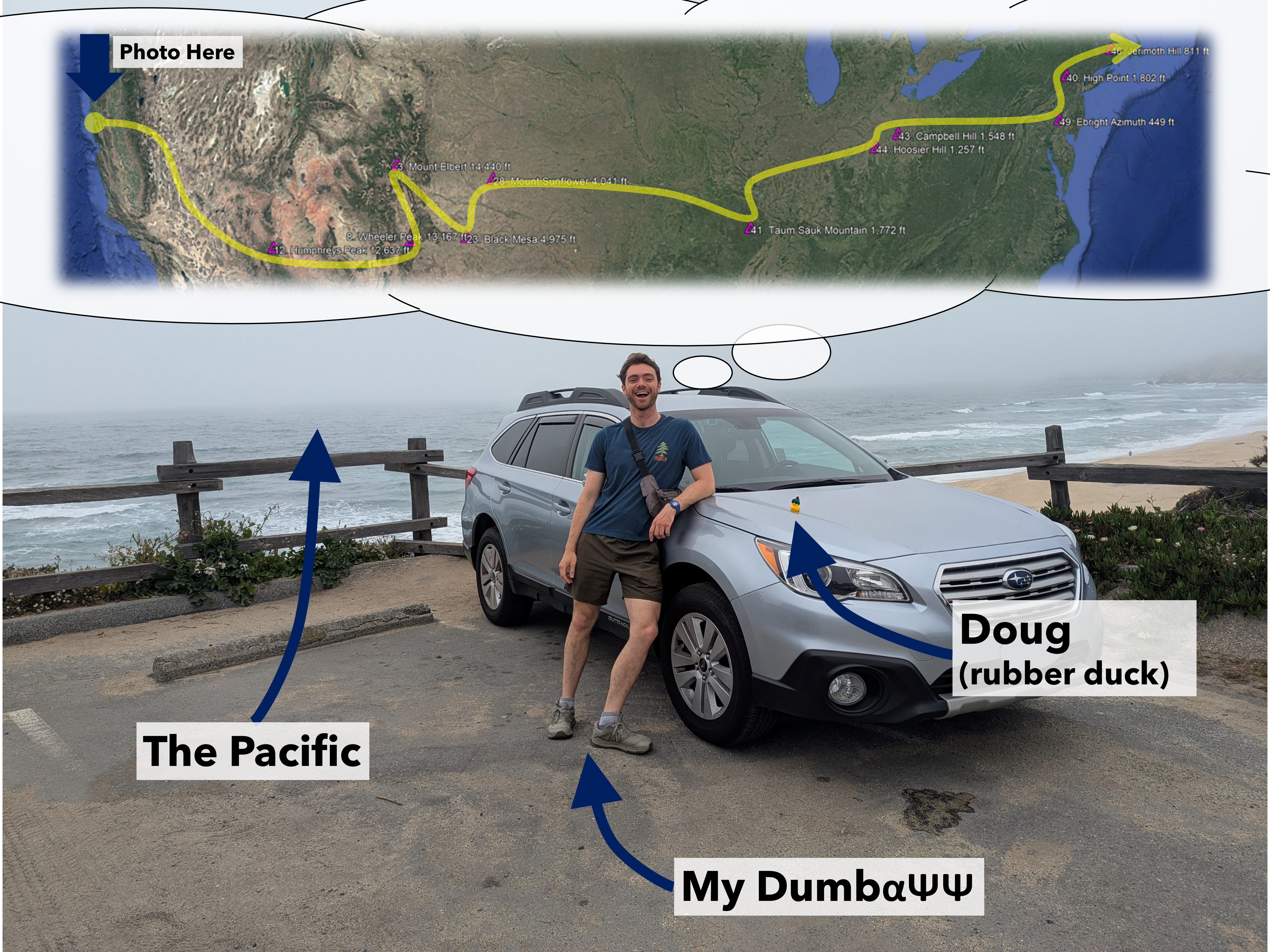
A summary of my thoughts as I depart from the Pacific to the Atlantic with nothing but high points on my mind.
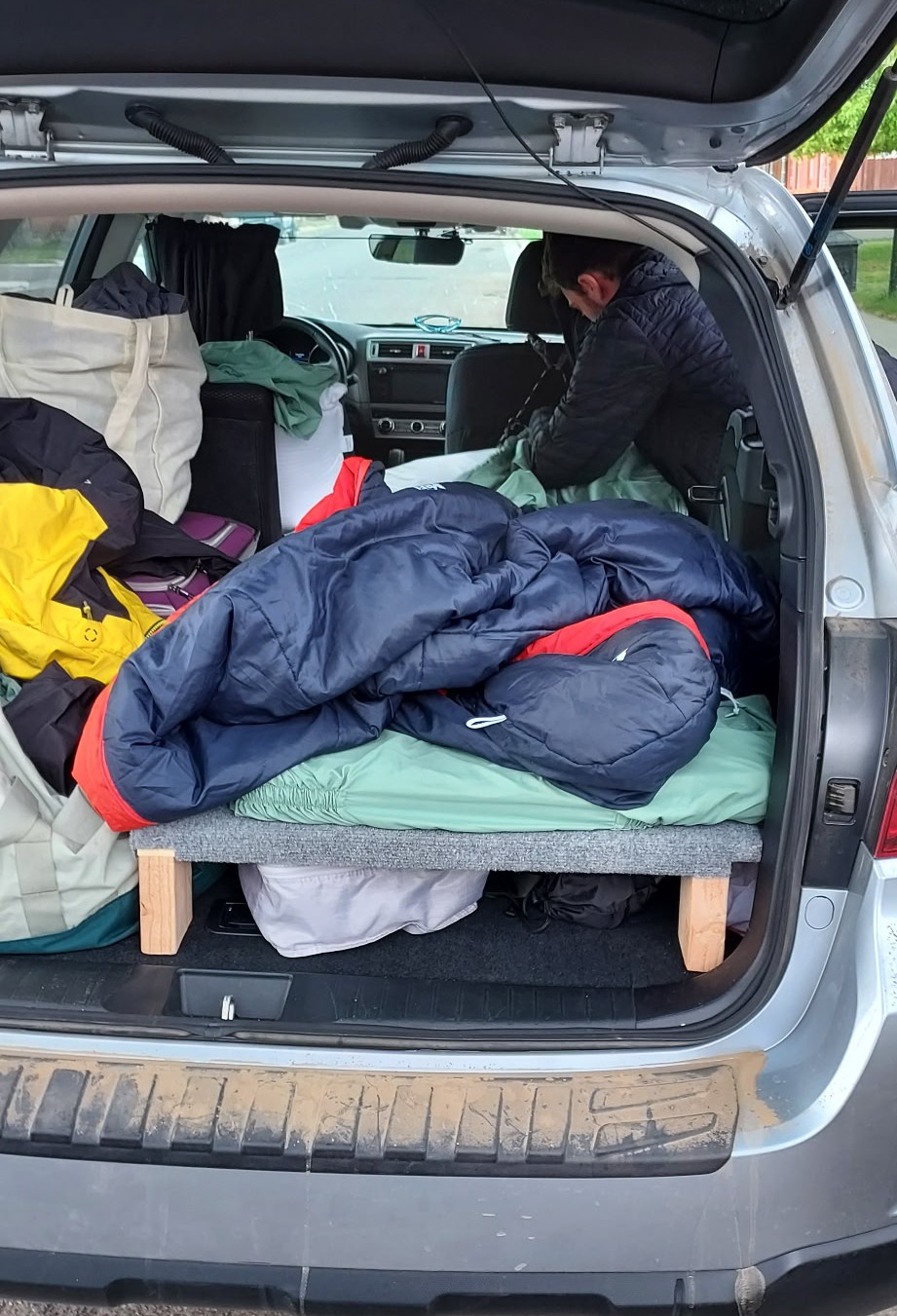
After many years of saving I finally got wheels of my own in March 2025. I decided to get my Subaru Outback, affectionately named Mu after the Greek letter used for the coefficient of friction, in California instead of where I am now based (Massachusetts) in part to make this west to east road trip possible as the christening drive (the other reasons being rust avoidance and access to power tools to build out the interior bed in my parents driveway).
The goals of the trip were simple enough: get the car across in one piece and bag as many not yet completed high points as I could along the way. While simple, often these goals conflicted, with some desired trailheads requiring some spicey roads, even for an outback :D.
Trip Stats:
A caltopo map of the main hikes and sleeping locations can be seen here.
Jump to state high points:
AZ | NM | CO | OK | KS | MO | IN | OH | DE | NJ | RI
May 19th - Day 1 - Departing the Pacific and Sleeping in the Sierra
While I had intended to depart the coast near Half Moon Bay around noon to get out to the central valley before the Monday evening commute traffic, I sadly failed, leaving around 4pm and getting across the Bay Bridge just in time to join everyone else. Never fear however, I got to enjoy a nice dinner of canned Chef Boyardee ravioli behind the steering wheel in bumper to bumper traffic on 580 east. After picking up some duct tape, engine oil, and gas (the essentials) in Manteca I zipped across the central valley and up the foothills in the last light of the day. I had originally hoped to make it over the Sierra Nevada that evening but was getting quite tired as still an hour out from Sonora Pass so decided to find a pull out in Stanislaus National Forest and call it a night at about 6,000 ft. This was my first night sleeping on my new bed setup in the Outback and using the blackout window covers I had finished making that morning/afternoon (hence my delay). Could have been the exhaustion, but there were no issues sleeping that night.
Story continues after Day 1 photos.
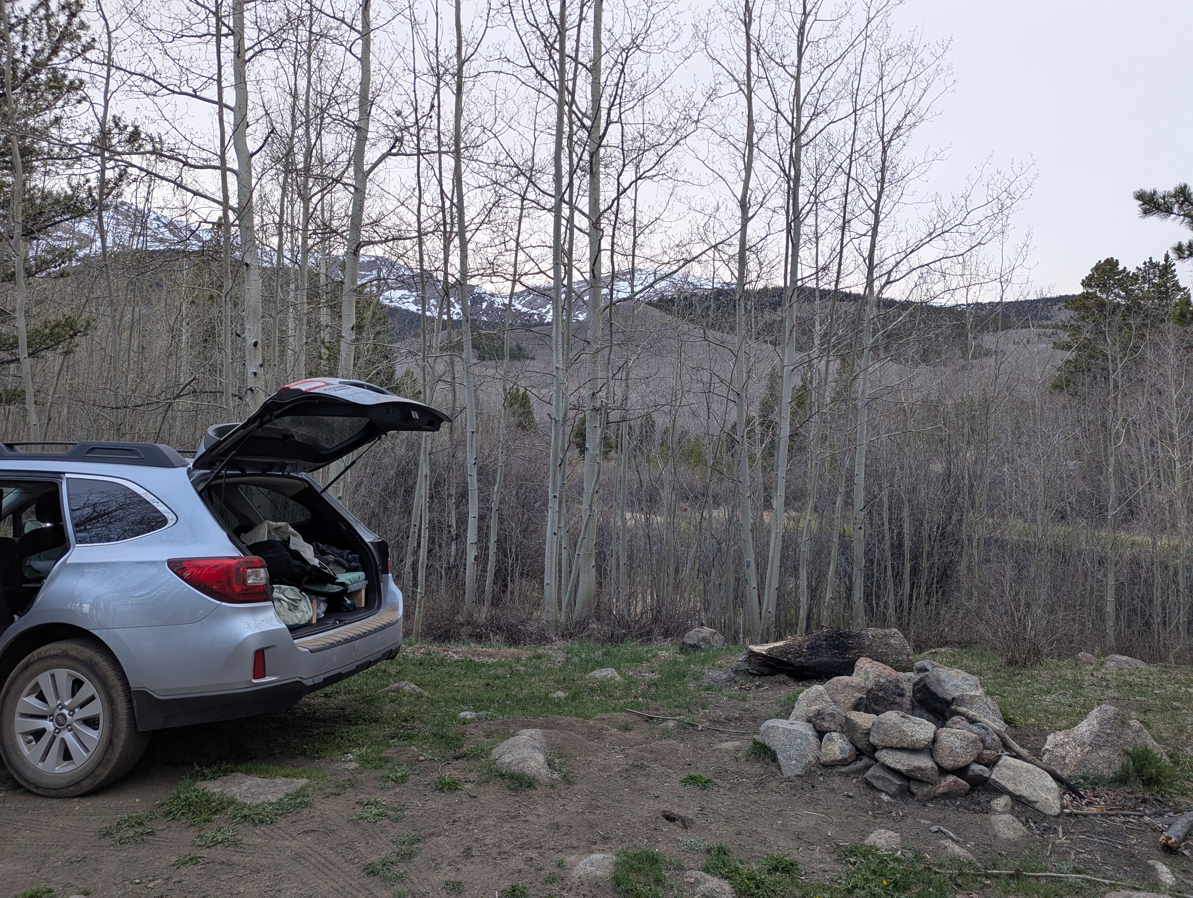
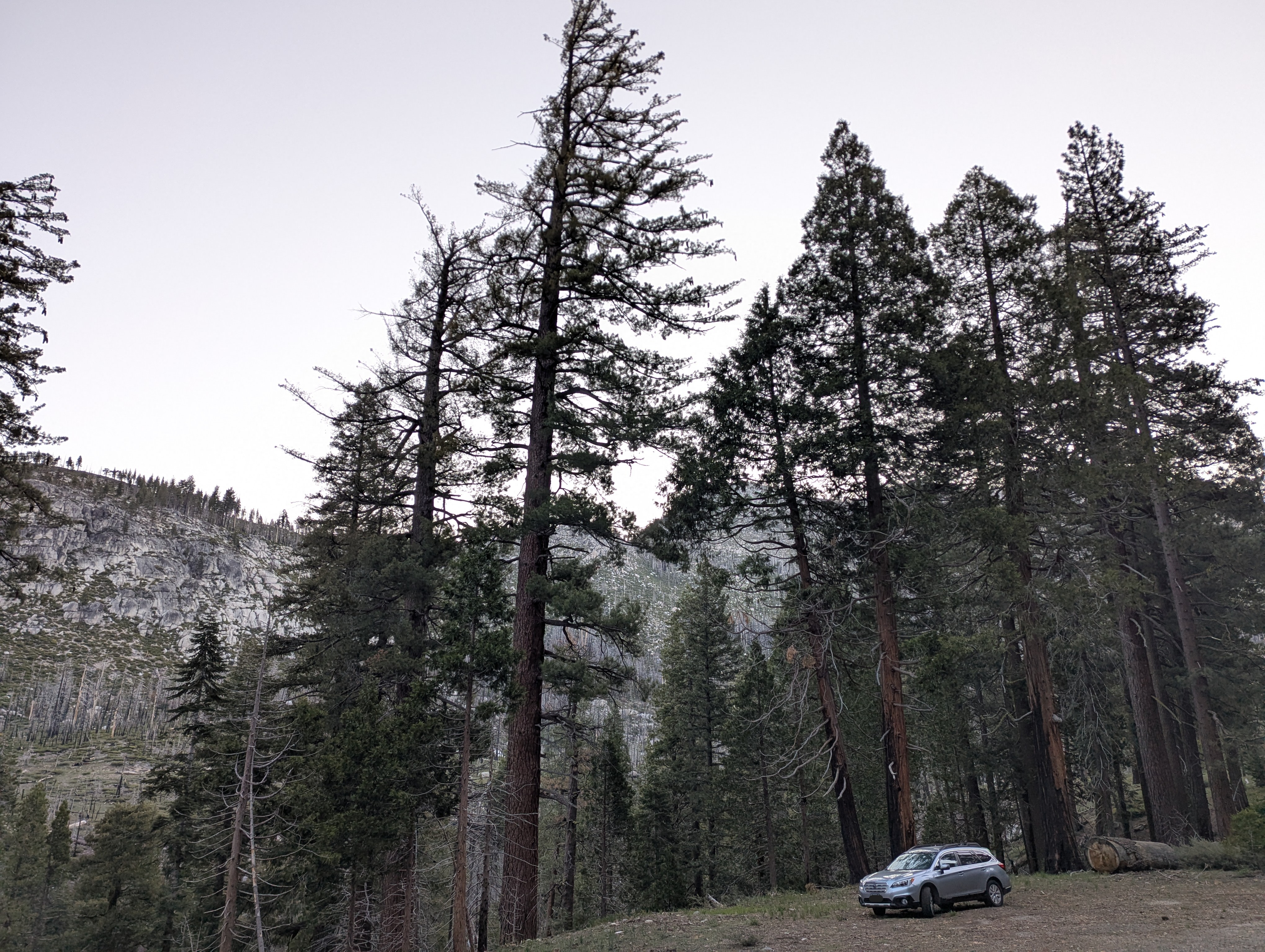 Aside from the photo starting at the Pacific, no more photos were taken on Day 1, which I attribute to my annoyance at the traffic and laser focus on getting up to altitude to ensure I got some acclimation. The above photo was taken the morning of Day 2 and shows the nice trees around my sleep spot for the first night. I imagine it would have looked similar if I had actually taken it on Day 1, sans light of course
May 20th - Day 2 - Eastern Sierra, Manzanar, and Telescope Peak
I was up and driving by 5am on Day 2, reaching the top of Sonora Pass (9,600 ft) at the same time as the first set of skiers were skinning up to begin their quest for spring snow. I coasted down through Bridgeport and onto probably my favorite stretch of mountain highway in the U.S., highway 395. The Eastern Seirra south of Bridgeport are absolutely stunning, rising almost 10,000 ft from the Owen's Valley floor to the crest. I took breakfast in the car just north of Mono Lake. Tortillas, honey, and almond butter is not quite five stars but the view certainly was. Out to the east I could barely make out Boundary Peak, the Nevada high point, at the far northern end of the White Mountains and Glass Mountain on the edge of the Crowly Lake Caldera both of which I climbed with my dad. To the west Mount Dana, another peak done previously with my dad, towered over Mono Lake. Further down I could pick out Bear Creek Spire and Mount Darwin, some of the few peaks I have climbed in these parts. The craggy cirques of the Eastern Sierra tried to lure me in as I drove, but my mission was firmly set eastward.
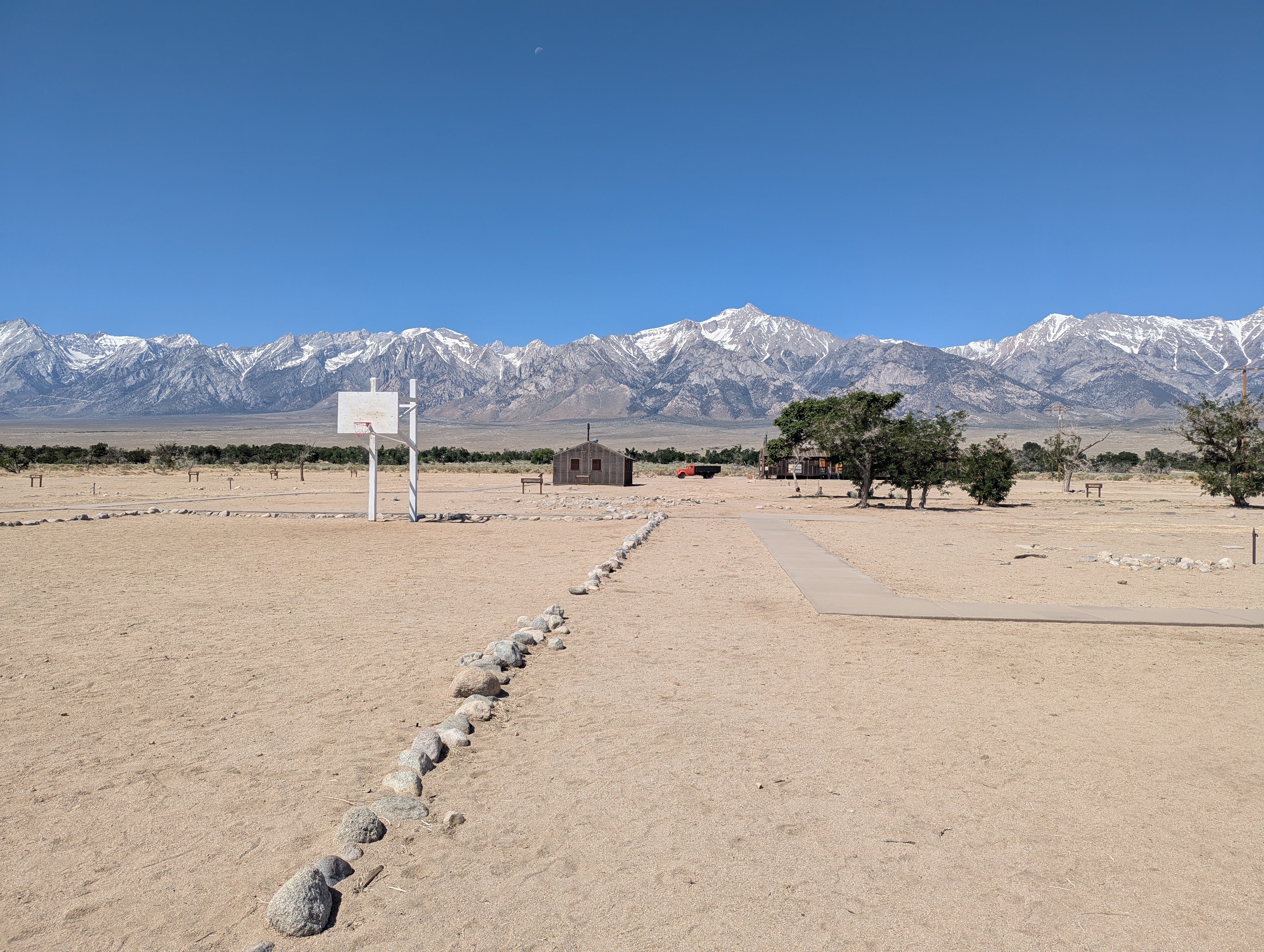
I always try to stop by Manzanar, the former Japanese internment camp, when I am in the area to reflect. Given the current direction of the U.S., this times reflection was especially poignant.
Lunch was had at the Lone Pine McDonalds. I choose a window where I could stare longingly at Mt Whitney, the California high point and the highest point in the lower 48, while I monched my BigMac and fries. I hope to do the mountaineers route in late April, maybe next spring, to avoid the pesky lottery. I filled up with gas and headed towards the middle of nowhere, where Death Valley National Park and its highest point Telescope Peak happens to be.
While Telescope Peak is only 11,049 ft, it has the 22nd highest vertical prominence of any peak in the lower 48 (according to Peakbagger.com at least). Moreover, because it directly abuts Death Valley with a minimum elevation of 282 ft below sea level, it has a vertical perspective looking down into Badwater Basin that is greater than that you would have standing on Mt Whitney looking down into Owens Valley, and in a shorter distance. Telescope Peak is pretty cool for a number of reasons, and one that I did not fully appreciate until I got there was just how isolated it is, both from other peaks and from people. Ony ~5000 people live within a 50 mile radius of the peak, ~100 people within a 25 mile radius, and none within 10 miles. For you East Coast folks, the 50 mile radius example is like standing in Princeton NJ and drawing a circle that includes Manhattan Island NY in the north, Philadelphia PA to the south, Allentown PA to the west, and a significant chunk of the Atlantic Ocean to the east and finding only 5000 people in it. Empty.
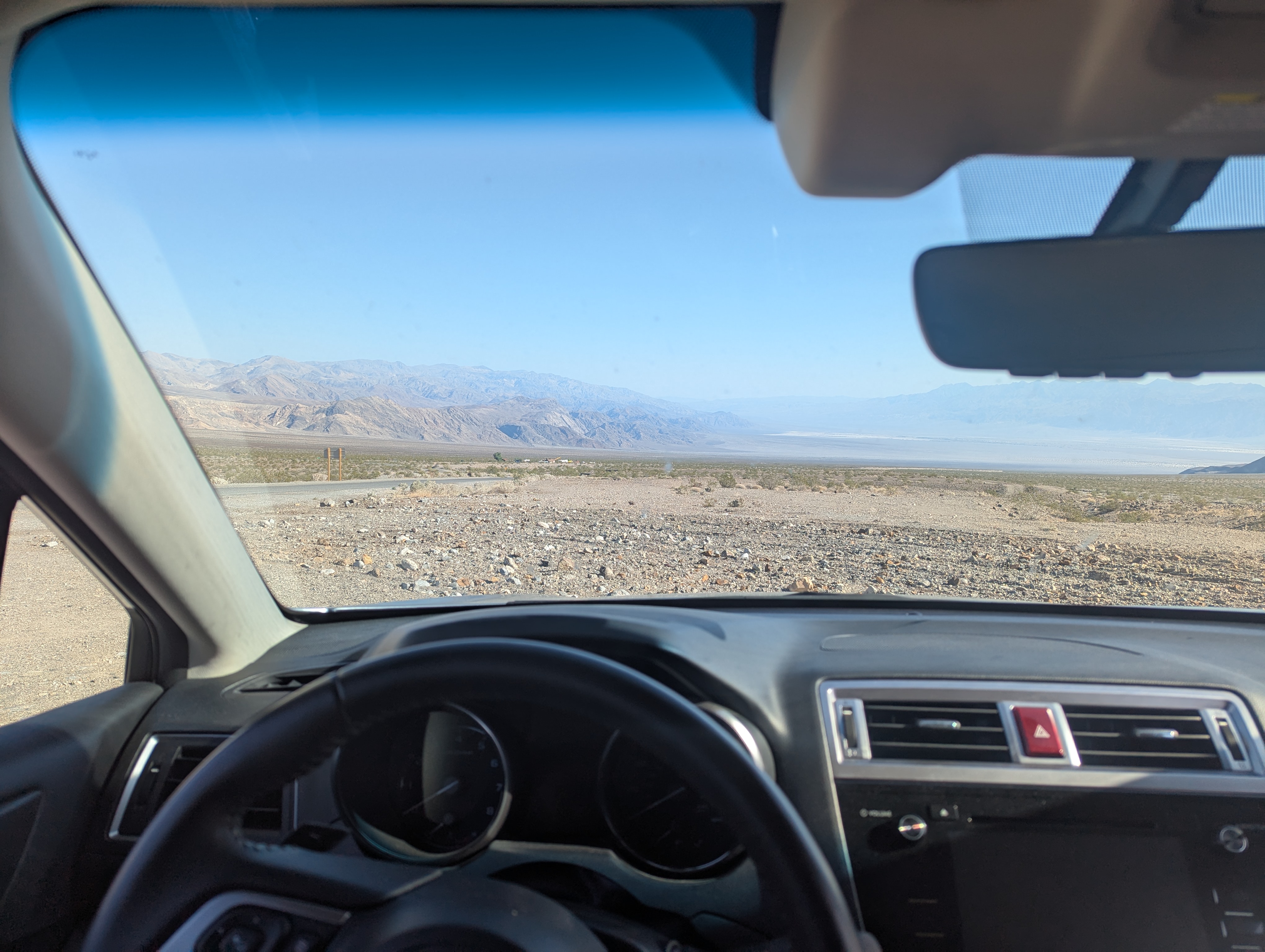
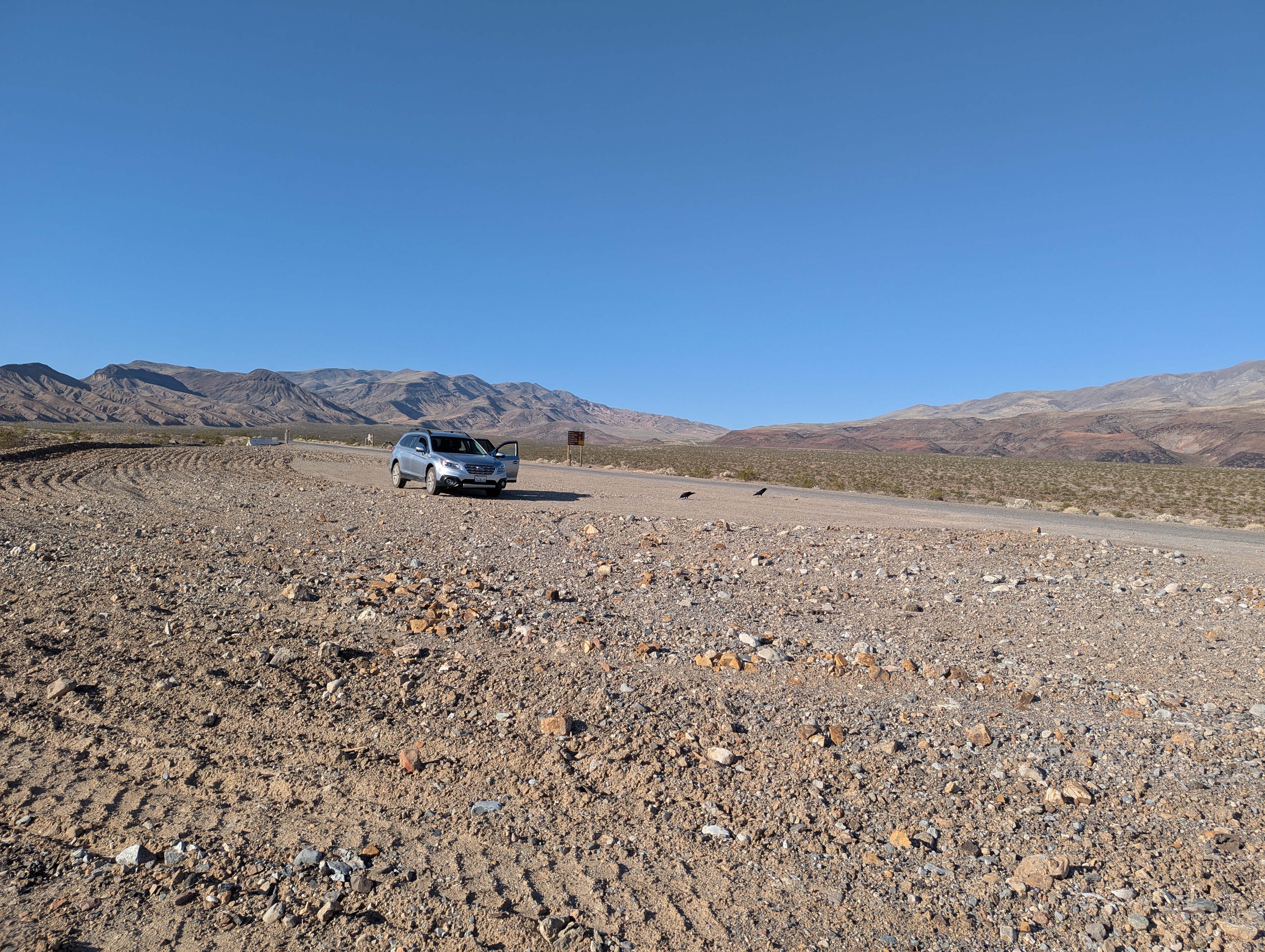
On the drive I could pick out Telescope almost all the way from Lone Pine CA, and had plenty of time to contemplate how absolutely screwed I would be if I got bit by a rattle snake. I followed CA 190 toward Furnace Creek CA as it dipped down several thousand feet and then back up through the desert valleys accompanied but the occasional rental car on its way to the lowest elevation in the U.S. After tuning off on Emigrant Canyon Rd I didn't see any traffic besides some wild donkeys until I reached the Wildrose Charcoal Kilns. I had read that the road further to Mahogany Flat Campground on the ridgeline was rather treacherous without high clearance and 4wd, but hey, that’s why I got an Outback. I certainly was at least going to give it a go knowing parking lower meant an extra 1000 ft of elevation gain and 2 miles of hiking. To the surprise of the two jeep owners up at the top, I made it no problem. Slow is pro. It was now about 3pm and I parked just in time to chat up the last hikers finishing the~13 mile 3,250 elevation gain trek to Telescope for the day before they packed in their lifted Tacoma and headed down the mountain. And just like that I was alone.
I decided it would be fun to try to get to the peak by sunset (I love racing the sun) so attempted to get in a quick nap after packing my bag and tossed and turned in the heat till 5pm when I started up the trail. The trail to Telescope is long, and for most of it the peak is in view, which really drags out the uphill. I startled a flock of quails who's collective wing flaps seemed to vibrate in my chest cavity, and even though it was broad daylight the shock got my adrenaline absolutely pumping. The good news was I needed it because I knew I was going to be cutting sunset close. So there I was having been at sea level the day before, now up at about 10,000 ft pushing myself as hard as I dared knowing I had to do it all back in the dark. Once on the long ridgeline the adrenaline gave way to awe at the expansive view into Death Valley and out toward Las Vegas on the left and toward the Sierra Crest on the right, pretty incredible. The juniper and pinyon pine gave way to bristle cone pines (known for being the oldest trees on earth) as I climbed, and as my and the peaks shadow stretched longer to the east. I was kicking myself at this point because I brought both my microspikes and ice axe just in case I encountered significant snow when I should have just asked the hikers who had come down. Only rug sized patches of snow remained.
I topped out about 30 minutes before sunset and after taking some photos plopped down for my dinner break and to soak it all in. There was a lot to soak in. As the sun sank behind Whitney and the Sierra Nevada Crest on the western horizon I watched as the darkness slid up over the eastern sky, like being within an opening eyelid to darkness. My elation at my high position and the pastel sunset quickly turned to apprehension as I contemplated the many things I could encounter on the way down with no moon in the sky. A mountain lion? Big foot? Moth man? Extraterrestrials? Gatorade bottles in my hands served both as a constant reminder to keep hydrating and as a loud clicking device to break through the eerie silence and in theory scare off whatever baddies lurked in the darkness, or to at least provide some false sense of safety somehow. The headlight spot became my world as the landscape visible for 100s of miles in every direction slowly faded to inky black. I could pick out tiny towns as clusters of light far far off to the east. The stars were absolutely incredible, but being so hyper aware of how alone I was I could only bring myself to turn off my headlamp for two several minute breaks. I nearly jumped out of my skin when a reverberating low noise began emanating from up ahead. It sounded like a distant launching rocket, but it was close. The damn quails got me again. At least that’s what I told myself because I could not think of any other potential earthly culprit. I was ecstatic to see the trailhead register both because I was physically exhausted and mentally in the position of a small child thoroughly afraid of the dark again. It was about 10:45pm when I got to sleep. It had been a long long but successful first full day.
Story continues after Day 2 photos.
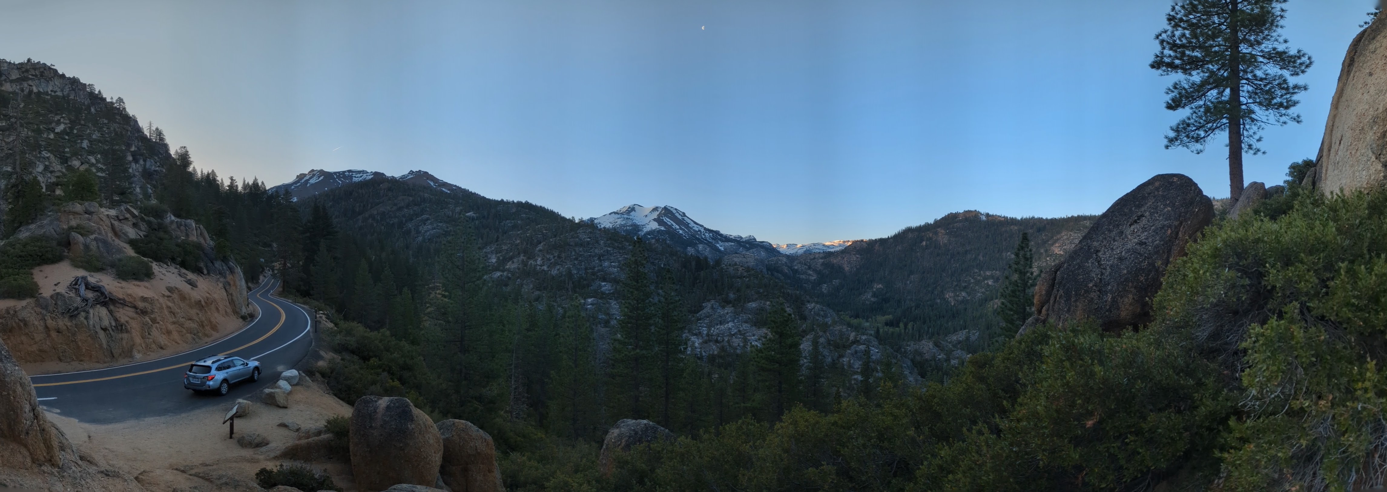 A panorama of the road climbing up the west side of Sonora Pass.
 Mu at the top of Sonora pass. Plenty of snow still with some folks skinning up to do some spring skiing as I passed through.
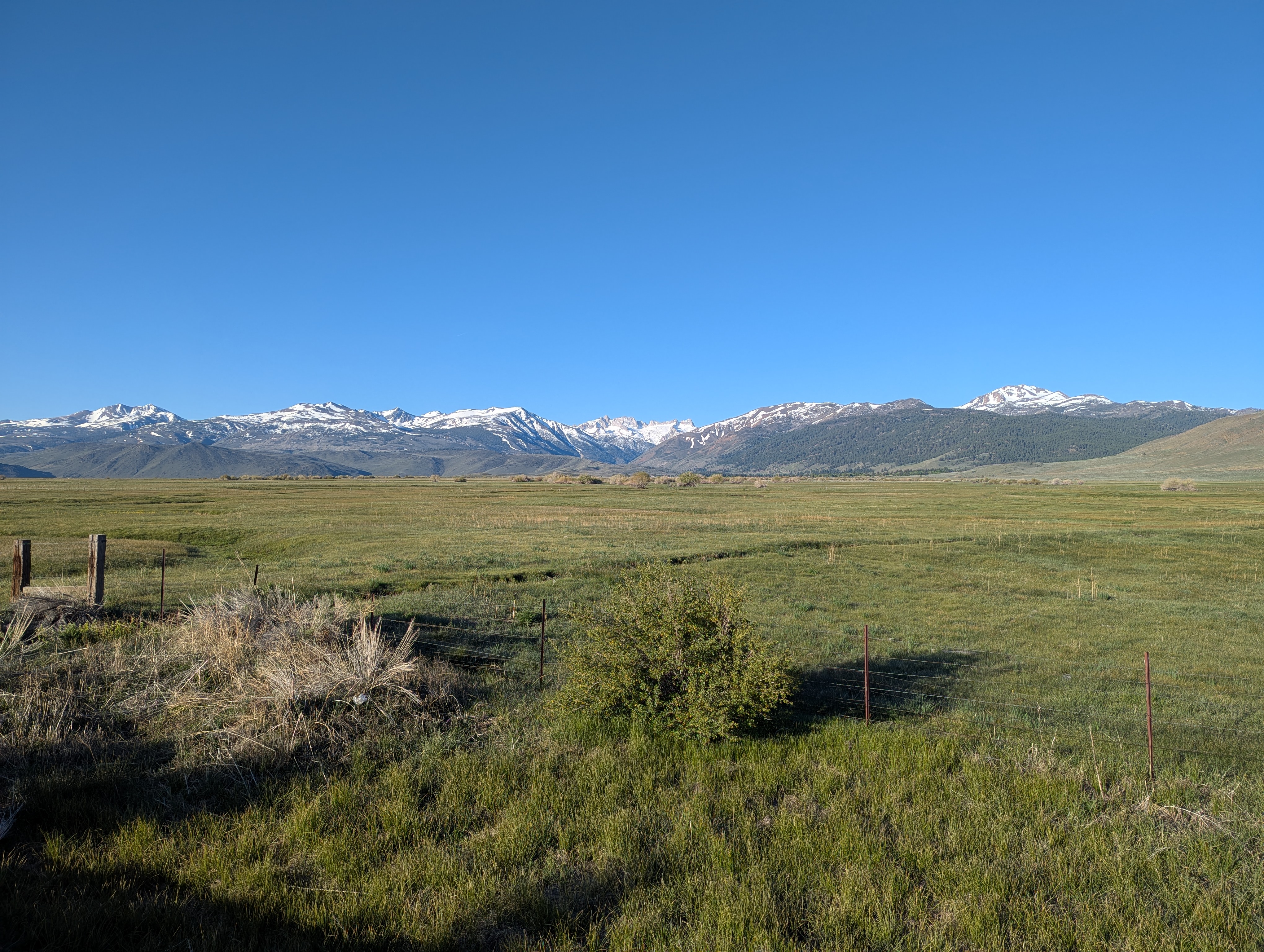 The vivid green grass of cow grazing areas near Bridgeport CA with the snowcapped Sierra in the back is always a must stop photo op. The jagged ridge in the back middle is the aptly named Sawtooth Ridge behind Twin Lakes.
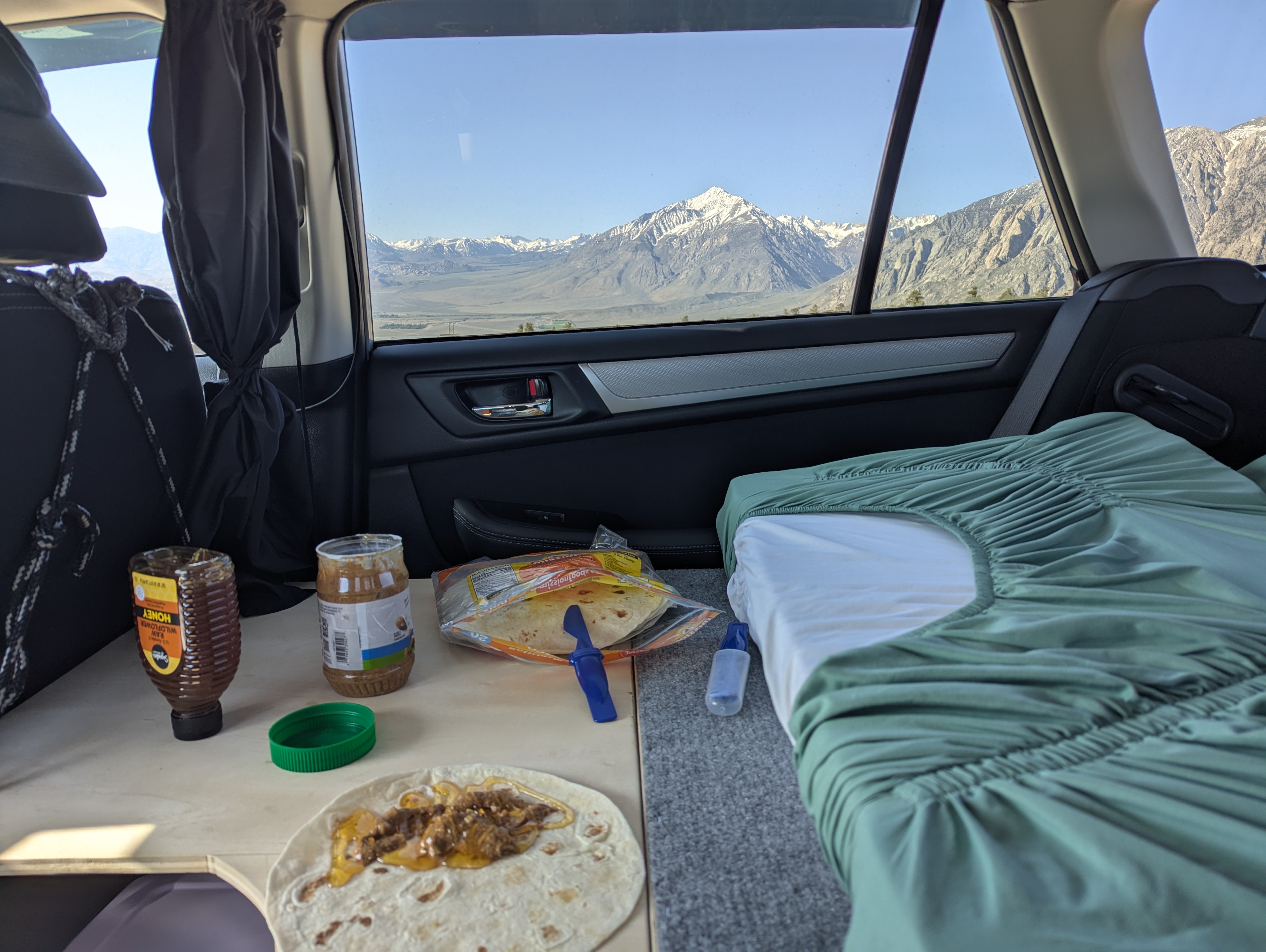 Breakfast on the bed at Mono Lake Vista Point, but my eyes are on the mountains of course.
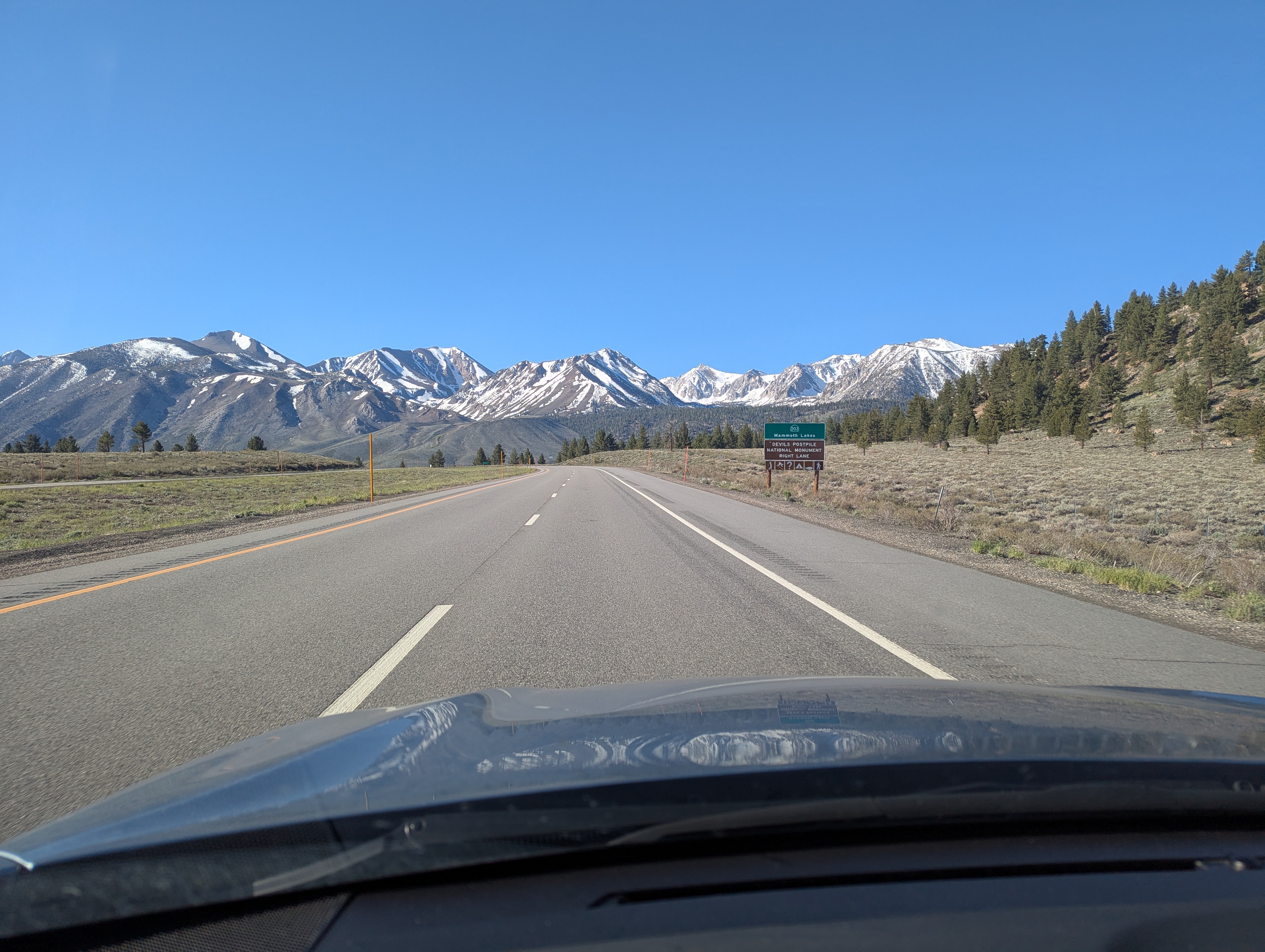 Highway 395 does not disappoint, Laurel and Bloody Mountain seen here driving south just before the turnoff to Mammoth Lakes.
 Striking beauty over a solum place at the Manzanar internment camp.
 I think few McDonalds can compete with the view from the Lone Pine establishment, Mt Whitney nicely framed here by utility poles above the parking lot.
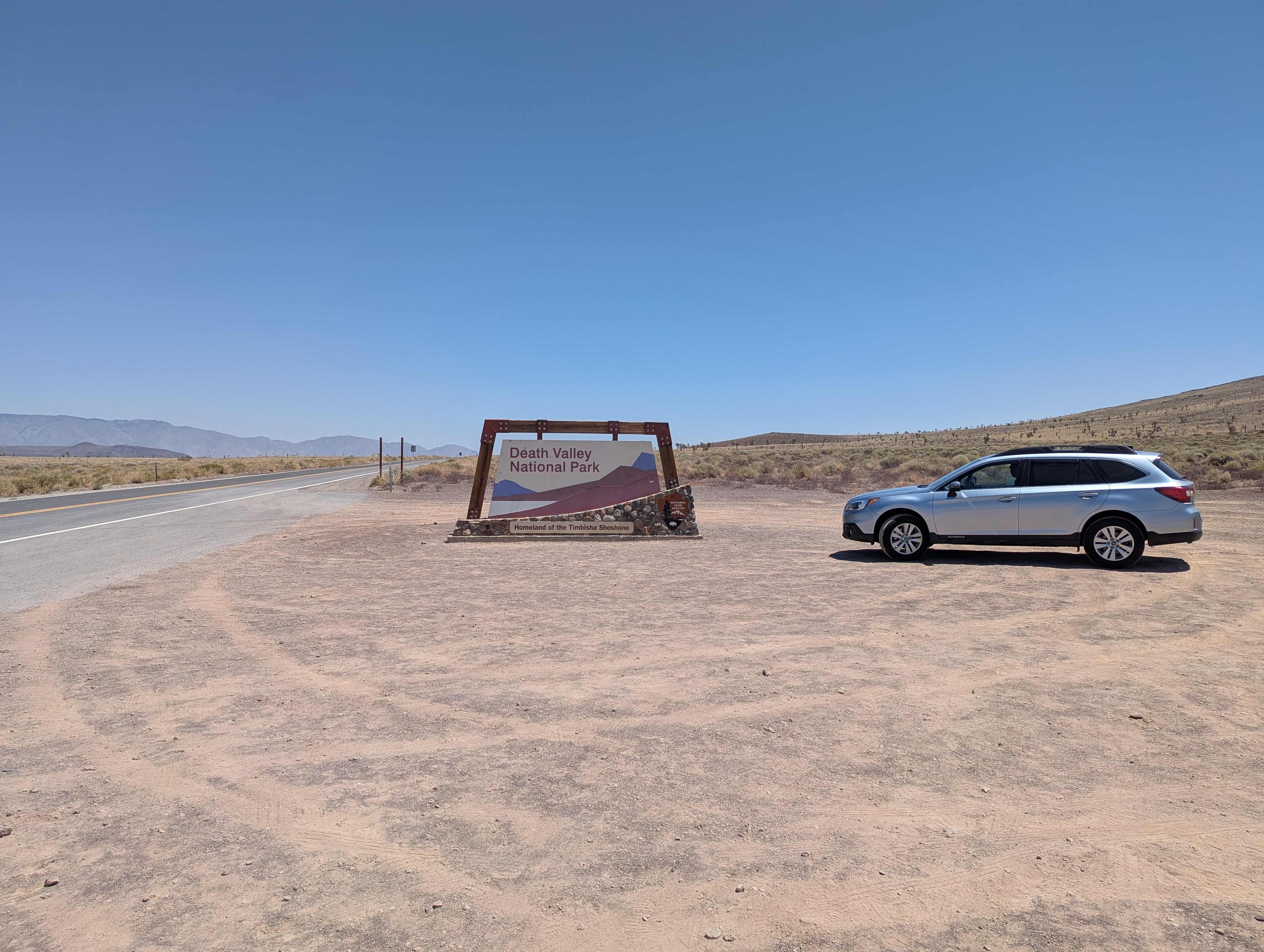 Entering the middle of nowhere: Death Valley National Park. While most go for the low point, on my third trip here it was time to get the high point.
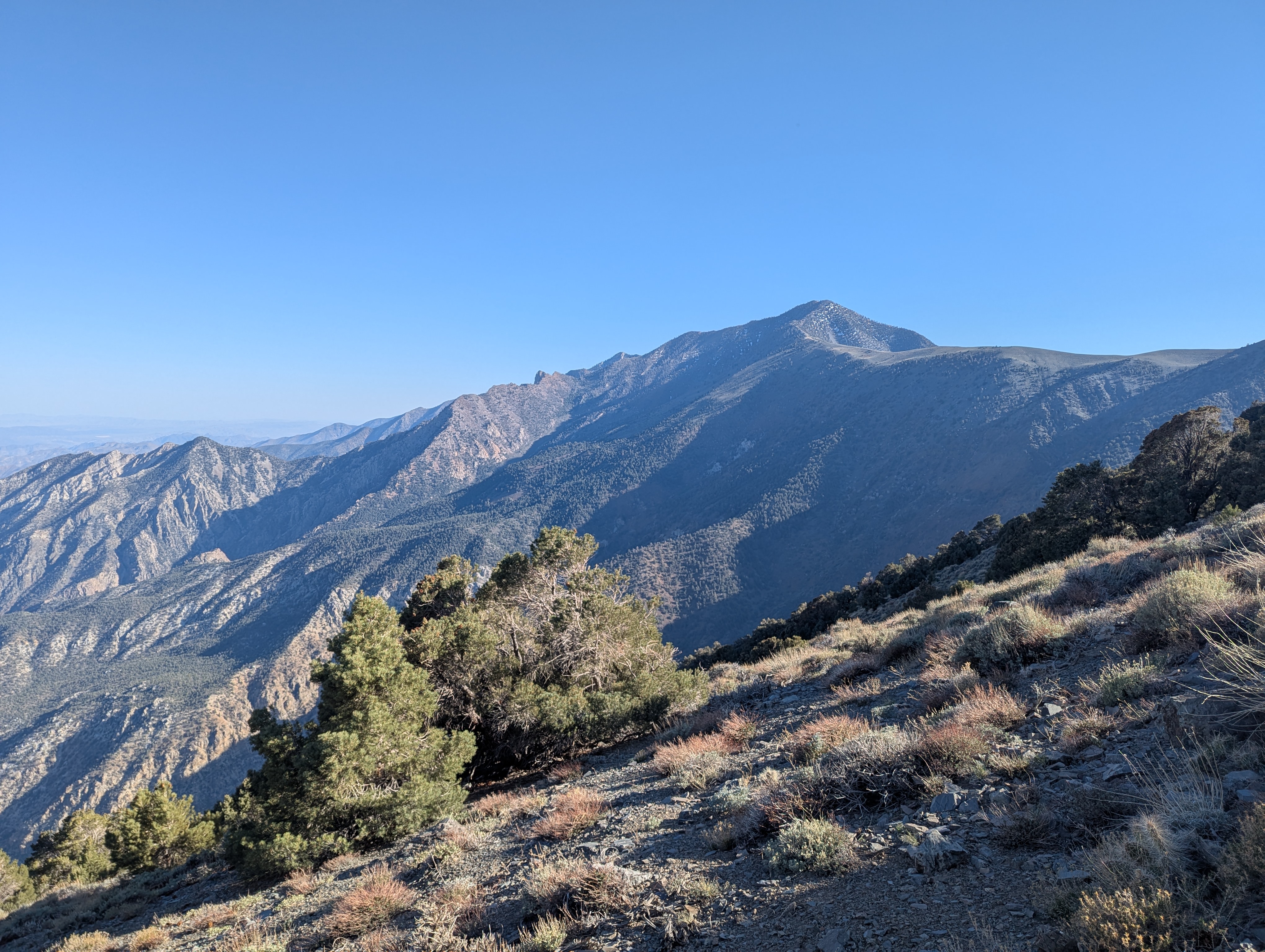
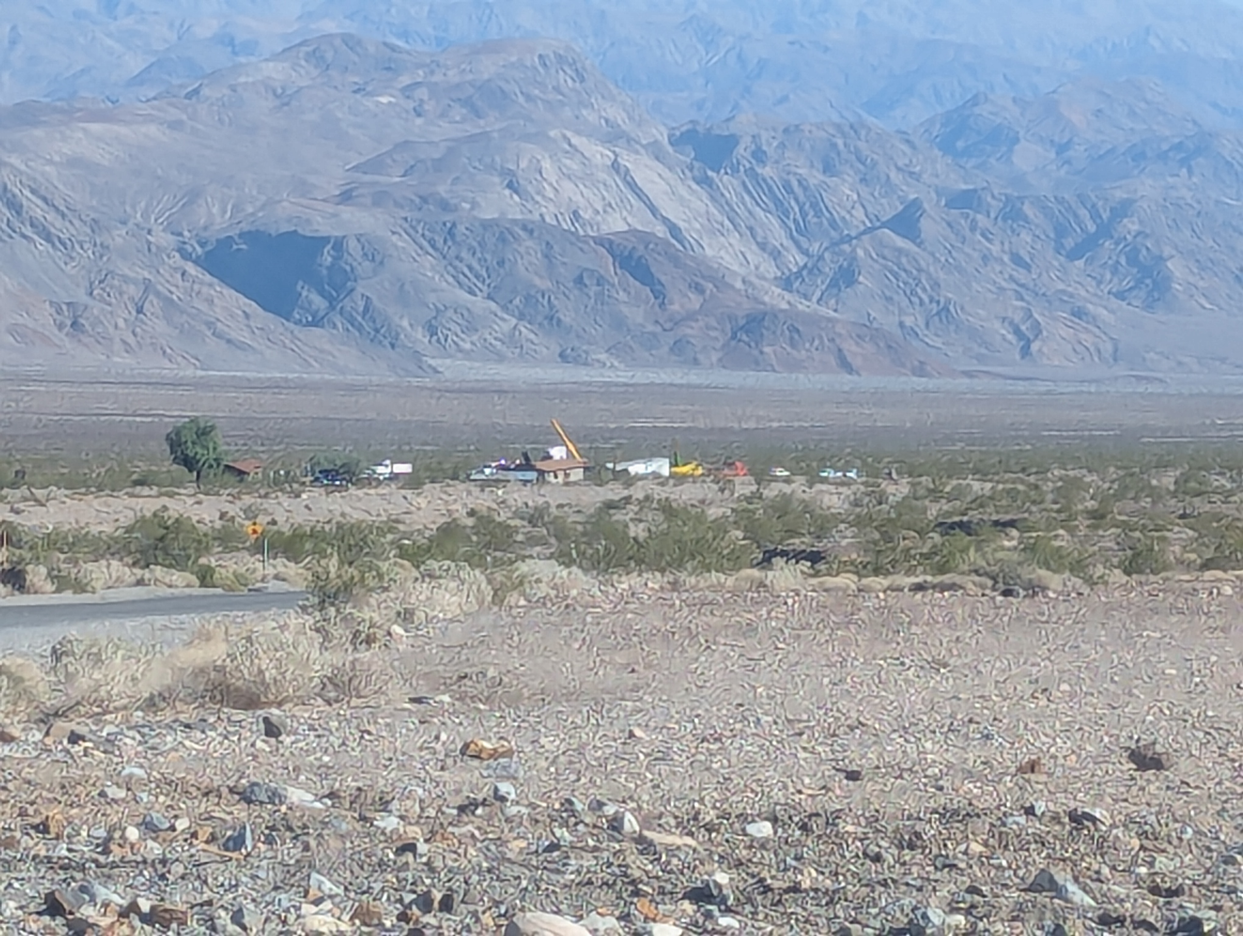
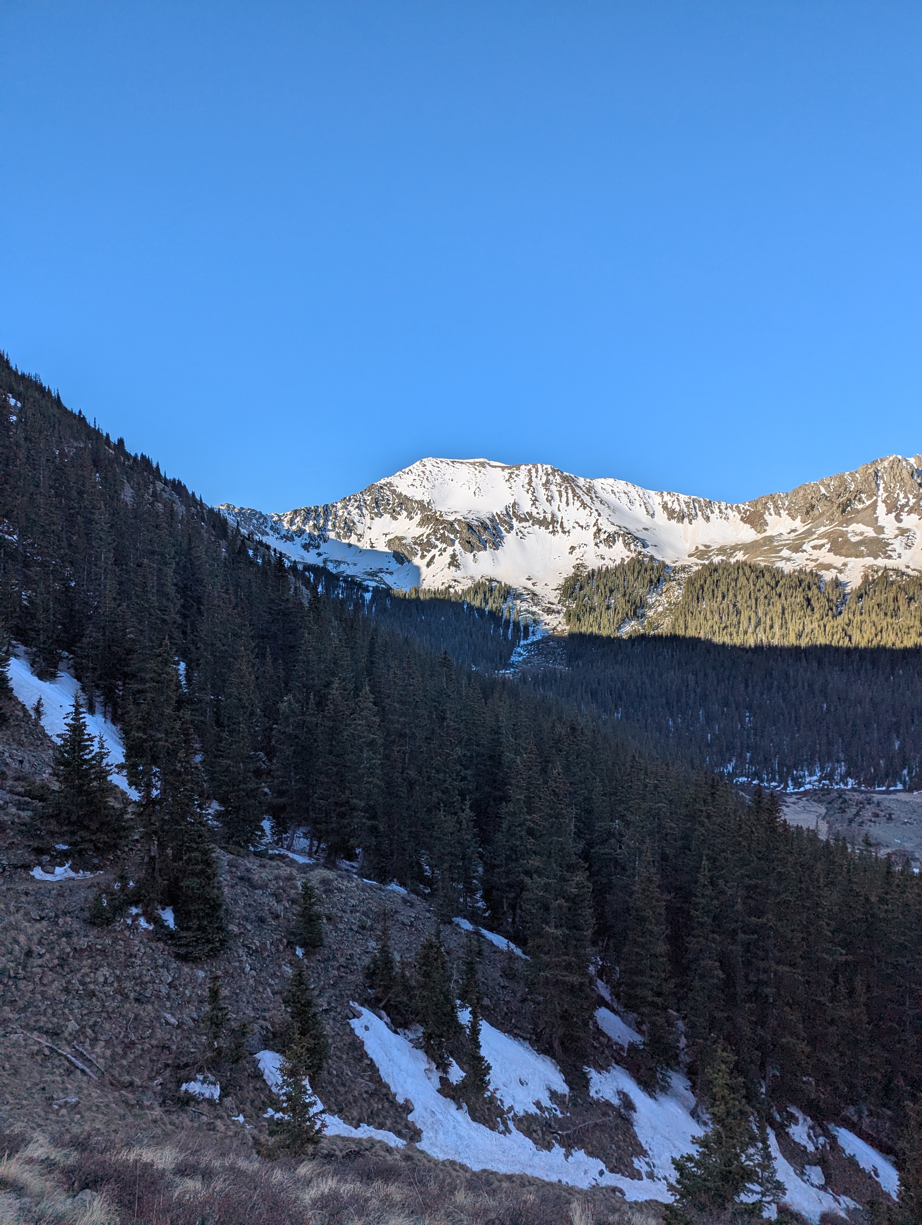
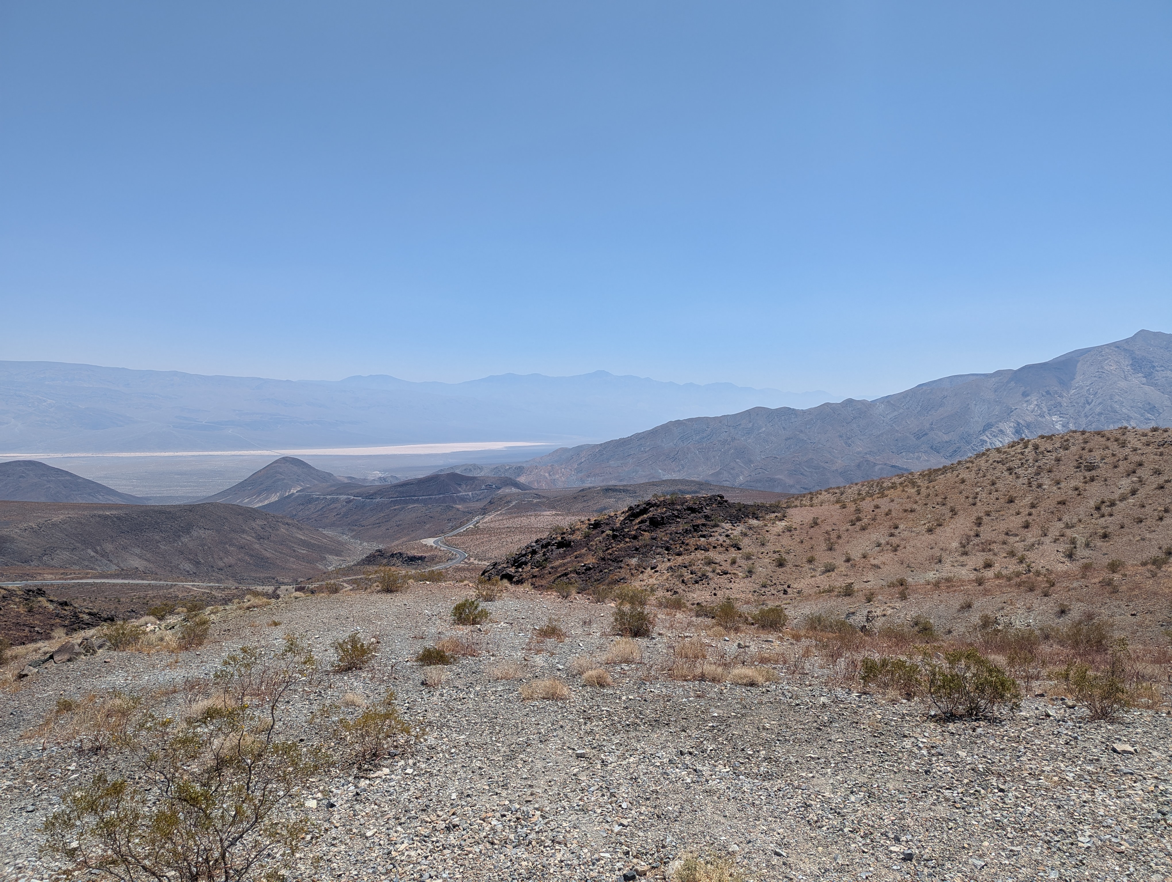 Telescope peak (center of far ridge) as viewed from above Panamint Springs looking over the Panamint Valley, about 30 miles away as the crow flies.
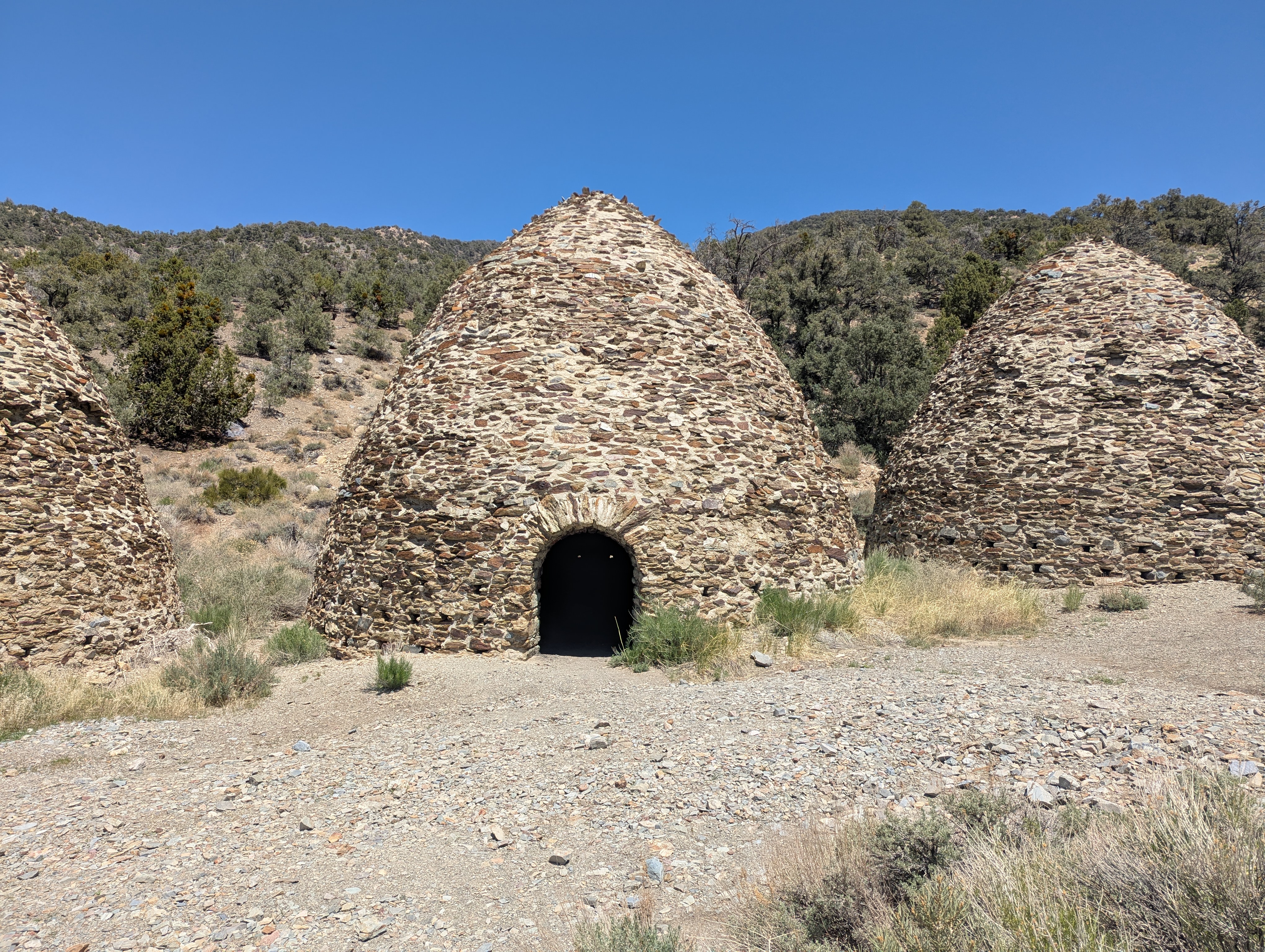 Very well preserved, the Wildrose Charcoal Kilns were built 1877 and only used for about 2 years before some other source of fuel for a distant mine was found. There were quite a few cars parked here for surrounding hikes but all cleared out by the next morning.
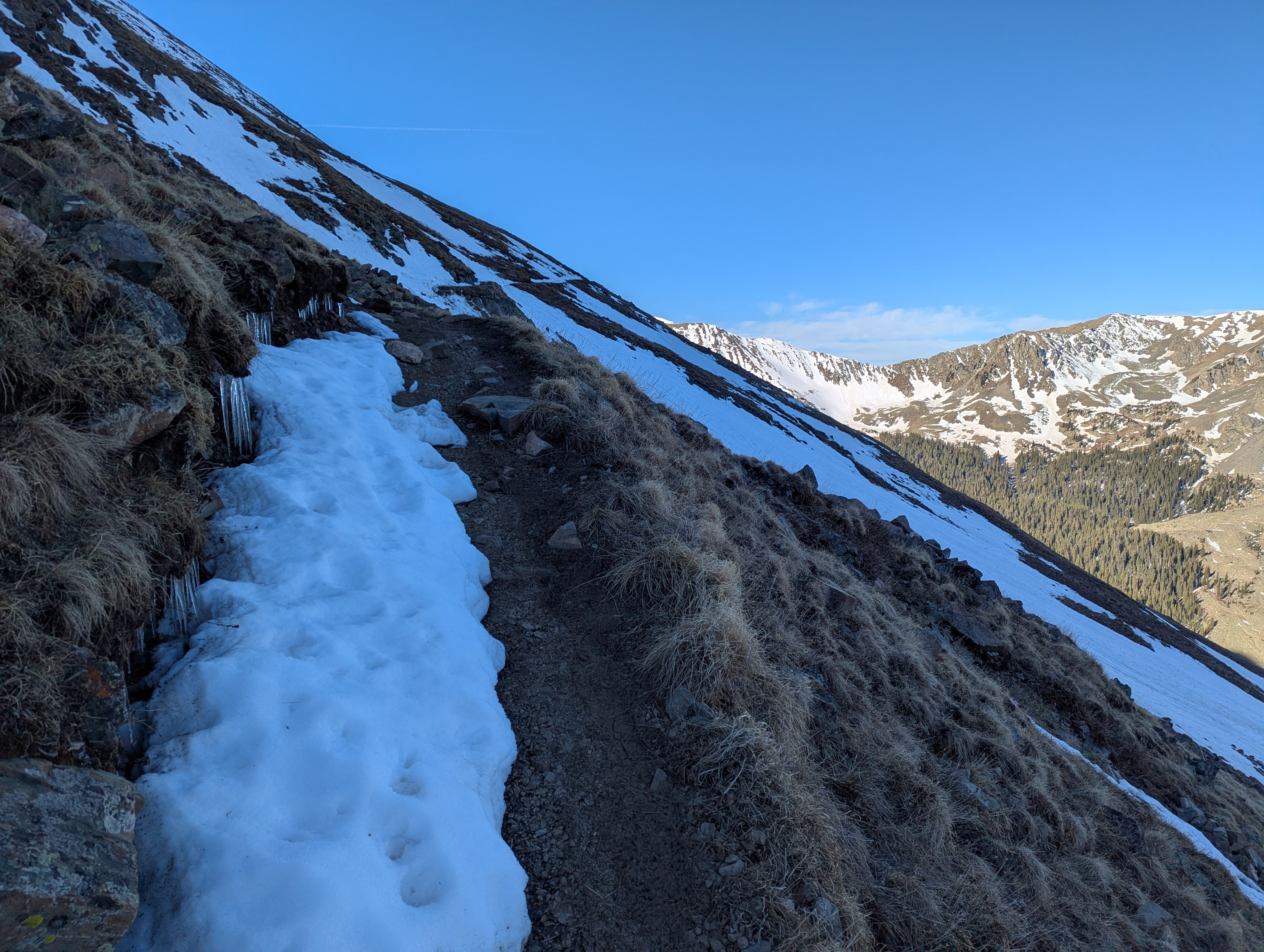
 About a mile into the hike, you get your first look at the view of Telescope Peak that you will have for the remainder of the hike. I was spooked by the quails shortly after this photo.
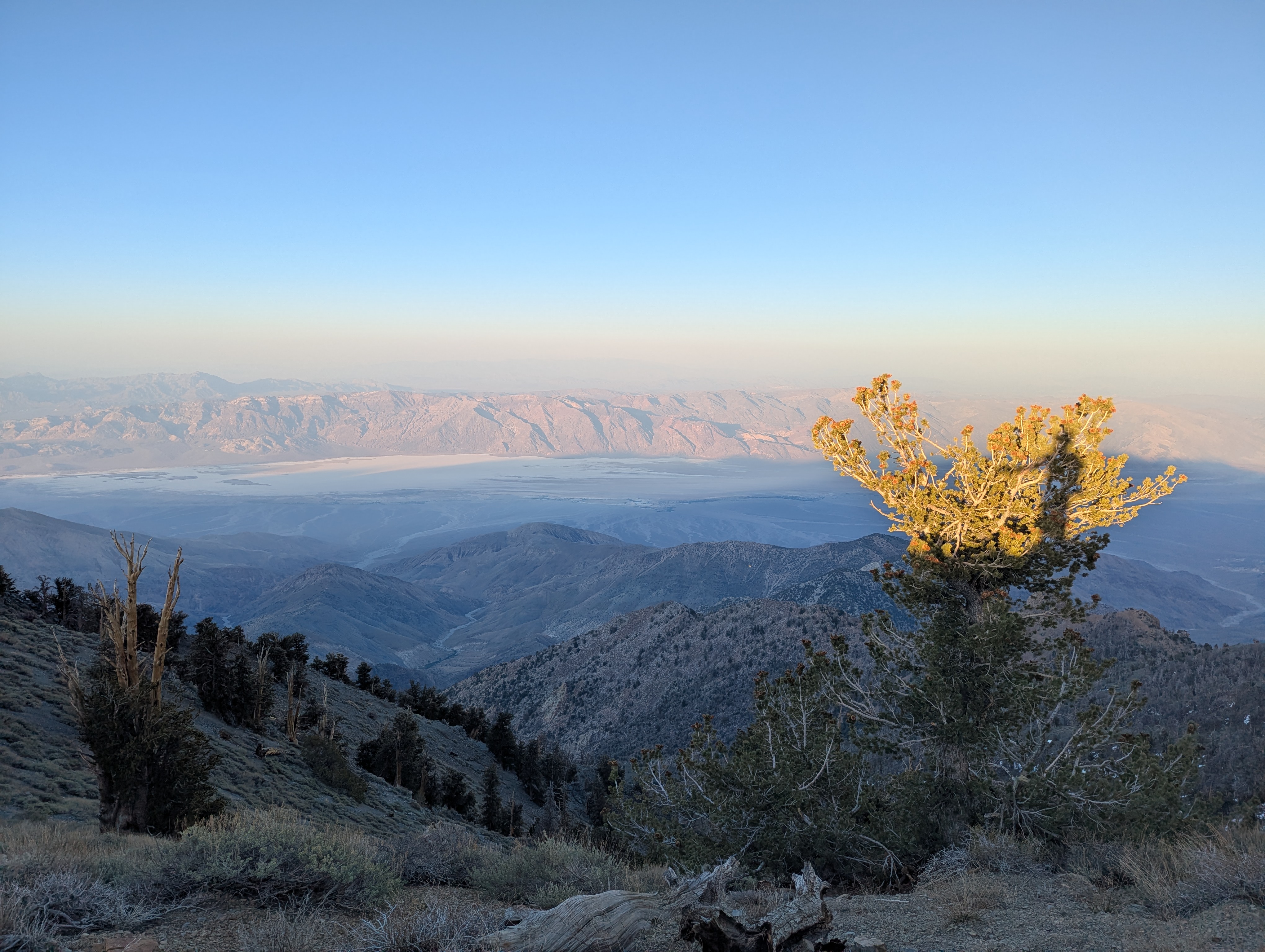
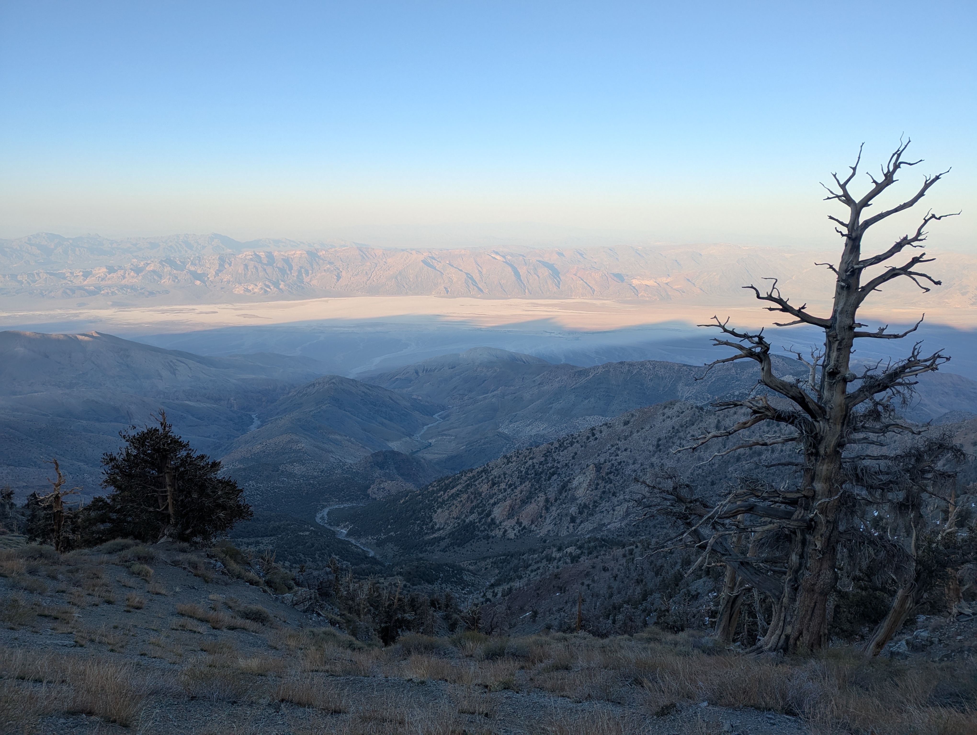 Some very nice Bristlecone Pines for being this far south. Badwater Basin is against the far side of the valley center left.
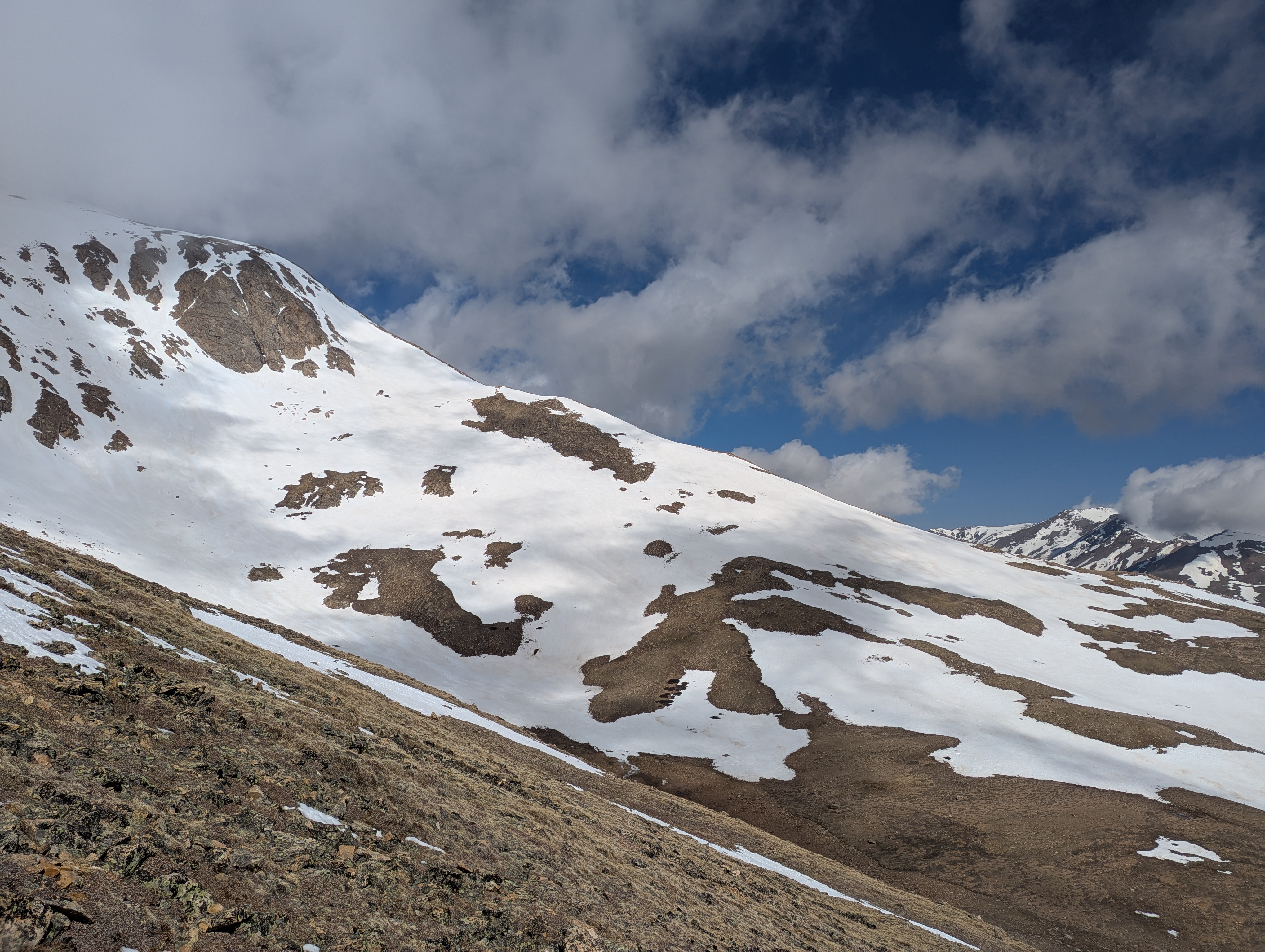
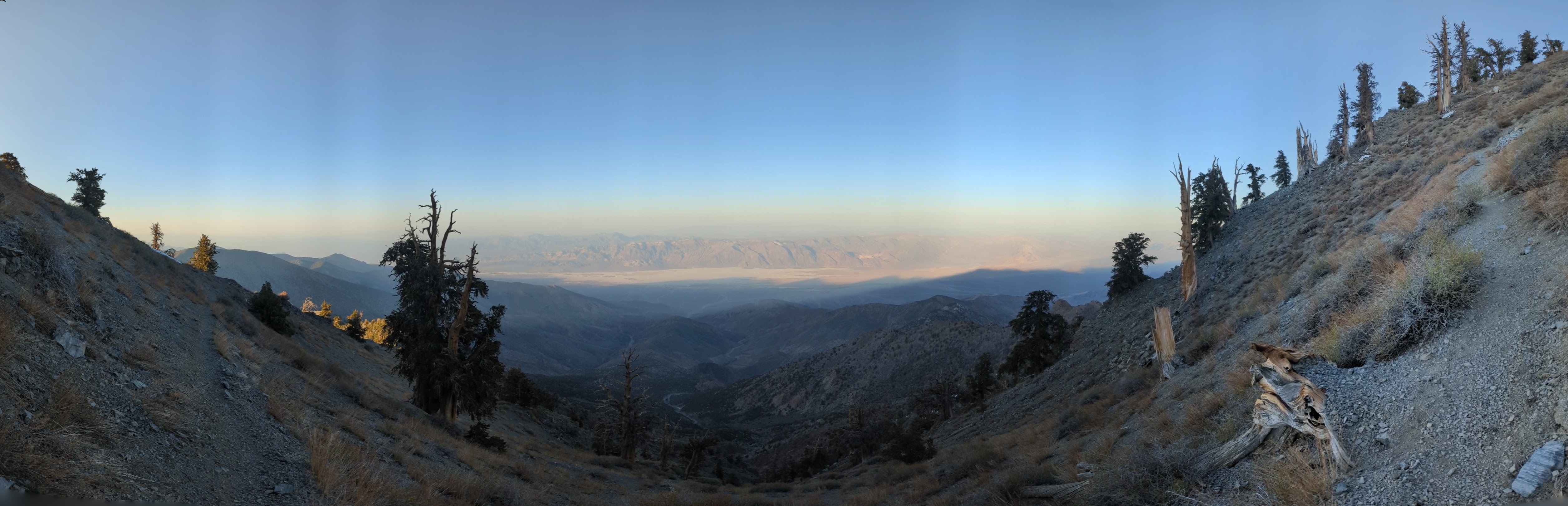 A panorama of the sparse Bristlecone Pines and the growing shadow of the ridgeline Telescope stands atop as I make the climb up the final switchbacks on its eastern face.
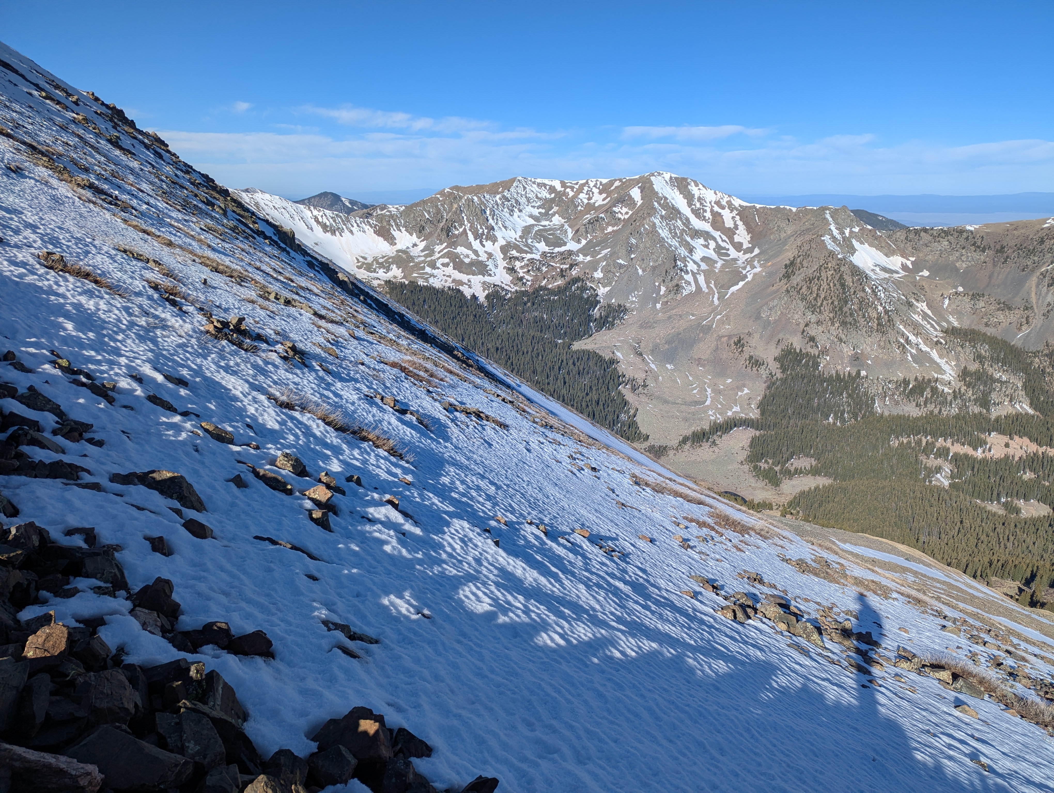
 My shadow drawing attention to the view on the final shore ridge walk between the false and actual summit.
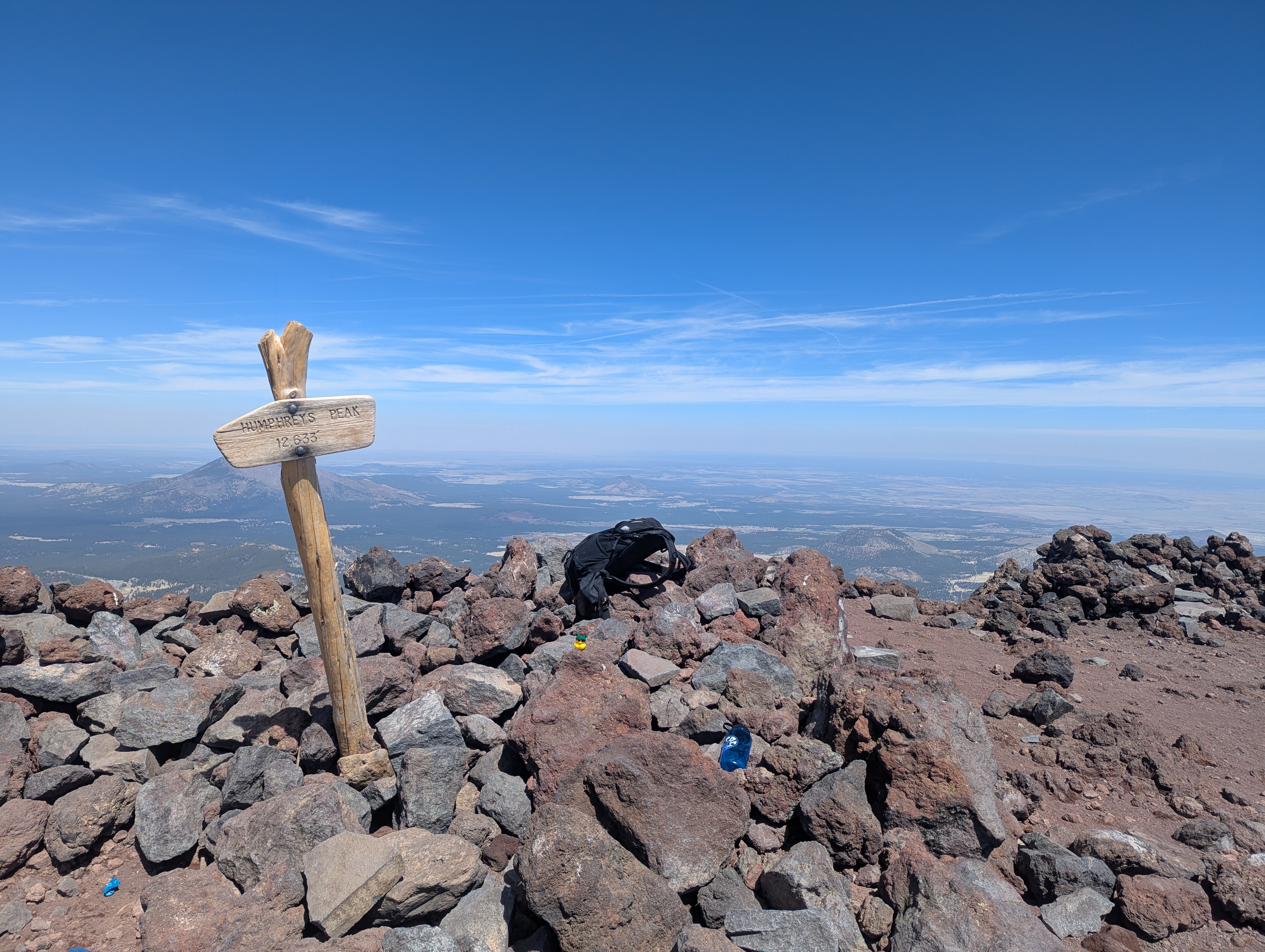
 The summit of Telescope peak, Doug's first high point, with a nice wood sign and the peaks shadow stretching to the southeast. Badwater Basin, between Doug and my backpack sits about 11,300 feet below through the haze.
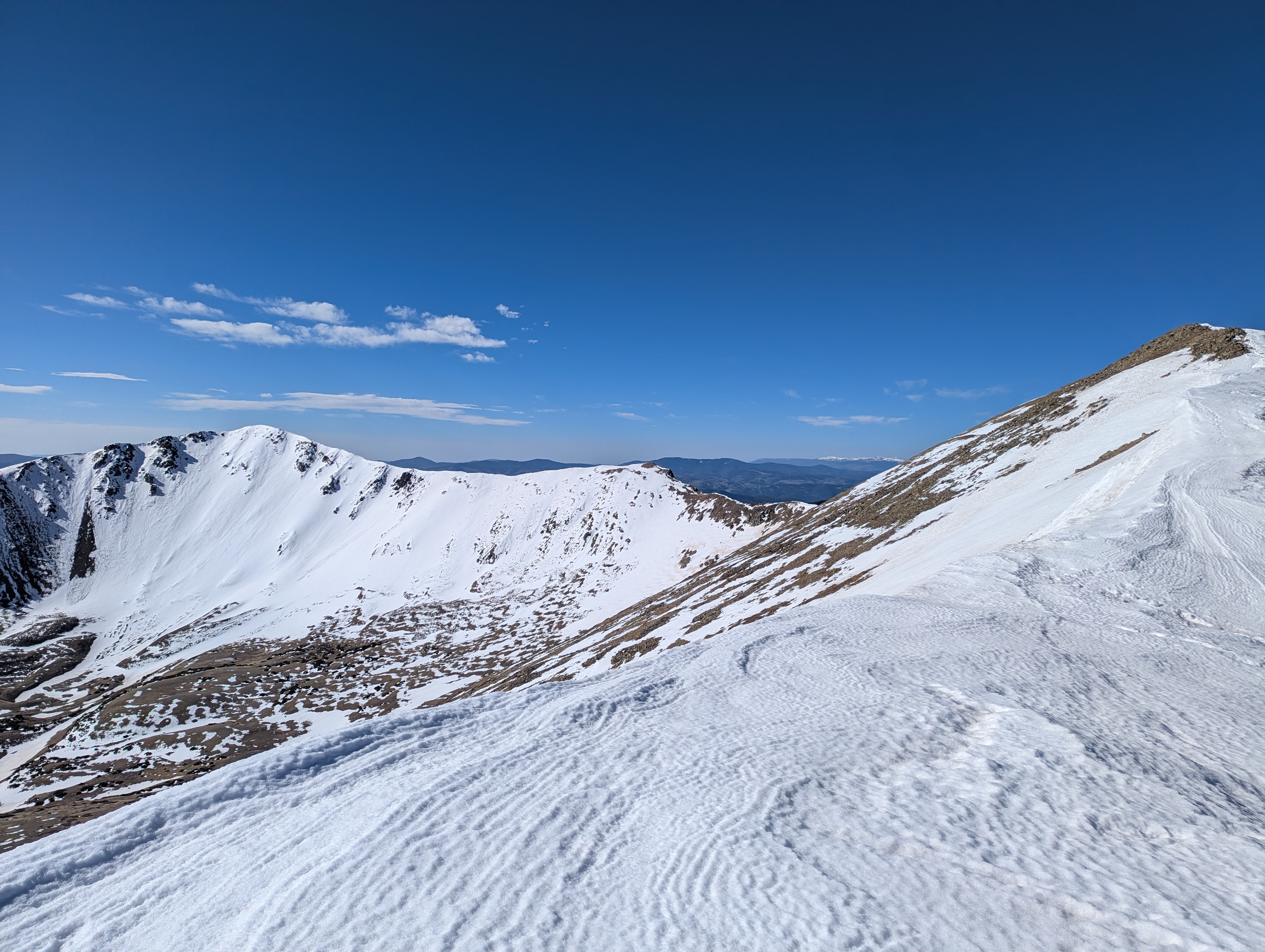
 A panorama of the summit with the center being roughly north. The sun is setting over the Sierra Nevada blowing out the exposure and preventing us from seeing the crest.
 Now backlit by the setting sun, the profile of the Sierra crest, almost 80 miles away, stands tall against the horizon. The sun passed roughly behind where I'd expect Mt Whitney to be. Its hard to say what the farthest north peak I can see on the crest is, but it must be more than 100 miles away.
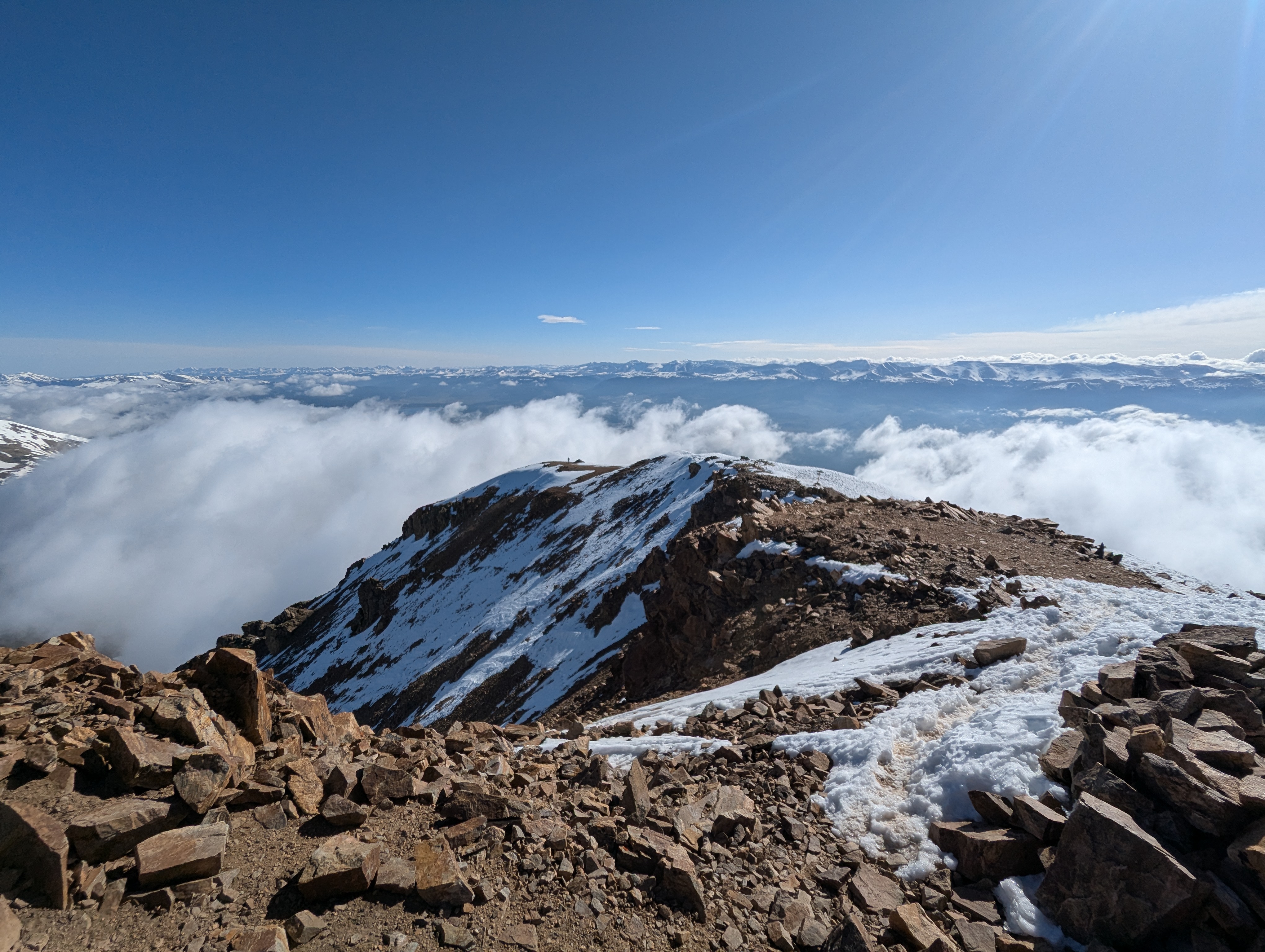
 The same panorama of the summit as before, this time sans sunlight. It was about this point, after the adrenaline from racing the sun had worn off and the air was thoroughly chilled that I really realized just how alone I was.
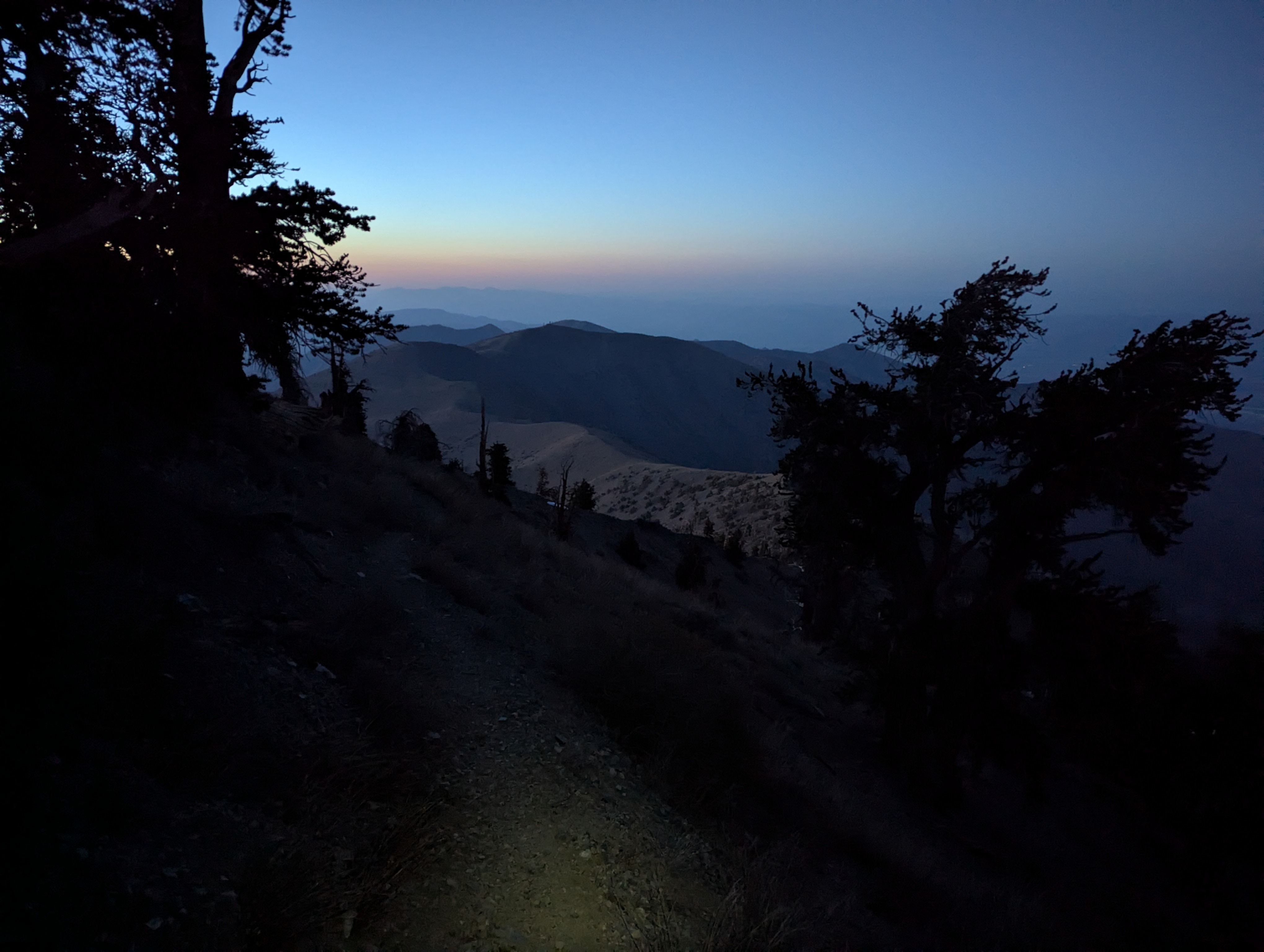 My feeble headlamp spot on the ground as I descend the switchbacks and stare dismayed at the long way down I still must travel in the dark.
May 21st - Day 3 - Trapped in Death Valley and Drive to Humphreys Peak
The first rays of sunlight on the 8,000 ft ridge woke me around 5am. The day called for a ~6 hour drive to Humphreys Peak and depending on my timing I also hoped to stop by the Grand Canyon or Hoover Dam along the way.
After a quick Greek yogurt and random items breakfast I started the drive down the mountain, navigating the rutted road with care knowing full well applying the brake too hard too suddenly would certainly cause me to bottom out on some very impressive sharp rocks. My only company on the road back to CA 190 was a kit fox that trotted on the road ahead of me for quite some distance before darting off into the scrub.
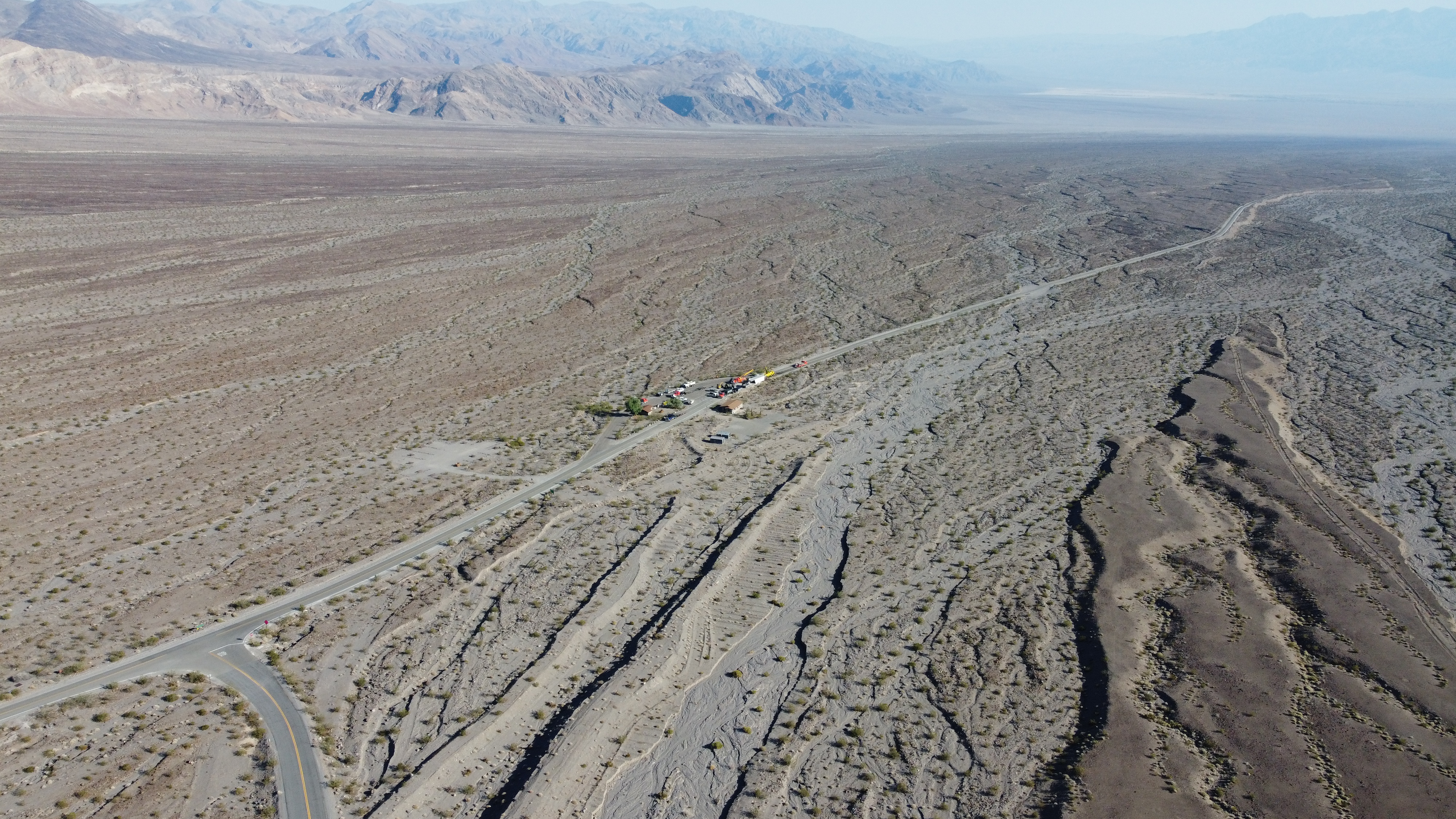
I was making good time as I reached CA 190 which would take me to Furnace Creek and then on to the Nevada border, at about 8am. I saw what looked like cranes around the small buildings of Emigrant Campground but didn't give them a second thought. But as soon as I made the right turn I found three heavy duty flatbed tractor trailers blocking the right lane. Odd. I peered around them in the left lane and saw Caltrans crew trucks about 500 ft ahead. No flaggers though. Again, odd. I decided it was probably best to stay put but make my presence known by pulling to the middle of the road so they could see me waiting there. After about 5 minutes they noticed me and one of the Caltrans trucks started in my direction. I backed back into my land and rolled down my window to see what was happening as they pulled up.
"How did you get here?" they asked seemingly with as much confusion as their question caused me.
"Uhhh, I came from over by Wildrose Campground…" I responded still not really understanding their question.
"Oh, so you came in from the south side to get there?" they pressed further.
"No, that road is washed out… I came from this side yesterday and stayed up on the ridge overnight" I replied still confused.
"Oh, the rangers said that no one was left back there. This road has been closed for 18 hours. A big rig lost its breaks and crashed here yesterday around 2pm."
Well, that explained a lot. I had passed by maybe 20 minutes before the accident, and it sounded like rangers had swept the area the previous evening, thus the empty road on the way out. I asked how long he thought it might be before the road opened. Don't know was his answer, and I believed him. I had no service there almost at the bottom of death valley to really understand my options but I really only had one: sit around and wait in the heat. I had plenty of supplies to hang out, and given it seemed all the necessary equipment (the flat beds, two dump trucks, an excavator, two front end loaders, and two big rig tow trucks) were already on scene and hard at work I bet it wouldn't be more than 4 hours before the scene was cleared.
So I waited. I went back up Emigrant road a ways to a pullout that overlooked the scene, setup the window shades, rolled down the windows, and set out to finish up the last chapters of The Restaurant at the End of the Universe. In that moment, I quite related to its "protagonist" earthling Arthur Dent, a tragic external event trapping me, but with no knowledge of the trap simply carrying on with my silly little quests of self-fulfillment.
Some ravens showed up and cawed incessantly at me in the heat. I was going to be there a while so I thought I might as well give them some water in my empty yogurt container. Skeptical at first they eventually lapped it up happily. They stopped cawing and seemed content to just hang out. After a couple hours I decided to go explore the canyon around the road for a bit, watched some ants, contemplated the geologic history of the carved hills, and enjoyed some wild cactus flowers. Upon my return to my spot overlooking the accident scene the ravens returned again as well.
It was about 11:30am when I spotted a "follow" car, snake of cars and RVs in tow, making its way down the road from the west toward the accident scene suggesting the road would soon be opened. I made it to Furnace Creek a little after noon, refilled water, and used my renewed cell service to figure out my plan. Unfortunately I wasn't left with enough time to visit the Grand Canyon, nor enough to bring the Gatorade bottle I had sealed atop Telescope Peak to the bottom of Badwater Basin for fun and instead started making a beeline east to reach Humphreys before sunset.
The drive took me through the desolate desert flats on the border between California and Nevada. The path took me through Pahrump NV, which I swear must be the fireworks capital of the U.S. I saw at least five giant warehouses all with competing discount deal billboards plastered along the entire road. Las Vegas was what I expected, traffic. The remaining road to Flagstaff was mostly uneventful except for one really bad driver that would drive 90 in the slow lane slamming on their breaks inches before rearending trucks and cars there before deciding they should try to pass them instead, just why. Because of their chaotic movements I was travelling on average at a similar speed and thus unfortunately had frequent encounters with them. I made it to the Arizona Snowbowl parking area about 20 minutes before sunset which I watched before turning in for the night.
Story continues after Day 3 photos.
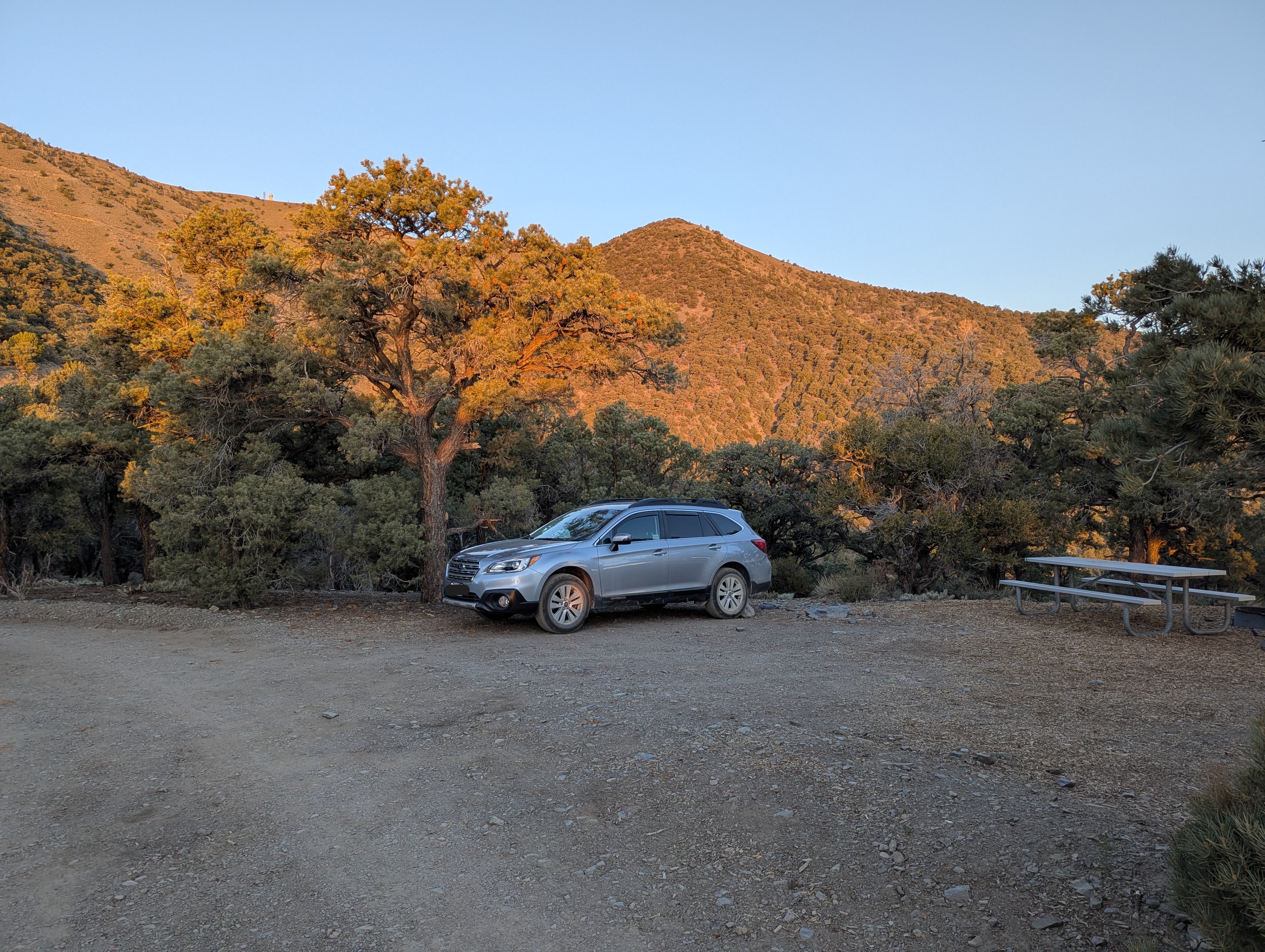 Morning light at Mahoganey Flat Campground on the ridgeline.
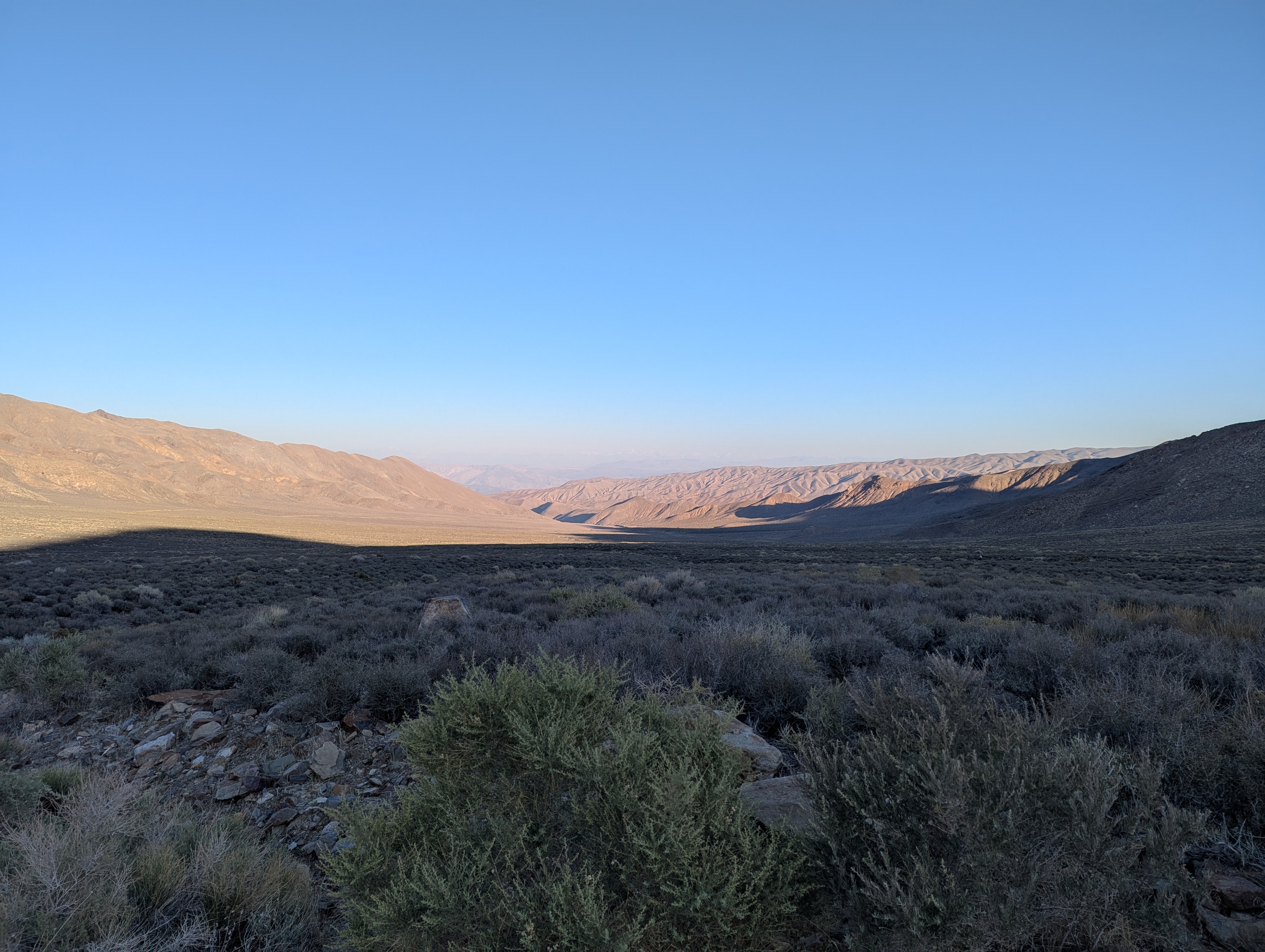 Big fan of how low light brings out the desert's folds. This was taken shortly before I realized I was stuck.
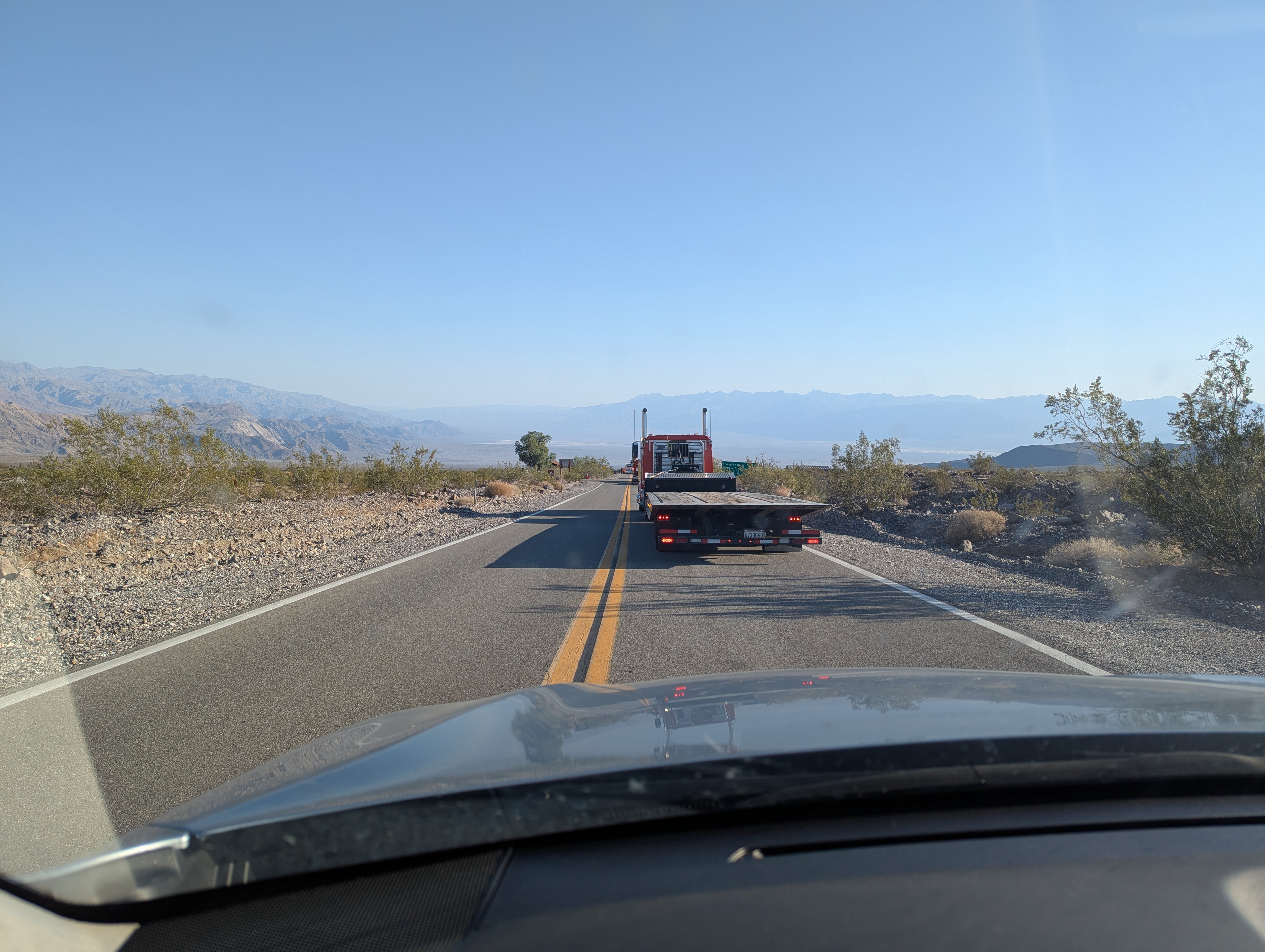 Odd, who left all these here? Where is the flagger? This is where I waited patiently to figure out what was going on.
 My pull out above the scene watching things get cleaned up.
 Quite the assembly to get things sorted out.
 Watering the ravens, at my purgatory pullout in the desert heat.
 The ravens thanked me for the water by helping me snap this photo from above.
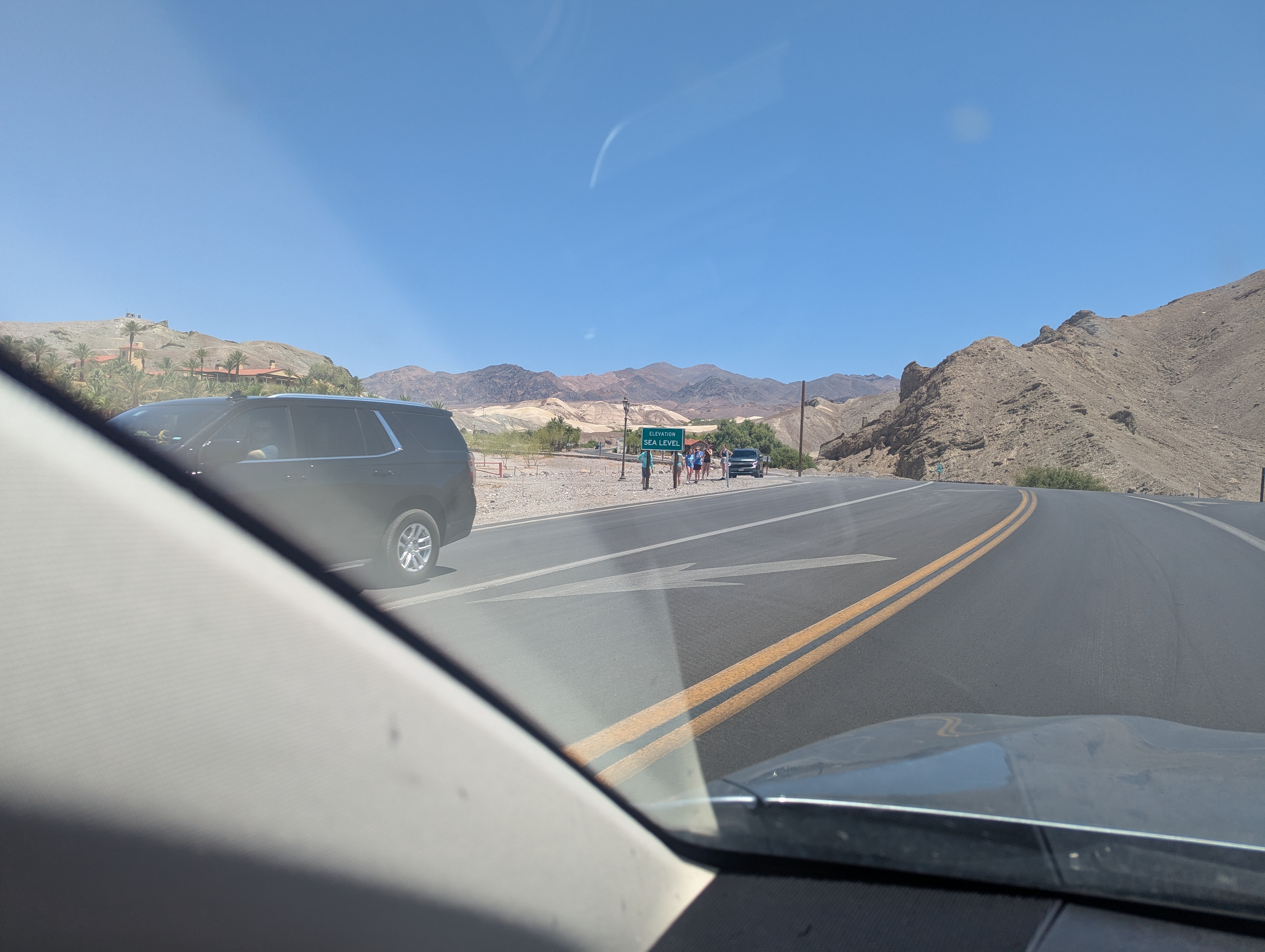 A quick snap of the sea level sign surrounded by tourists as I pass. It had been less than two days since I started at sea level and after being up at 11,000 ft now I was back!
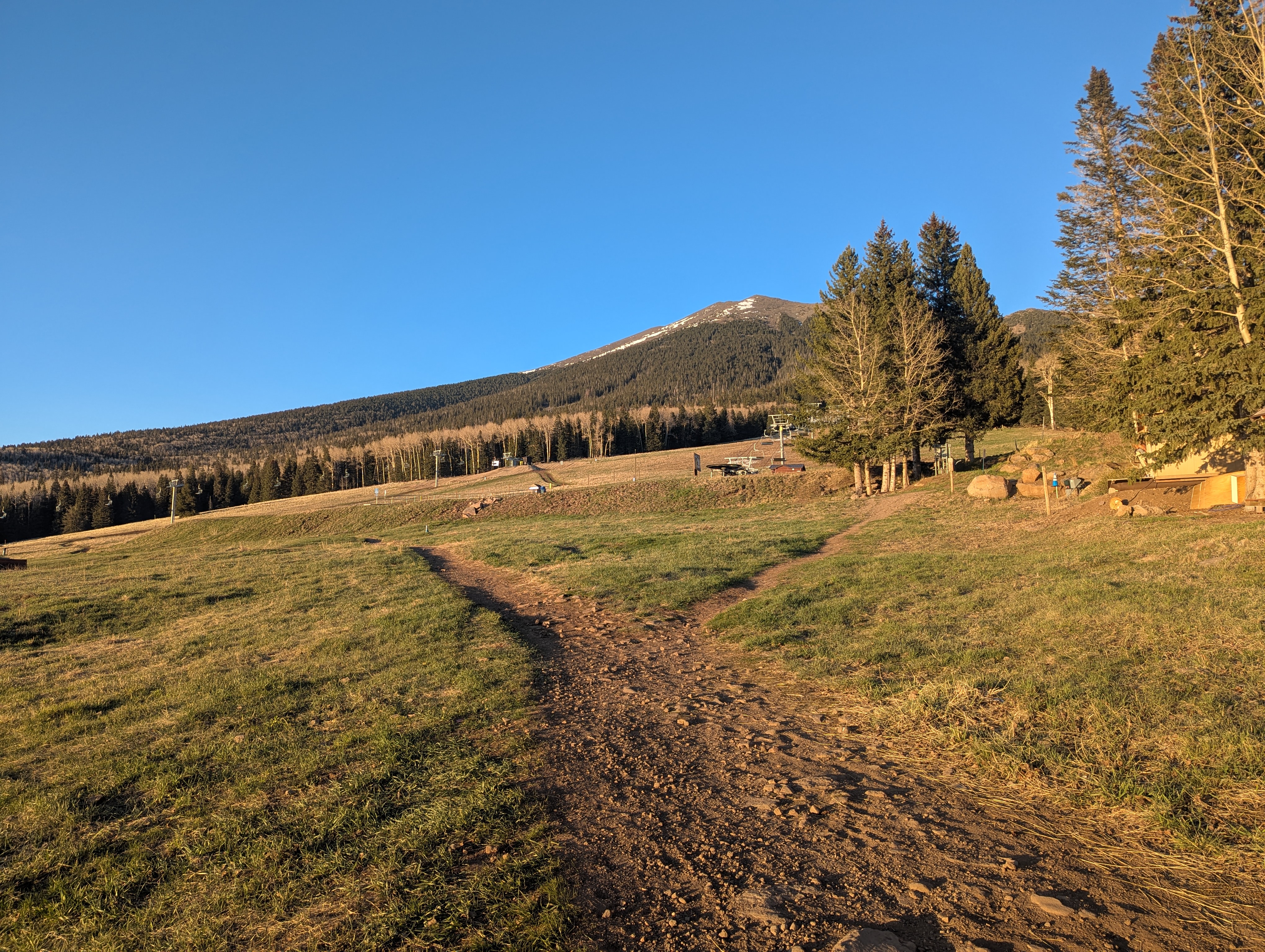 Sunset at Humphreys, glad to have made it!
May 22nd - Day 4 - Humphreys Peak AZ and Drive to Santa Fe
I tried to get up about an hour before sunrise but slept in for an extra 30 minutes and didn't get on the trail till about 6:30am. The trail is mostly long switch backs up Humphreys west flank through the trees. The trail is well traveled but unfortunately much of the snow had not yet melted out in the trees leaving many patches that were quite treacherous to navigate with no hiking poles and with the freeze overnight. The ridge was welcome milestone as the snow was no more and the view of the lesser peaks to the south and down into the adjacent ski resort were great. I caught up to a young man who was huffing quite a bit, and it made sense too as I found out he had come from Dallas the day before and was not standing well above 10k feet. Having already been at 11k the night before I felt pretty comfortable with the altitude.
I got off trail a couple times on the ridge traverse to the summit because of my tendency to keep going up which took me to the ridgeline itself instead of the trail about 50 ft below. After a couple of false summits I made it to the top and had my little meal at about 9:20am. The Dallas gentleman and another young man joined me on the summit and we discussed other high points we had done before I headed down the mountain. All was well until I just about broke my right ankle (rolled it real nice), coming with a little too much speed down and not being as careful as I should have been with my foot placement. The possibility of my high pointing ambitions for the trip being just about over crossed my mind, but at the moment my first task was getting off the mountain which for a second also seemed out of the question under my own power.
After a much much slower descent I made it to the car and decided at the very least a stop at the flagstaff REI was in order to finally get some trekking poles. I got some In-n-out too, not knowing when the next time I would get to be graced by its flavor and desperately in need of a pick me up as I limped around with a ballooned ankle in Tevas. In somewhat higher spirits I began my drive east, not sure where I was going to be staying the night but hoping to at least make it to Albuquerque NM. The desert landscape was fun to pass through, looking a lot like radiator springs from the first Cars movie. I had PF Changs for dinner, way too much food but so good, and decided it would be wise to take a rest day the next day and ice my ankle each night to see how it does. After acquiring the ice I headed to my first rest stop sleeping spot and parked it in for the night just shy of Sante Fe NM.
Story continues after Day 4 photos.
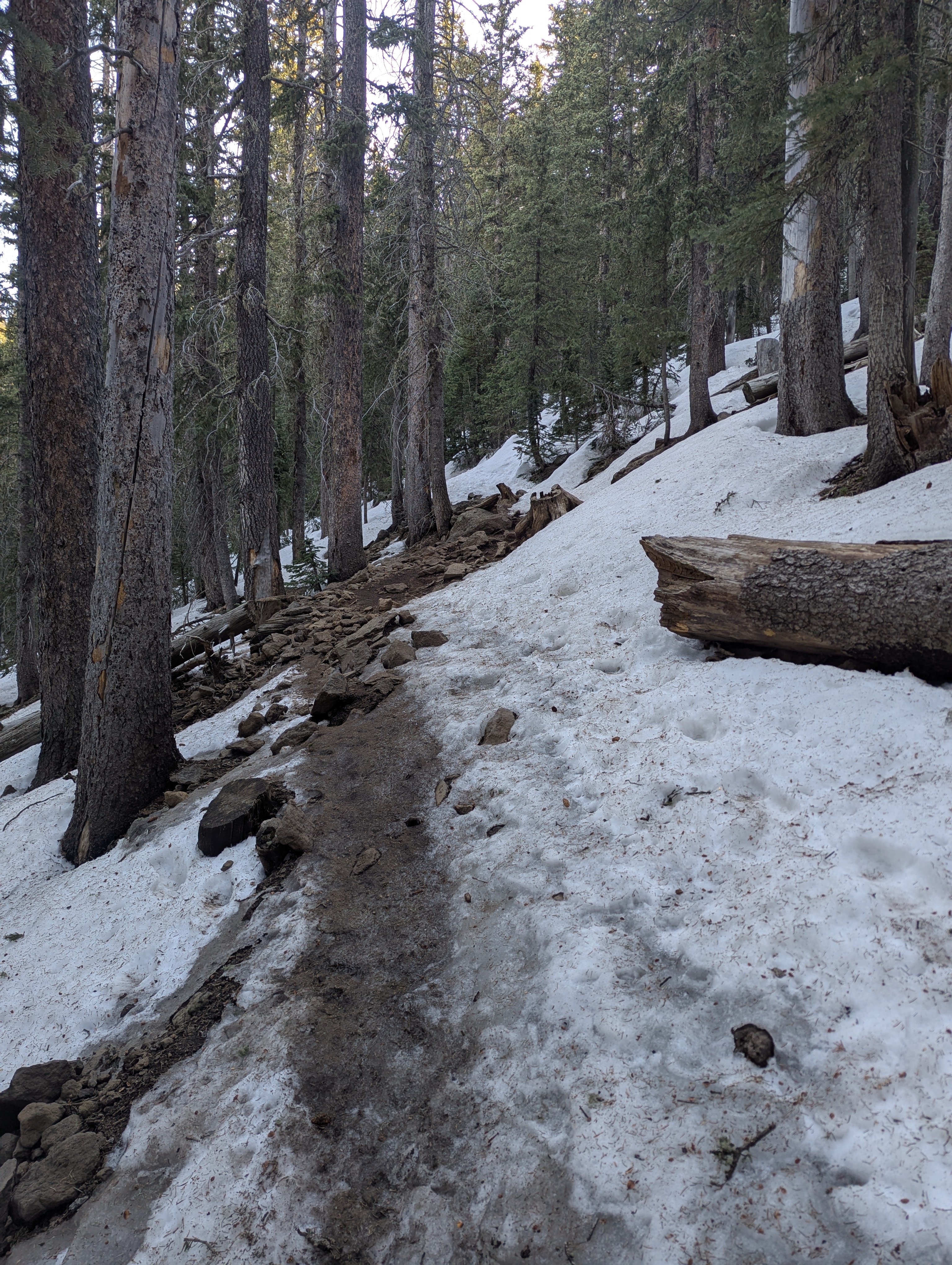 Mmmm a nice frozen curst on the snow patch obstacle course below tree line. I was too stubborn to put on the micro spikes I was carrying of course.
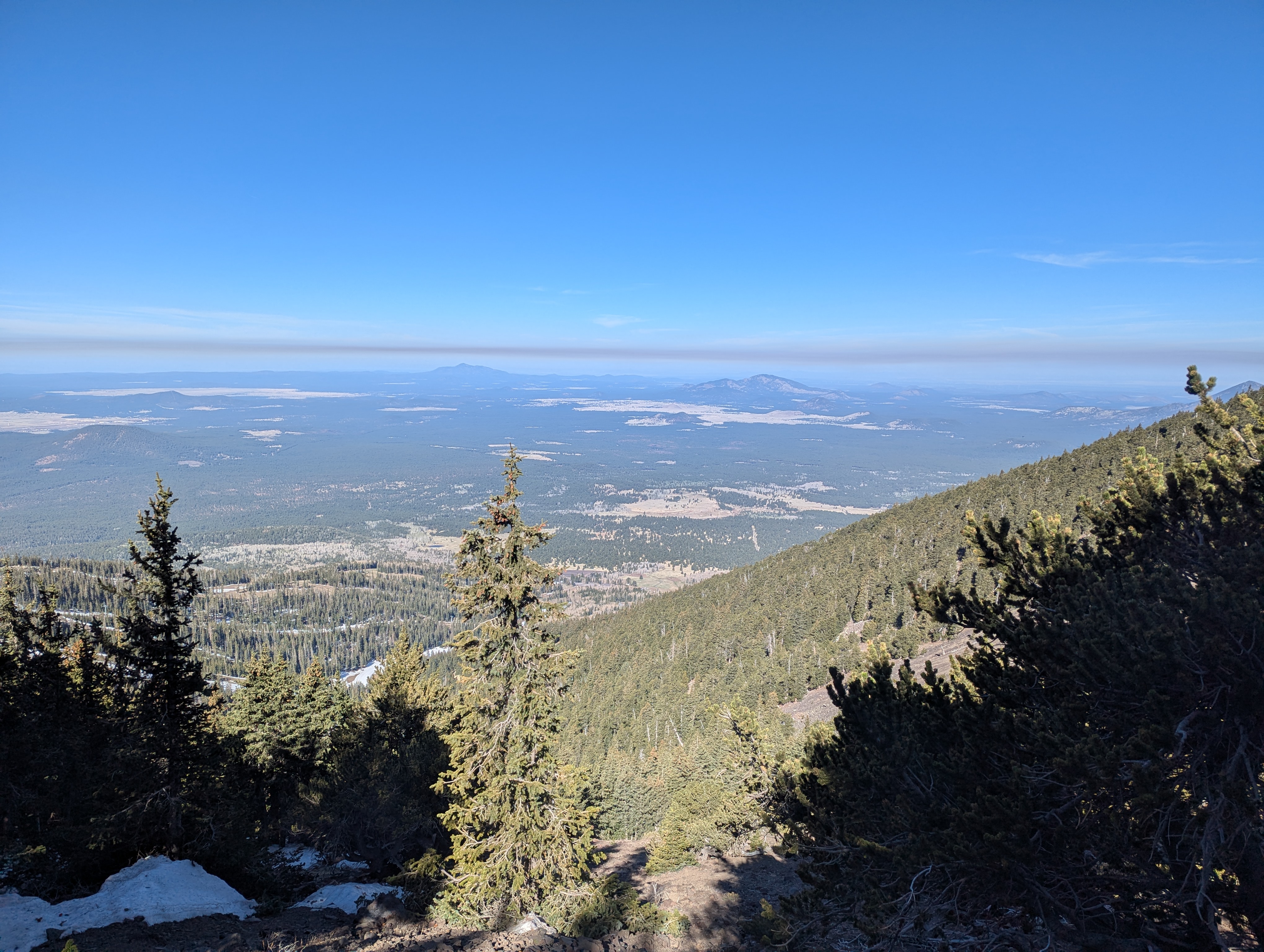 First nice view through the trees back to the west.
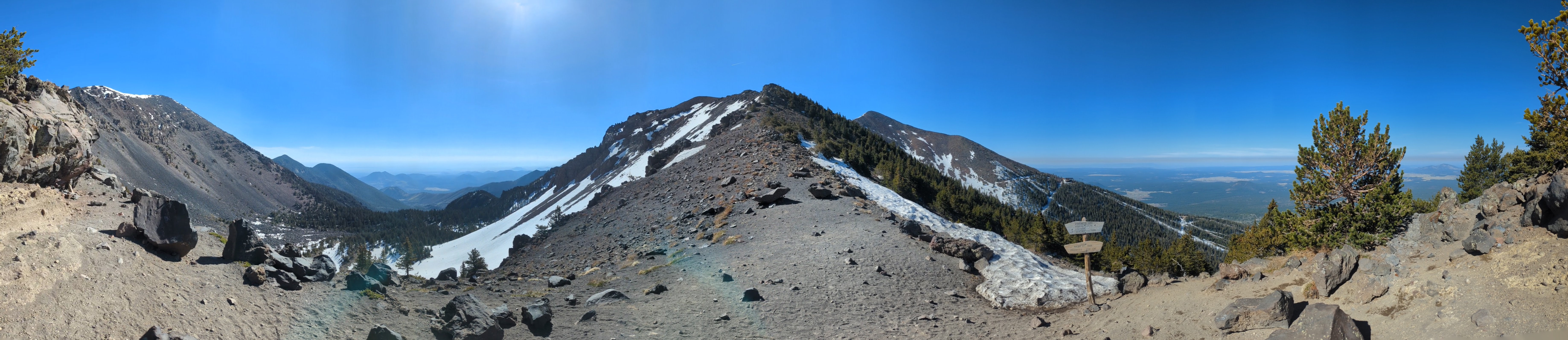 A panorama of where the trail meets the ridgeline. The trail I came up on is down to the right (west), Agassiz Peak is in the middle (south), and Humphreys Peak is on the far left (northeast).
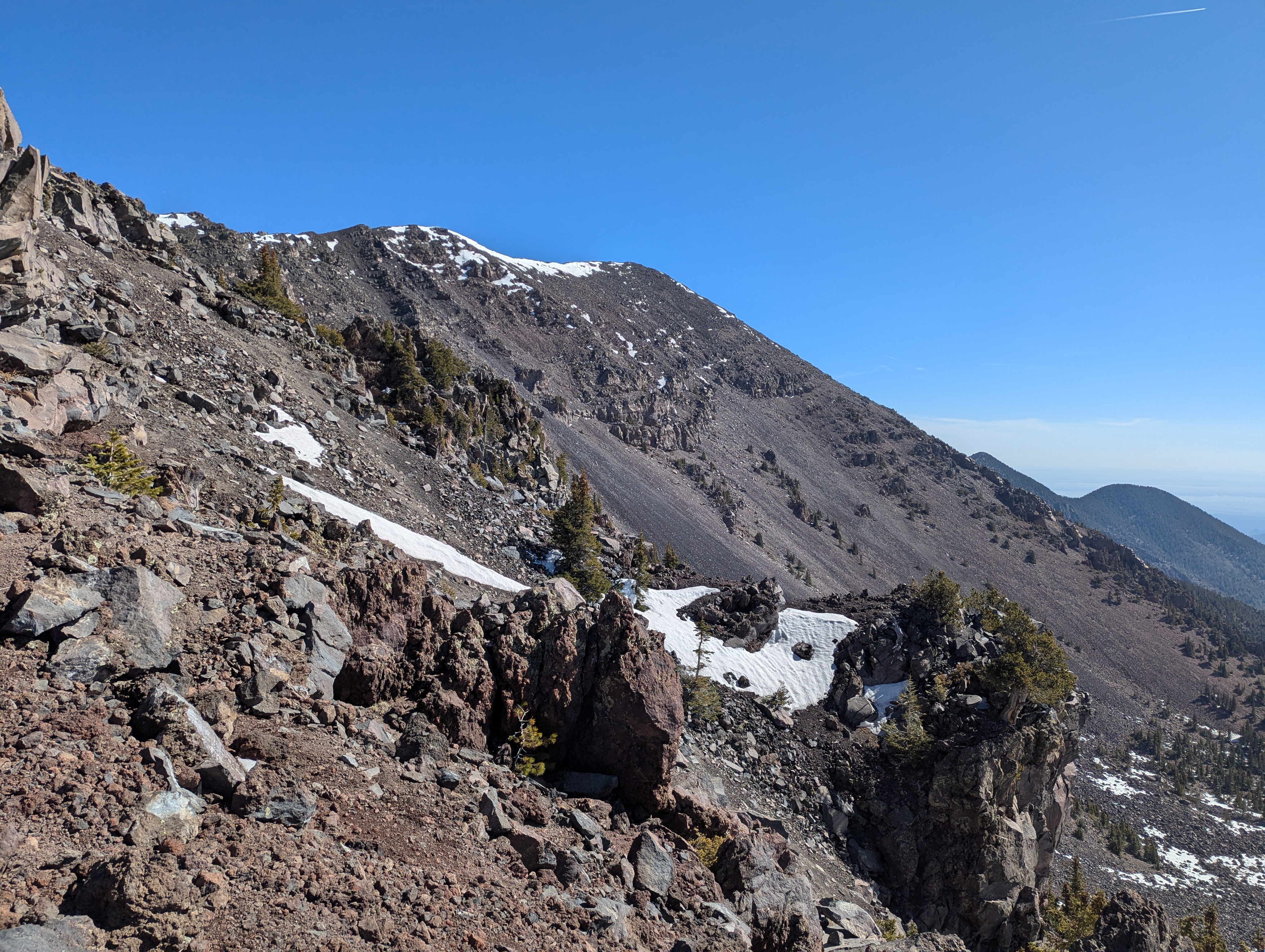 A better view looking towards the summit of Arizona.
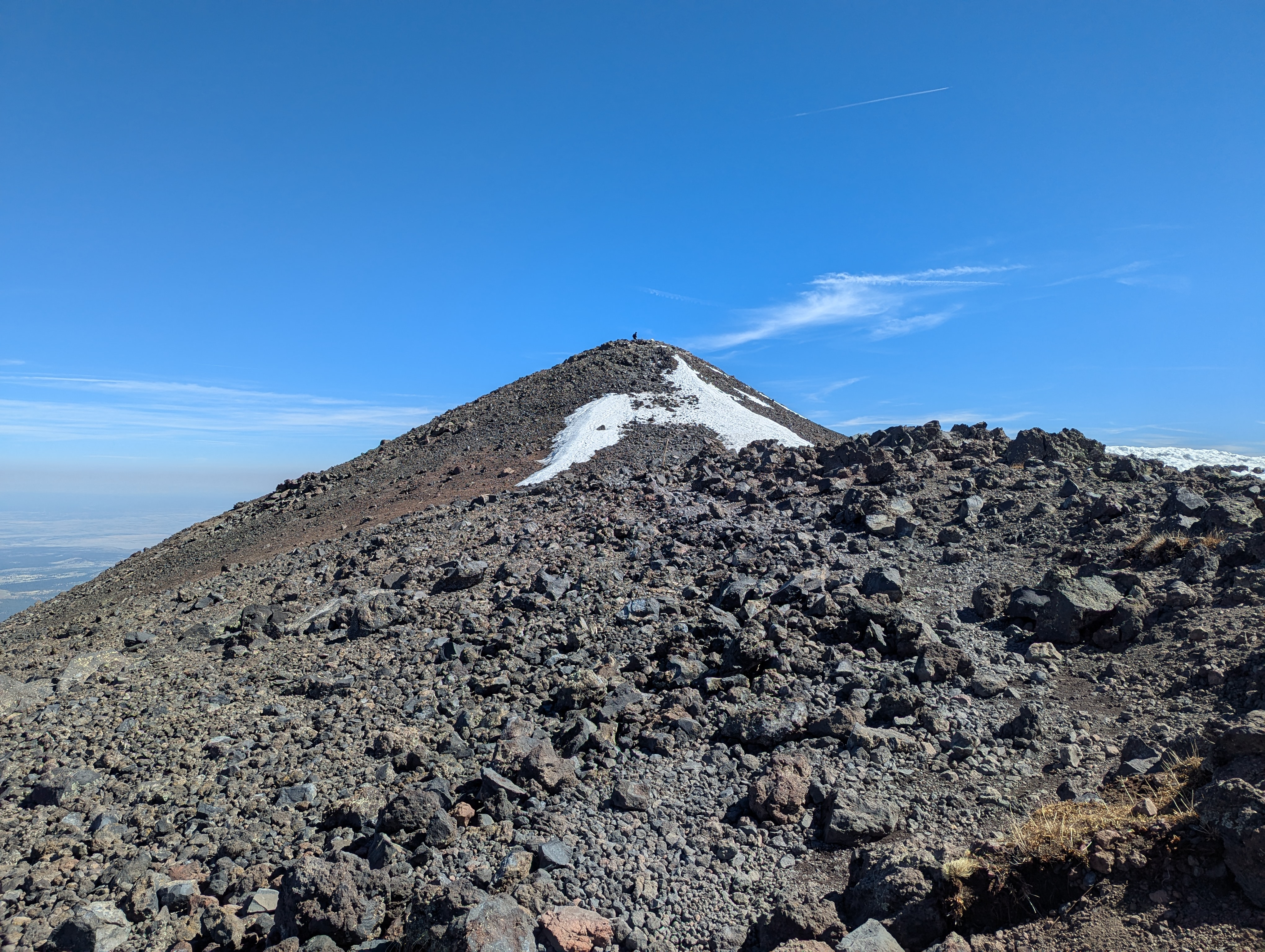 Most of the way up the ridgeline traverse on top of the last false summit, with a person on the true summit for scale.
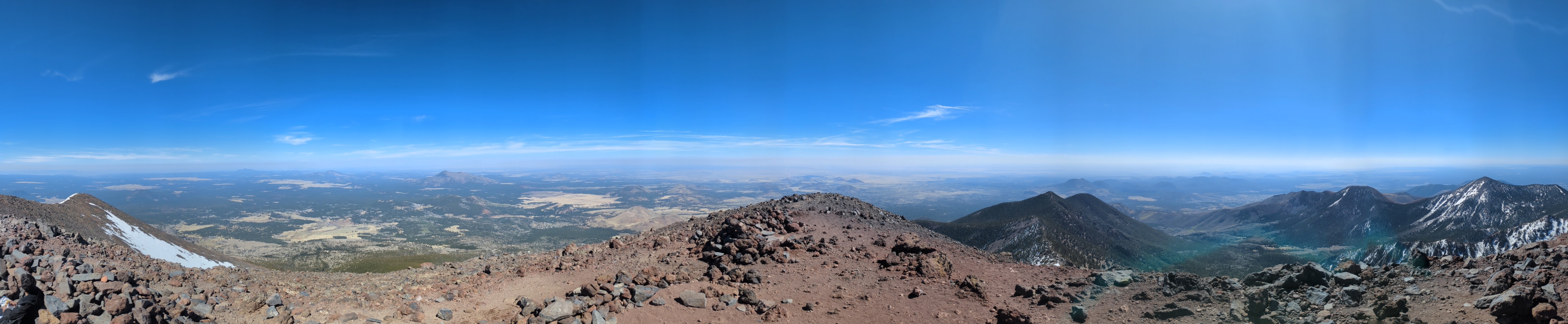 A panorama from the summit looking north in the middle.
 Doug (strutting on a rock below the backpack) atop his first state high point. A nice sign on top too, I guess.
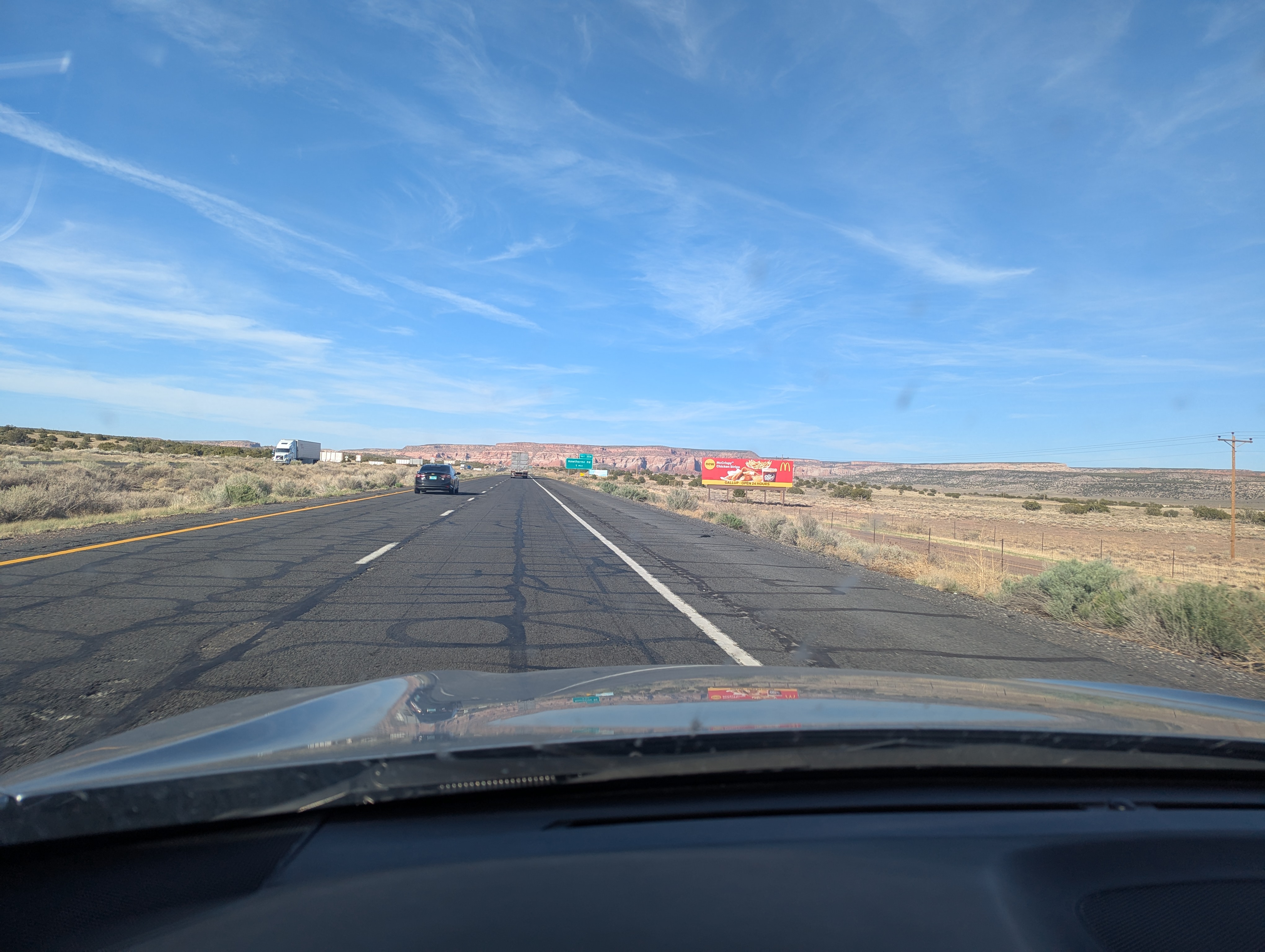 The American southwest in a photo: cirrus filled blue sky, gorgeous carved mesas in the distance, and a big billboard letting you know the distance to the next quintessential American dinning establishment.
May 23rd - Day 5 - Santa Fe and Rest Day
Overnight I had iced my ankle and made sure I parked so that it was well elevated uphill. Lucky for me it was looking much less balloon like. Nonetheless a rest day was still in order to make sure the sprain didn't turn into an actual break. I am very familiar with ankle trouble unfortunately, having broken both and sprained them both more times than I can count. The plan for the day included a jaunt around Santa Fe, a trip up to the Wheeler Peak trailhead near Taos Ski Valley to scope out sleeping spots, and some sightseeing in the around the upper Rio Grande.
Downtown Sante Fe is very cute architecturally, but what likely used to be mostly art stores is now dotted with high end shopping establishments. I did a bit of a look around the square and surrounding area, found an old church, America's oldest house*, and the state capitol building (which was quite refreshing compared to the many white marble buildings I was used to). *This is a dubious distinction on at least two fronts because 1.) the home was built when New Mexico was not a part of the U.S. and certainly not by Americans and 2.) there are nearby pueblos that are much older and seem functionally identical.
My drive to check out the trailhead took me through the town of Taos and the Taos Pueblo which was quite an interesting vibe. There were two distinct types of cars on the road: luxury SUVs (think high end Range Rovers and Porsche Cayenne) or beater cars held together by bailing wire. I hope the imagery serves as a reflection in place of any societal commentary I could make here. It also goes without saying which category of car accompanied me on my drive up to the ski valley. On the way up I spotted a number of workable pullouts for overnight, having decided that I didn't want to sleep at the actual Wheeler Peak trailhead at over 10k ft.
Feeling good about my prep for the next day's hike I headed to a section of the Rio Grande to take a much needed dip and hang out for the afternoon. I had a little trouble finding a spot that wasn't occupied by whipping fly fish lures but eventually settled under a nice tree in the water to cool down and continue reading my very British space opera.
Sufficiently relaxed I drove to a Rio Grande overlook to munch on some snacks and then got subway for proper fuel for the next day. I pulled into my chosen overnight spot at about 8pm and was ready to sleep by 8:30pm in anticipation of my 5am wakeup (now on mountain time, the equivalent of 4am pacific).
Story continues after Day 5 photos.
 My lovely first overnight parking spot at a rest stop just outside of Sante Fe with an excellent view of the interstate.
 The oldest *house in America.
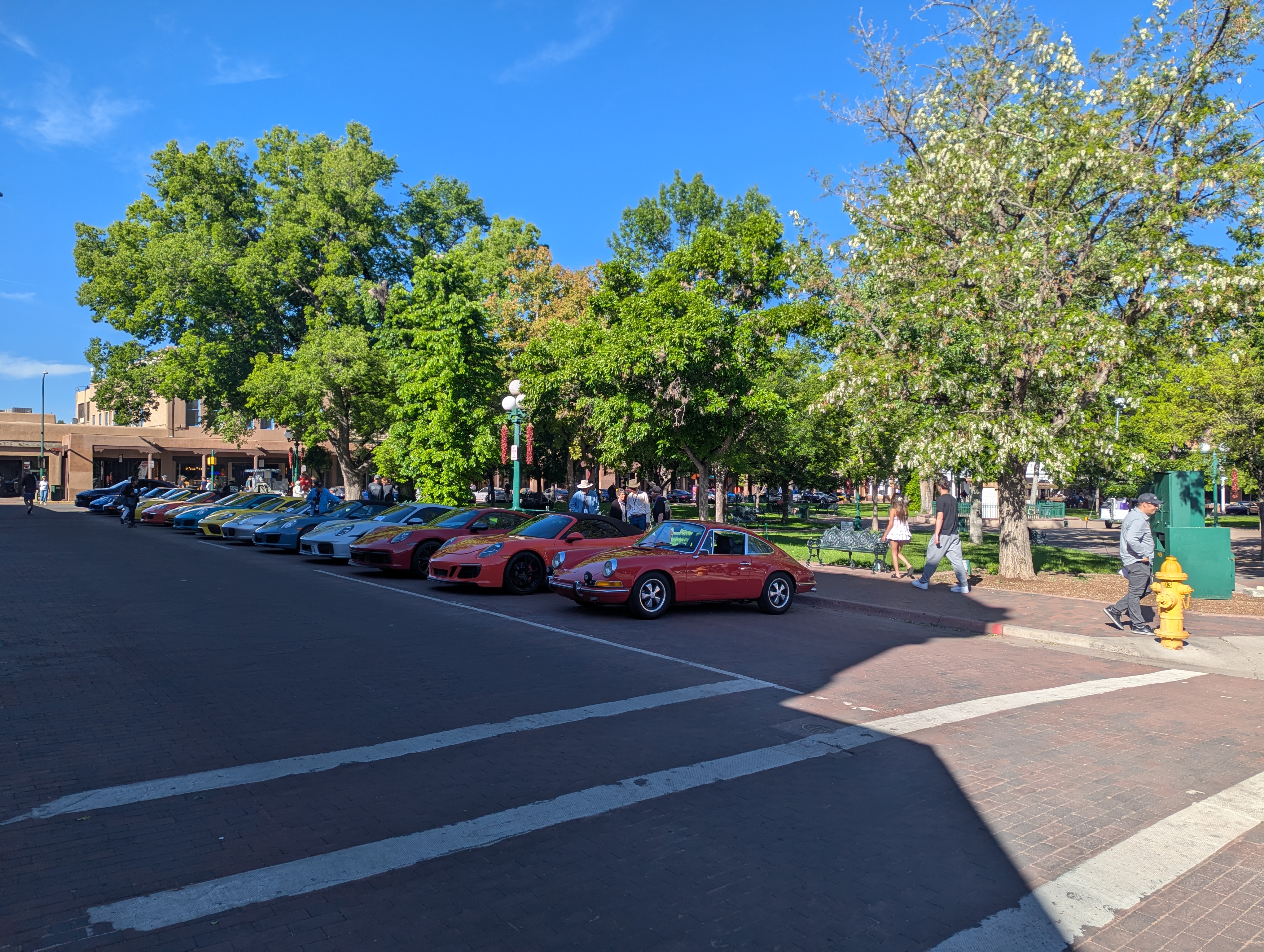 The downtown square was taken over by a Porsche showcase the day I was there. A fitting introduction to what I was about to experience in Taos.
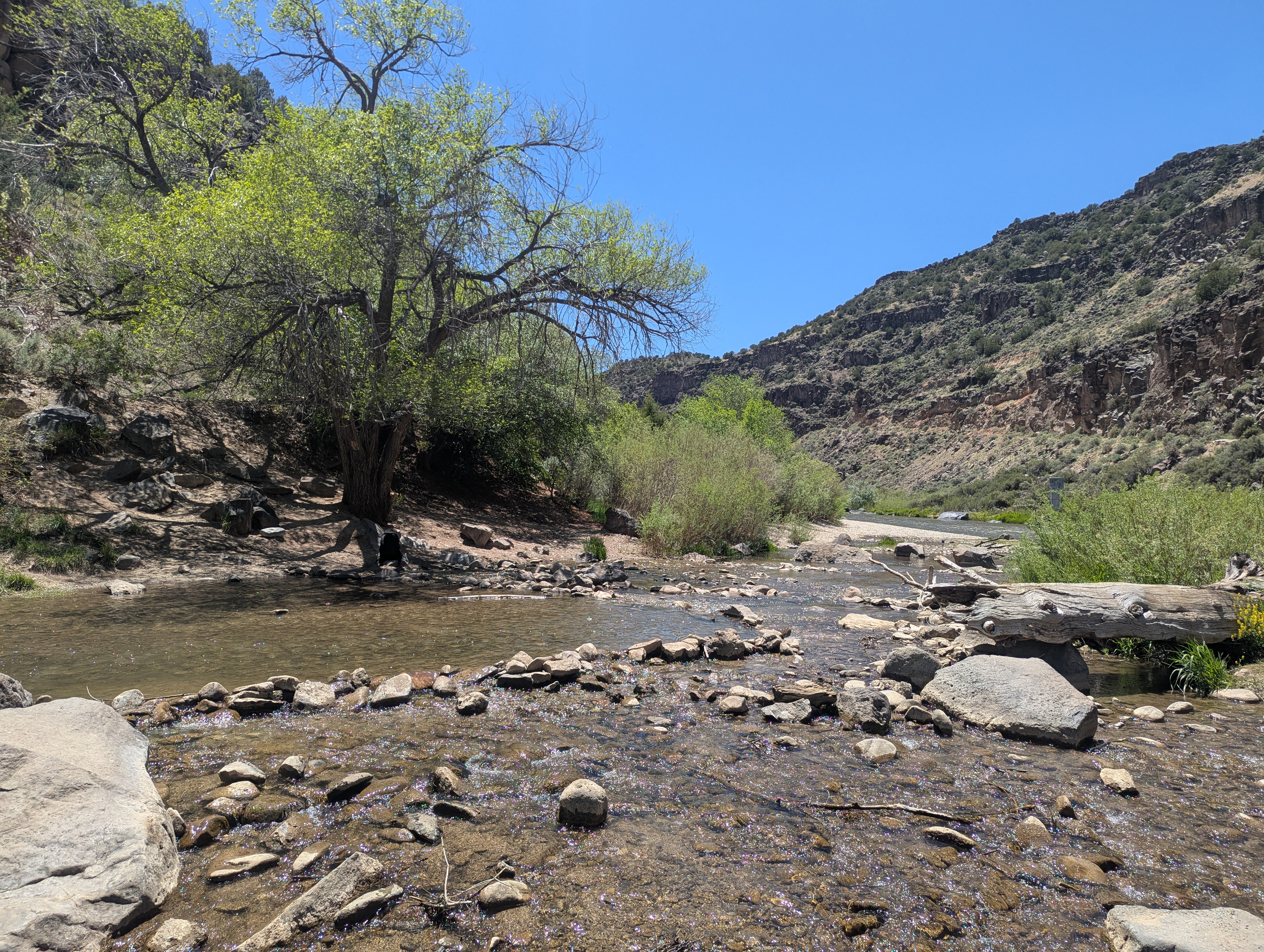 My cool river hangout, tree, rock pool, and all.
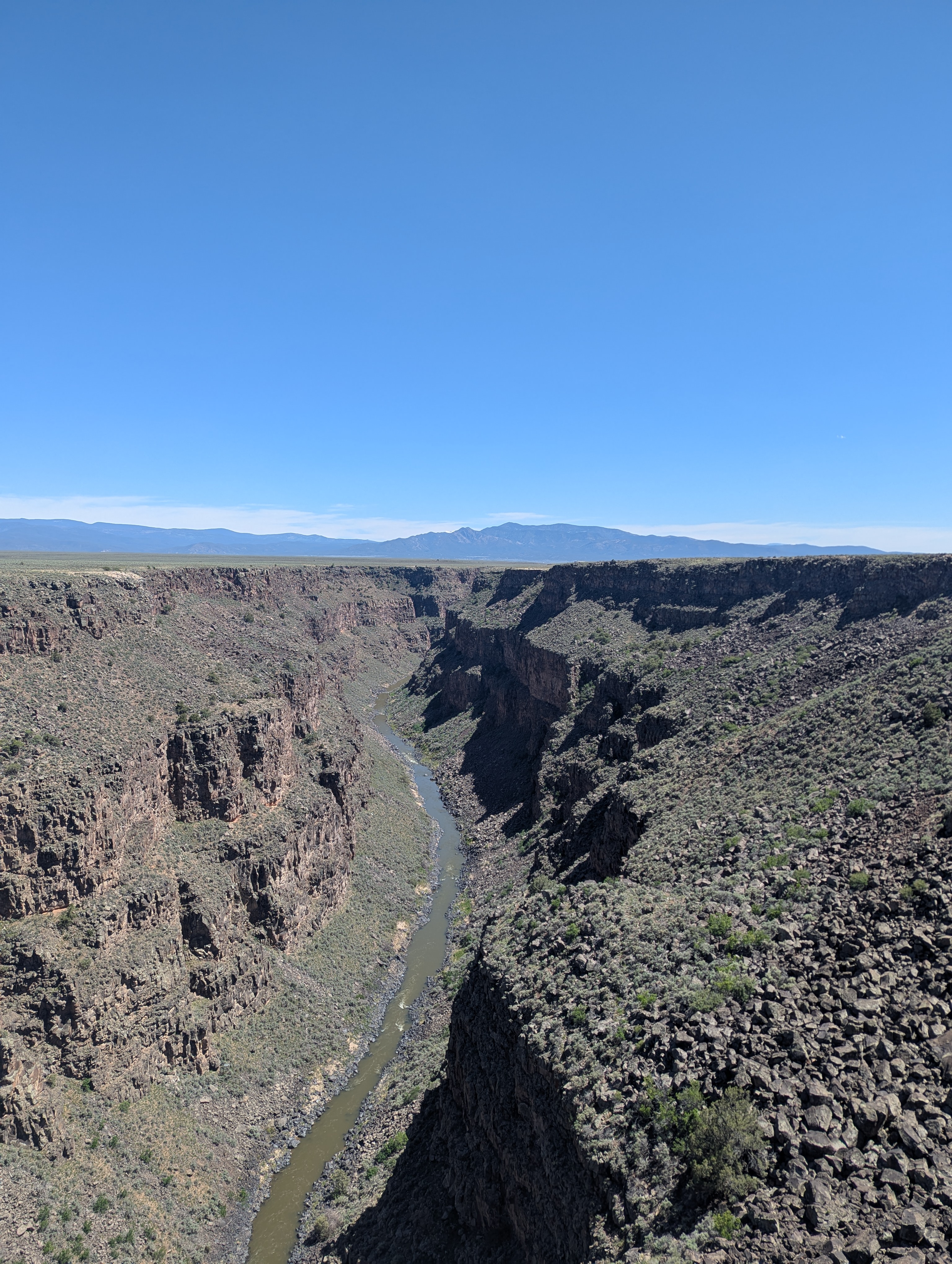 The upper Rio Grande. Fun to see it so far away from Big Bend National Park where I saw it last.
May 24th - Day 6 - Wheeler Peak and Drive to Elbert
I overhydrated a bit before bed and had to get up twice in the night because of it, leaving me feeling a little tired at my 5am wakeup. I quickly stuffed my face with some tortillas for calories and began the 20 minute drive up to the Williams Lake Trailhead. It was Saturday of the Memorial Day weekend I knew the currently empty parking lot would be full by my return, along with the trial.
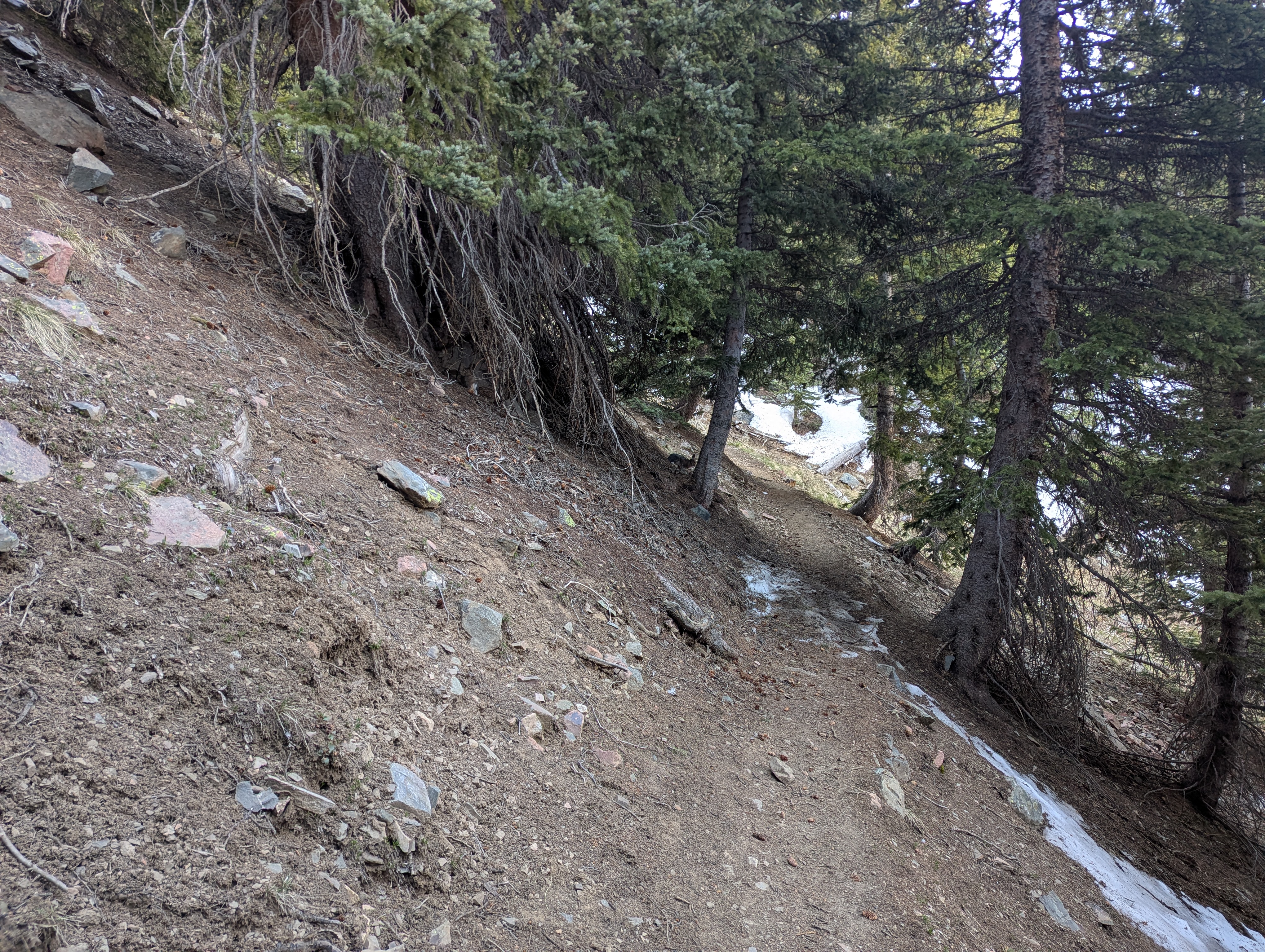
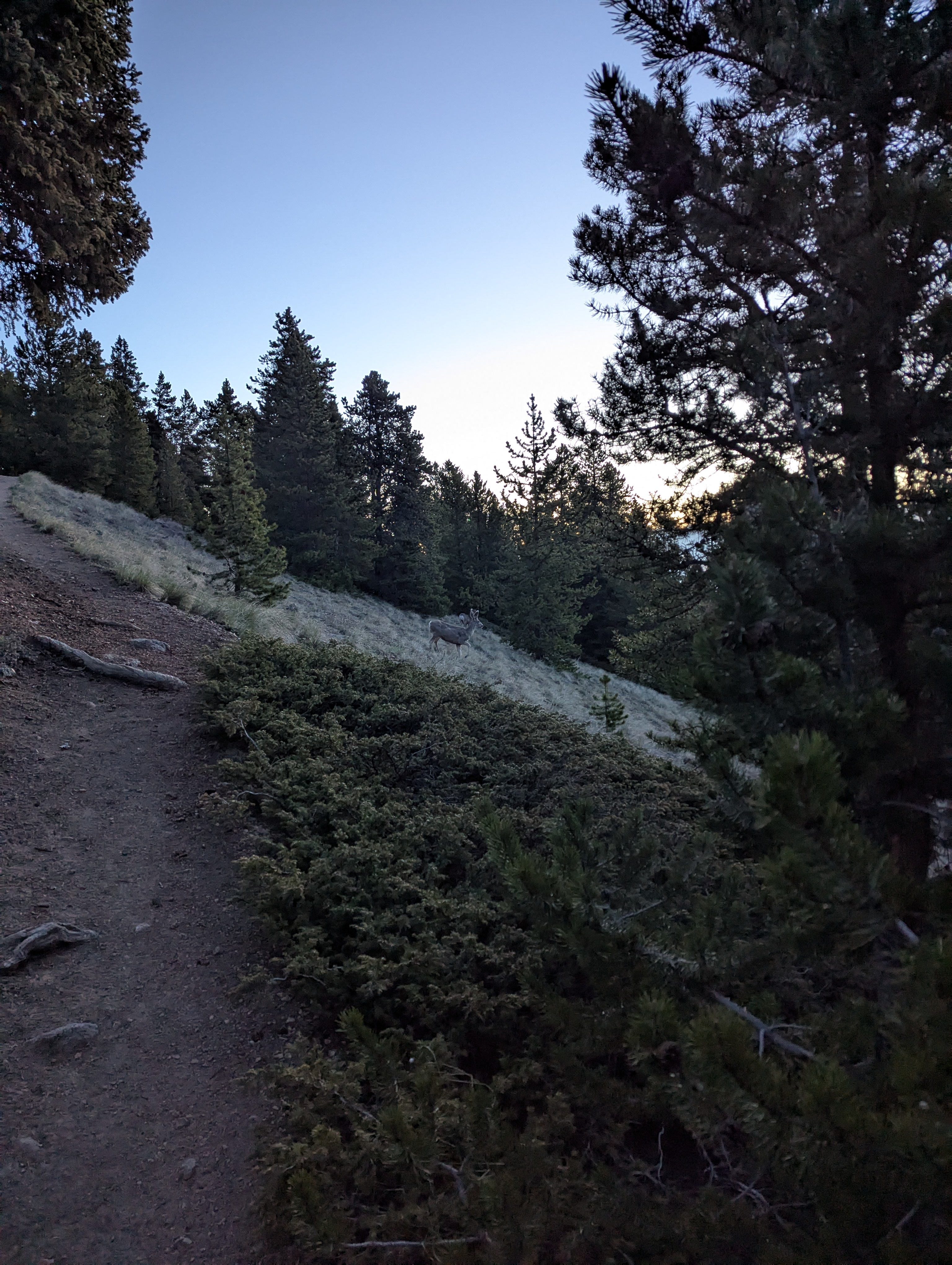
I was second out on the trail but quickly passed the couple and their dog who were headed to the lake for which the trial was named as dawn began to settle over the valley. The trails like that to Humphreys Peak was snow covered, but this time I came well prepared with my single trekking pole to balance across the frozen crust. I made it to the lake turnoff, perched at the low spot of a large glacial moraine that holds the lake in place, around 7am with still no other humans in site. As I began to climb the switchbacks up the valley's east flank I stumbled across a number of deer and some rabbits that looked well adapted to the climate. I poked above tree line just as the sunlight started to hit the west flank of the valley. The trail was still snow covered in many places but I felt no need to use either my micro spikes or ice axe. As I climbed I could see more folks coming up on the switch backs below me, some of which I think must have camped overnight at Williams Lake.
Reaching the snow covered ridgeline I was greeted with warm sun and a great view back to the south of Simpson Peak, and after a brief ridge walk on the snow reached the summit at about 8:40am. Wheeler Peak at 13,167 ft then became my highest state high point to date, surpassing Boundary Peak in Nevada, but still not surpassing Mt Shasta for my highest elevation in the U.S.. The summit is a great view in all directions, especially back down south into New Mexico. It also has a class cannon at the top as the summit register. However the clear view north of Colorado's many 14k peaks leaves the high pointer's heart a little heavy. I chatted with a couple from said state of high points (Colorado) who were the next to summit that morning about all the 14k peaks they had completed so far. They also told me that Elbert, Colorado's high point, was pretty easy and comparable to Wheeler, save with more snow and an extra 1,300 ft. The seed was planted. It wasn't on my list originally for this trip as its about 8 hours of extra driving, but given how well acclimated I was, casually eating an early lunch and conversing above 13k, and seeing that even with my ankle bungled I was still a day ahead of schedule, I couldn't help but consider booking it north into the Rockies. A third joined us on the summit and it was time for me to get down, now already 9:30am.
I decided to tag the nearby summit of Mt Walter, also over 13k, before heading back down the switch backs. The way up was now saturated with hikers every 50 feet or so, making it slow going as I yielded the right of way to uphill climbers and conversed with each for a few breaths. Some were huffing heavily but they were close and would make it in due time. I found a nice snow patch for glissading but regretted my choice as I had to post hole my way back to the trail at the bottom and make a stop on a rock to empty my boots of snow. The steady flow of uphill hikers continued with a few seeing the ice axe on my backpack and consequently asking what the conditions were like up top. I was sure to put their anxiety at ease and took shots at myself for needless carrying extra weight. After the trail junction those looking to summit Wheeler were quickly replaced with folks hoping to get to the lake. I passed at least three groups who had not been at altitude before and were eager to know how much further it was to this lake and clearly questioning whether it was worth it. Unfortunately for them I could not answer the latter question as I hadn't seen it, my mind set on getting back to the car to see if Elbert was indeed feasible. I strolled back into the parking lot that was now a madhouse at 11:50am. The trekking pole had done its job and I had made it back unharmed at a good pace.
I quickly unpacked my gear and changed clothes to hand over my spot to the numerous waiting cars and called my mom as I drove down to the ski area parking for a planning session. The call to my mom confirmed an important piece of information: that I could stop by our family friends house in Salida CO for a shower and laundry if I was in the area. That sealed it, the possibility of climbing Elbert and getting my first shower in 5 days was too great a prize to ignore. I was going to head north instead of east for Oklahoma. After a quick stop at Walmart and Subway for calories I was headed north on US 285 and then CO 17 up onto the Colorado Plateau. Unfortunately I did not have time to stop at Great Sand Dunes National Park and certainly not enough time to get to its high point Tijeras Peak, but I did get quite a view of the Sangre de Cristo Mountain range on my drive. After quick stop for a shower and food in Salida I continued north to Leadville. My planning found that the "easiest" route up Mount Elbert was from the east flank, and while most had it at 14 miles, there were dirt roads you could take to cut it to closer to 10-12 miles. One of those options was to drive up to the Lily Ponds, and this was the option I choose as it seemed the road would be doable in my outback. As I got off paved roads past twin lakes and saw many a 4x4 rig parked in the trees giving me looks as I went further up the road I got a little bit of an uneasy feeling. Luckily the ruts ahead where handleable with some speed and the right line. I made it to my target destination at 10,400 feet at dusk with enough lite to park and get in bed as the twilight faded behind my destination for the next morning: Colorado's highest point.
Story continues after Day 6 photos.
 Spot the two rabbits, one is much easier to see than the other but both are in plain view.
 Sunlight beginning to appear on the west side of the valley. Wheeler Peak is up and to the left.
 A good amount of snow remained on the trial but most could be easily navigated around. There were also some nice little icicle chains around.
 Almost at the ridgeline and finally in the sun. Lake Fork Peak is across the valley.
 Topping out on the snow covered ridgeline looking south toward Simpson Peak on the left with Wheeler Peak Ridge on the right.
 A panorama from the summit of New Mexico. The middle of the frame is looking west, with the southeast on the left and northeast on the right.
 Doug with the crooked benchmark on the summit of Wheeler Peak, both slightly out of focus, with the camera choosing the view south west.
 Looking roughly north from the summit over Mt Walter in the foreground into Colorado and its beckoning 14 thousand footers. The summit register cannon sits askew on the left. Looks like the point of backpack mounted ice axe also snuck into the bottom right of the frame.
 The view from Mt. Walter looking back south at Wheeler Peak, now with a small crowd forming on the summit.
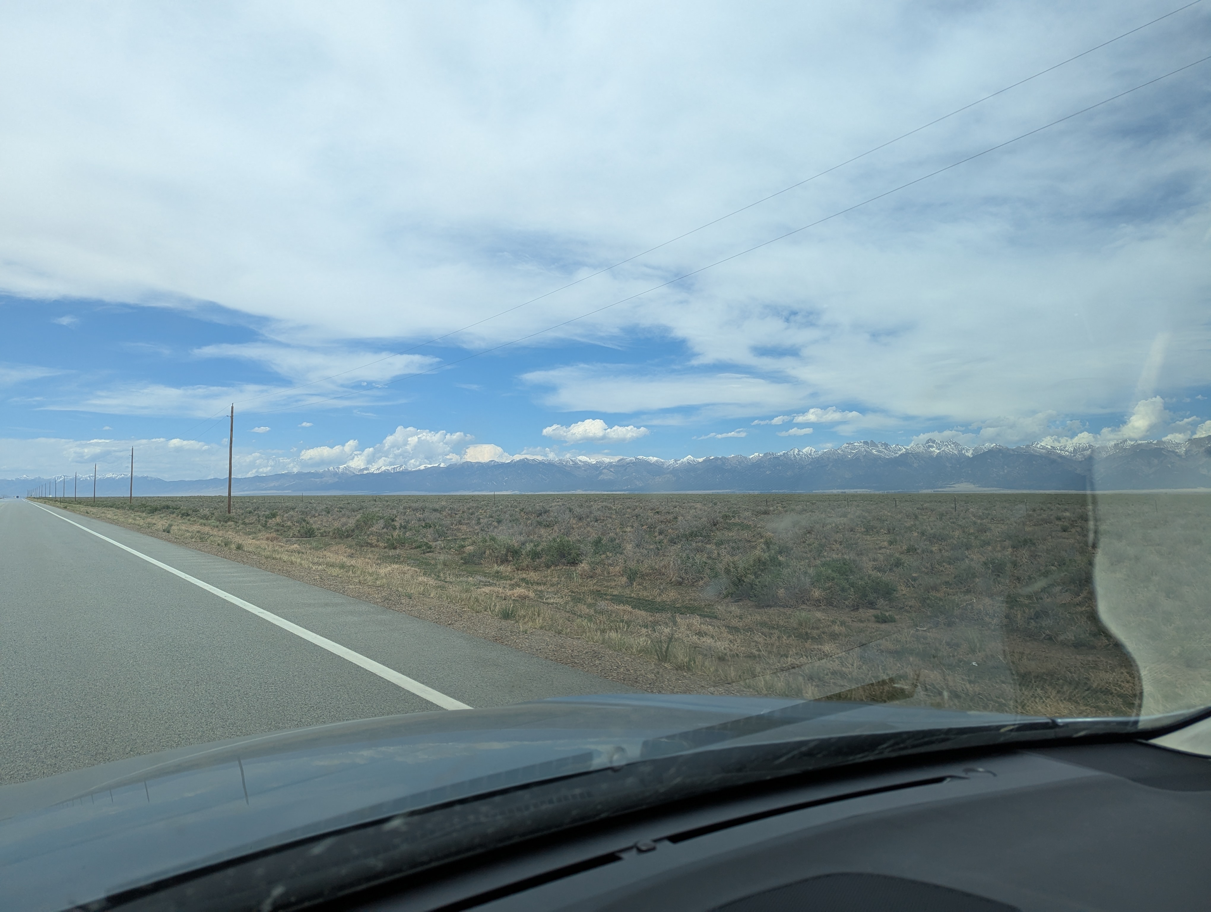 The northern end of the Sangre de Cristo Mountains as viewed from CO 17 northbound.
 My parking spot at 10,400 next to the Lily Ponds on the east flank of Mount Elbert.
.jpg) Laid out on my bed in the Outback I had a great view of my objective for the next morning!
Laid out on my bed in the Outback I had a great view of my objective for the next morning!
May 25th - Day 7 - Mount Elbert and Drive to Black Mesa
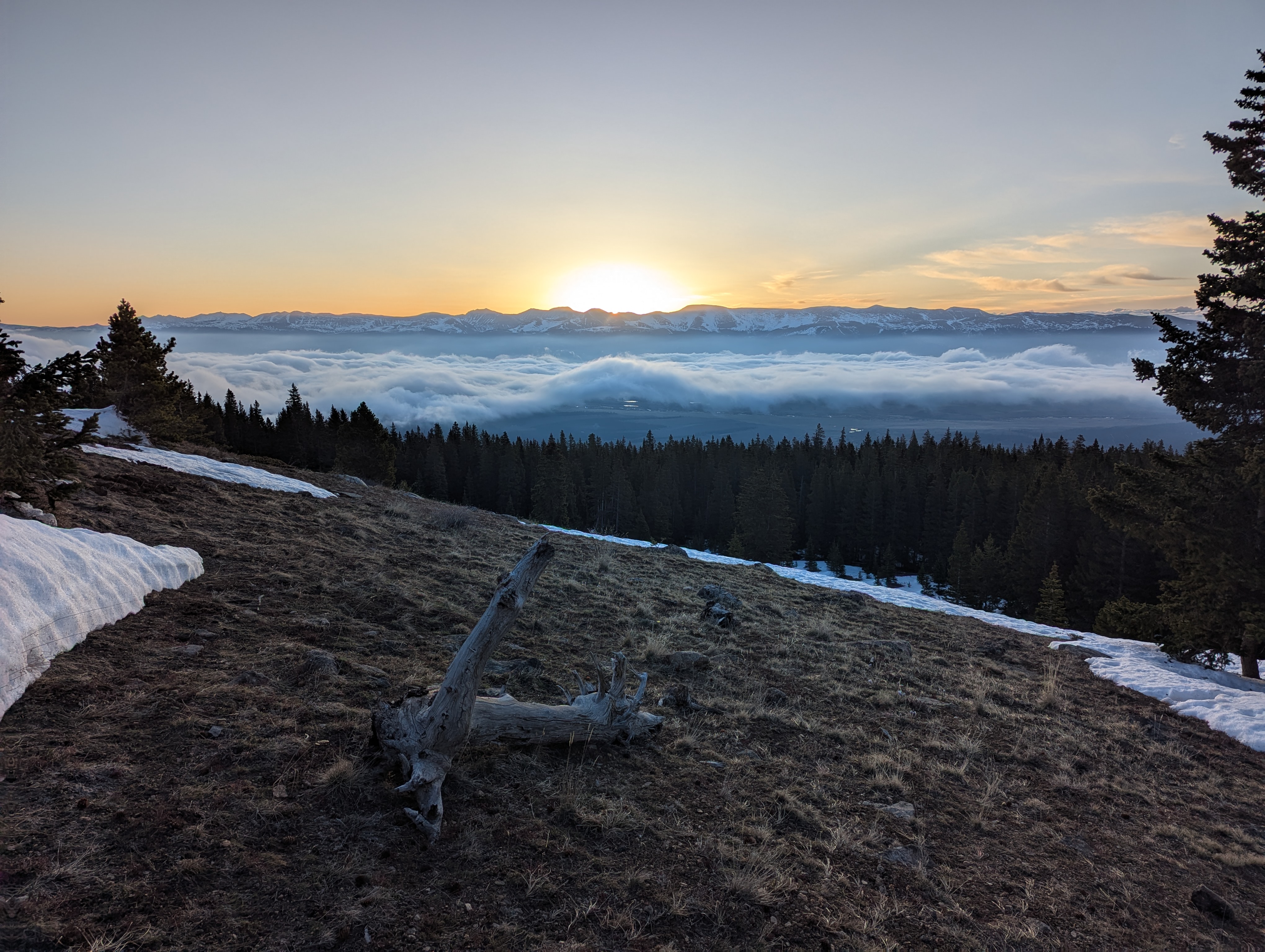
Knowing that thunderstorms were a potential threat, I got up at about 4:15am to start getting ready (downing more tortillas and a couple litters of water). A pair of hikers passed me as I prepped my bag at the car, presumably having started a mile down the dirt road at the paved lot. At 4:45am I started out on the trail that snaked around the Lily Ponds. I heard a couple of loud splashes which I realized on my way down were probably beavers slapping their tails to warn others of my approach. I caught up to the other two hikers shortly after starting up the South Elbert Trail and didn't see another soul beyond some deer until I reached the first large snow patch above tree line. The runner passed me with ease at 12,000 ft, I imagine he probably started at twin lakes that morning. The night was cold so the extensive snow fields were well frozen but still soft enough to chip my bare boots into. I knew that the way down would likely be a post holing bonanza which helped me keep my pace up as I climbed. A nice undercast formed to the east over Leadville as the sun rose, and the cloud shelf continued to follow me up in elevation as I went creating a really beautiful effect. My breathing got a little more labored and my pace slowed as I pushed through 13k but I didn't feel any other negative effects, having Russian rested my way across the American west. The runner passed me going down when I was about 1000 feet below the summit. I opted to take snow patches straight up the ridge in most places instead of switch backing across. I had again brought my ice axe and traction but felt solid enough that they were unnecessary given the low fall exposure and relatively forgiving snow. I had one snack break to watch the rising sun before continuing to the summit.
I topped out at Elbert's 14,440 feet at 7:40am, marking both my highest state high point elevation and the highest I have been in the lower 48. I had the quite expansive summit plateau to myself, it seemed like it could be a fun place to set up a grill and play a game of corn hole. The cloud layer below was steadily rising still and obscured some of the mountain below 10,000 feet. The views in all directions were breathtaking. The scale is definitely bigger than the peaks of the southern Sierra but not quite as jagged. And the rock color is very different of course. I snapped some photos, went to the far end of the plateau to relieve myself, and took some photos of Doug before settling down for some food. It is always kind of fun knowing you are the highest person on ground in a state, and with Colorado the only folks higher would be up on Whitney, so with confidence that as I looked east I was looking down on everyone, and without a hint of condescension, just awe. I saw someone start to come over the ridge on the North Mount Elbert Trail with the cloud deck hot on their heels and decided that was my que to head down.
The clouds hugged in close to the summit just after I departed, making navigating the snow fields down all the more fun. I snuck peaks of the surrounding landscape through wispy tunnels and found a couple of snow patches steep enough to glissade. I ran into one of the pair of hikers I passed early in the morning still coming up at about 13,000 feet and chatted briefly. I found his friend sitting with a nice view about 400 feet below awaiting his friends return. Looking north to the North Trail I could pick out a handful of specks climbing toward the top of Colorado. I started running into many more groups on my trial coming up at about 12,000 just as the snow starting getting soft enough for post holing to commence. We each shared in the misery as we passed. At least with all of their post holes I had some safe spots to step even if it meant stepping waist deep hole to waist deep hole. Into the tree line I cruised down the bare ground, stopping briefly to admire the carpet of eastern pasqueflower. Back at the Lily Ponds I took in the marvelous engineering of the beavers and then packed the car and headed down. Now 11:30am, it was all downhill from here to the east coast.
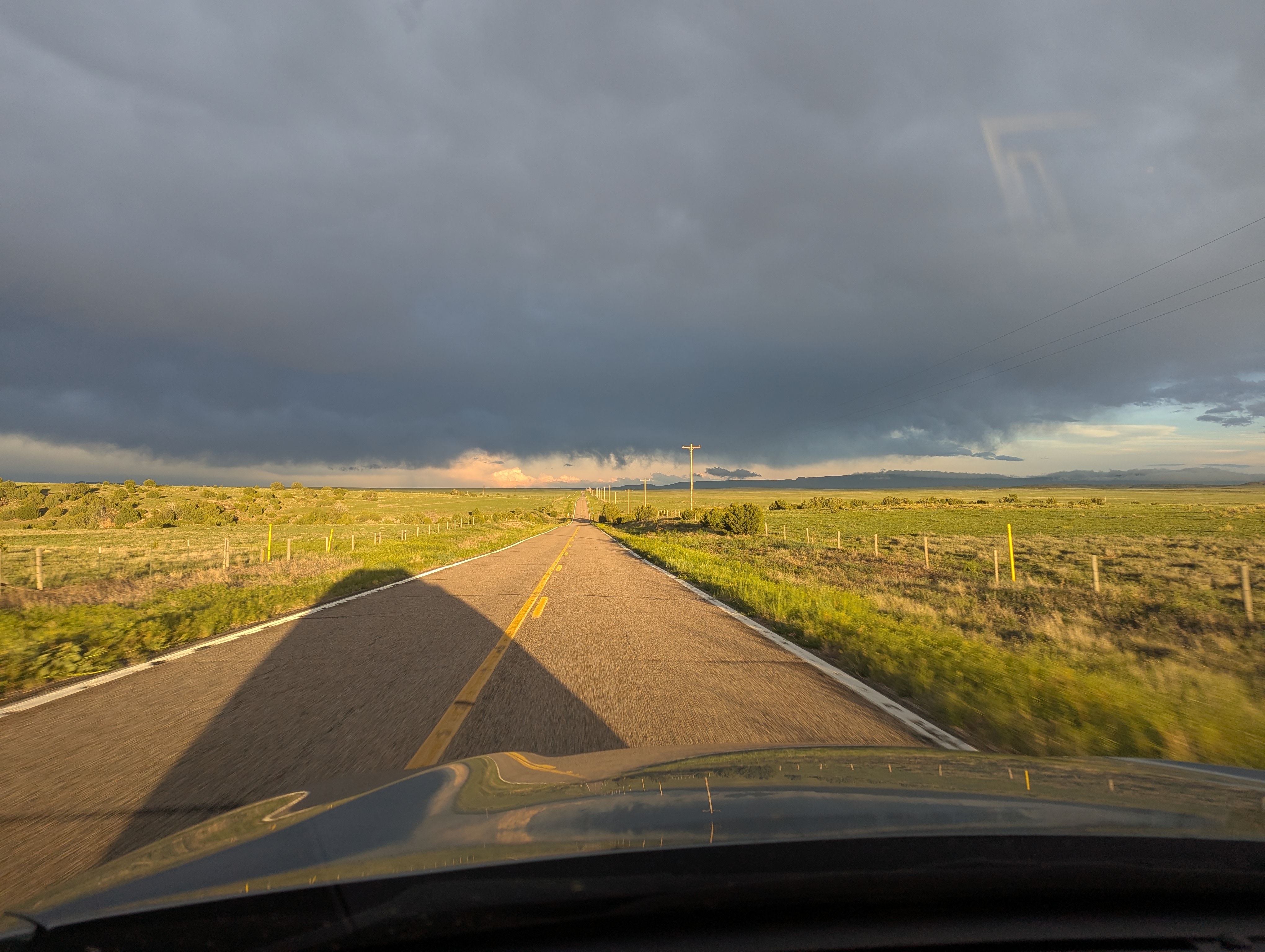
I stopped once again in Salida CO on my way south for another shower, much needed laundry, and lunch with a family friend (thank you!). After a brief interaction with the some thunderstorms I departed at 4pm following the building cumulonimbus clouds south and then east toward the Oklahoma Panhandle. The setting sun shining back under the high clouds created beautiful lighting conditions as I raced along the narrow two lane road hemmed in by green pastures. It had been a very long day and needless to say I was getting tired with 3 hours of driving down and at least 1 to go. Black Mesa, the Oklahoma state high point, is what I consider a boundary condition, lying on the far western edge of the state. I had looked at the surrounding road situation on Google maps previously and saw that they were paved. What I didn't realize was that the pavement only started in Oklahoma, and I was coming from the north through Colorado where they certainly were not.
Things started to turn horror movie real quick once the sun set, as the moisture laid down from the thunderstorms soaking rain lifted into a thick fog, and flashes of distant lighting made the low cloud flicker all around. My speed reduced considerably Google maps still said I was just 20 minutes from the trailhead parking lot I had set as my destination for sleep. What I have come to realize is that any county road without a set speed limit, Google maps assigns a 55mph speed to. The fog, the darkness, and now the clay road meant I was doing more like 20mph. Then suddenly loud noises started, like it had started to hail. But nothing was falling from the sky. I stopped. The racket stopped as well. In my groggy state I opened my door and felt the ground. Mmmm real nice thick sticky clay. The clay was sticking to my tires an inch deep and then getting flung off with speed into the wheel well. I was not in a good place. Spooked and exhausted I decided to call my mom to talk to someone to help stay awake an focused. No sooner had I explained my predicament did I find myself a the top of a grade with my headlights illuminating a narrow concrete sided bridge at the bottom. I eased on the brakes and immediately began to slide. Gulp. With urgency I let my mom know that talk was over and I needed to lock in. Brakes were no longer an option, I was in a controlled slide, the goal was to keep it straight which was easier said than done as I fishtailed back and forth. Thank god for the slight ruts in the middle of the road that helped me get lined up back with the one lane bridge, and thank god there was a hill up the other side. I shot the bridge and carried speed up the opposite side, not wanting to do it all again in reverse. I stopped at the top and politely told my mom that I now had enough adrenaline to stay awake and didn't really want to be on the phone with her during any potential future near misses.
Thankfully the worst of the clay seemed to be behind me but I didn't let myself drift above 15mph just in case. At one point hundreds of piercing green eyes greeted me out of the fog. Damn cows. They were all over the road and I slowed to a crawl as they moseyed out of the way. Two calves, seemingly delighted by the sudden appearance of day light frolicked in front of me, one of them almost bucking my headlight out. Having lost trust in Google maps I checked a couple sources at each of my next turns. I am glad I did because the road Google wanted me to head down had a physical sign next to it that said quite clearly, DEAD END. At last I made it to the pavement about 2 miles from my destination. At the Black Mesa trailhead, now aware of my road predicament I checked the weather for the following morning hoping it to be dry. What I saw was more rain. Potentially heavy rain. I drew up a new plan to try for the Oklahoma high point in the morning and then to drive south deeper into Oklahoma to stay on roads I could count on being paved before backtracking north to Kansas once I had reached civilization again. Moral of the story is: don't mess with wet clay roads. Especially if you climbed the second highest peak in the lower 48 that morning, its dark, and you have never driven said roads before.
Story continues after Day 7 photos.
 Some deer, commonly my company on these early starts, in the first morning light.
 A lovely view back east over Leadville CO sitting under a nice cloud deck as the first sun rays poke over the mountains.
 A panorama of the one of the larger snowfields. This would become the nemesis of me any many other hikers on the way back down.
 A panorama from the summit plateau looking roughly south west in the middle, north on the right and east on the left. The rising cloud deck can be seen on the right and left.
 Doug, again out of focus, cheesin on the summit looking north toward Mount Massive.
 So much potential for this summit plateau. I was thinking corn hole, but ultimate frisbee might be an option too if you trust your aim.
 A hiker comes into view from the North Trail, the clouds hot on their heels, as viewed from my snack spot.
 Having descended a fair bit and clouds now well above I could make out at least five people ascending the north trail ridge route. This was taken from near where the second of the hiker friend duo was camped out as their partner continued up.
 Back in the tree line and the once innocent cloud deck is now pushing up up up into less innocent forms.
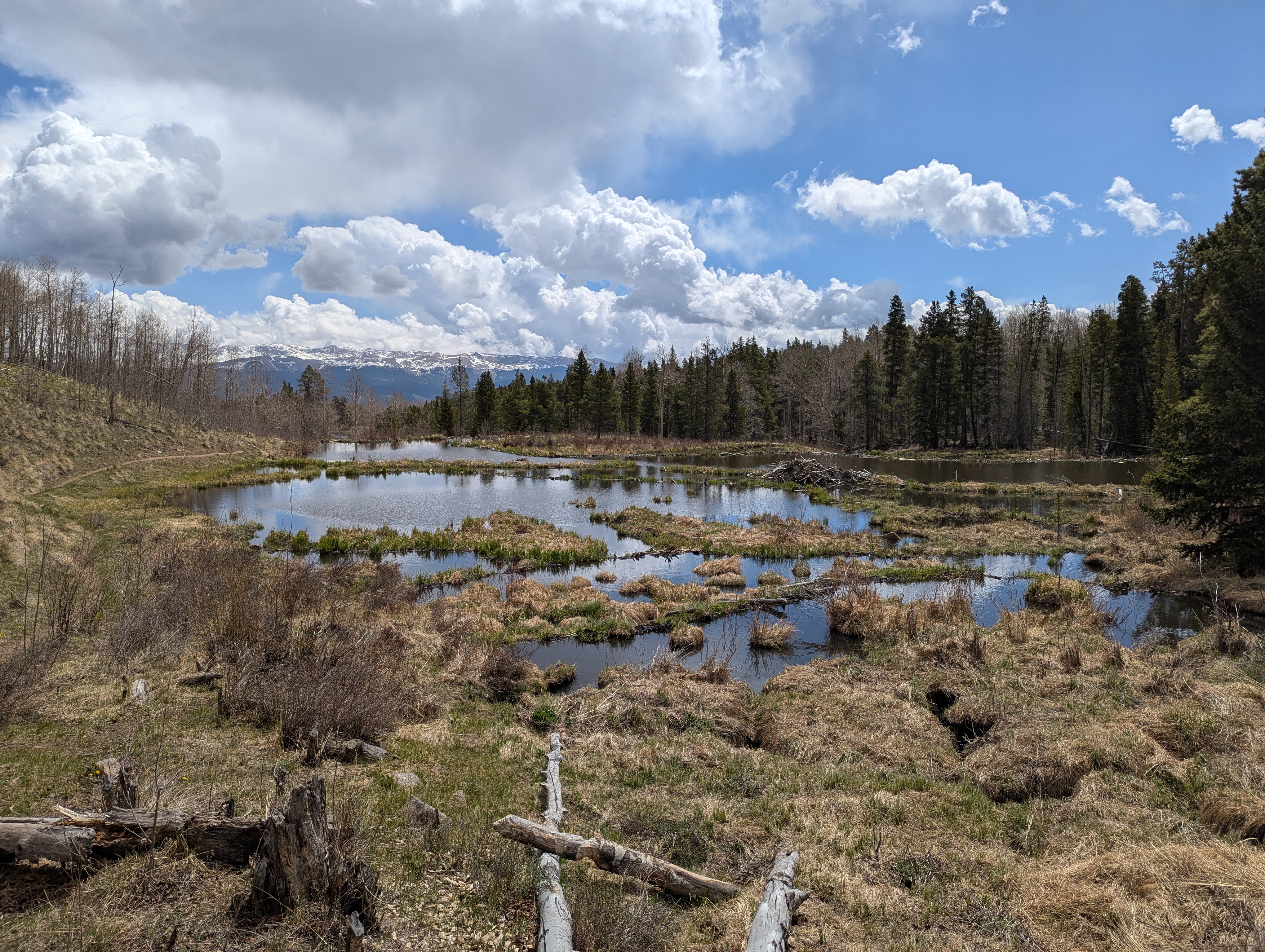 Have to stop to admire natures great engineering marvels. I wonder where the highest beaver lodge in North America is… this one at over 10,500 feet has to be up there, right? Maybe not.
 Caught in the act of making my bed with nice clean sheets, thank you so much again!
 Golden light flooding under the cloud layer as I raced south to Oklahoma. This heavenly scene should have given my due warning for the wet clay hellscape I was about to enter.
May 26th - Day 8 - Black Mesa and Mount Sunflower
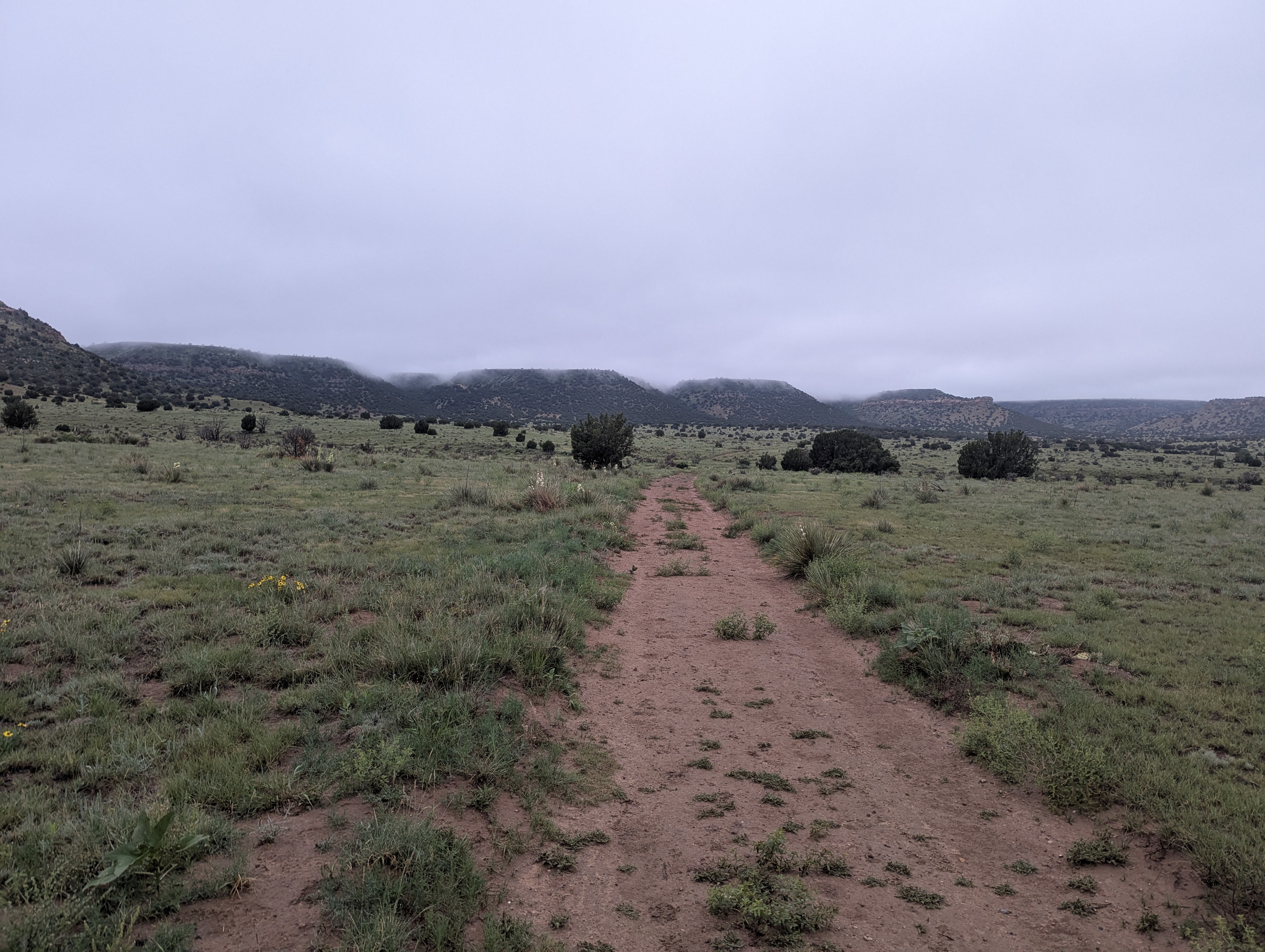
The soft sound or rain was my companion for most of the night but let up around 4:30am. I really really didn't want to get up, but a quick look at my phone confirmed that I only had about four hours before thunderstorms were slated to return. And the highest point in Oklahoma is certainly no place to be with lighting around. I threw my boots back on my aching feet and headed out on the trail toward Black Mesa under a drippy overcast at first light. I pushed the pace fast, aiming to be back at the car by 8am and needing to do more than 8 miles to achieve it. At least the air was cool.
I picked my way through the familiar clay patches that stuck like dough to my boots, a layer flicking off with each step. The trail is flat for 3 miles before heading straight up onto the mesa itself, but now at half the elevation as the day before the climb was breezy. I topped out on the Mesa in the cloud but still enjoyed the variety of color in the spring flowers. At the summit marker I took some quick photos of the non-existent view and started booking it back. I was greeted by a chorus of coyote howls as I approached the route back down. They were close enough to make me grip my trekking pole tighter but it was light out and I knew they weren't interested in me anyway. Halfway down the mesa edge I heard rocks falling from above as something skittered up the face. I suspected deer and was very surprised when I saw a curly horned friend standing on a rock ledge. Big horn sheep? Definitely big horn sheep, but I was very surprised as I didn't think there were any in Oklahoma. Well, barely Oklahoma I guess, given the border with Colorado was four miles north and the border with New Mexico 2 miles west. As I continued on three more popped out of the trees just feet ahead of me and jumped up the slope before stopping to watch me pass. Still surprised I began googling as I walked to see what their range was. Turns out I was indeed on the edge of it, and I was extremely lucky to see them. Apparently their presence in Oklahoma was first discovered when a carcass was found at Black Mesa, and they have only been seen alive in the area by an handful of people. Somewhat comically, one naturalist apparently spent 7 days around Black Mesa before they finally saw one small juvenile from a distance. And here I, not even knowing of their existence, stumbled upon four adults right on the trail on my sprint to the summit and back. I considered it a good omen for the day.
Some light rain began to fall as I speed walked the last mile to the car through the clay. Before departing the area I stopped by a nearby river bed to see some fossilized dinosaur foot prints. They looked like holes in the mud, still cool though. Satisfied I beat the worst of the rain and didn't get hit by lightning I blasted south and then east to "big" town of Boise City OK for lunch and gas. Then it was onward to the north mostly on US 385 to the Kansas state high point: Mount Sunflower. The drive to Kansas did not disappoint my expectations, rolling tilled fields as far as the eye could see. The hardest part of the Kansas high point was navigating the mud pit at the turn off onto the property it sits atop. The high point itself is a nondescript rise above the surrounding nondescript rises but is marked by some fun art and a little covered bench area, perfect for a snack. But first I had to run an obligatory summit mile around the mud and grass in my Tevas to feel like I actually accomplished something. Satisfied I got back in the car and started driving east down the longest gentlest slope that is Kansas. There is really not much to say about my 5 hour drive across toward Topeka except that when I finally stopped at a rest stop to sleep it was because I couldn't bare driving straight any longer.
Story continues after Day 8 photos.
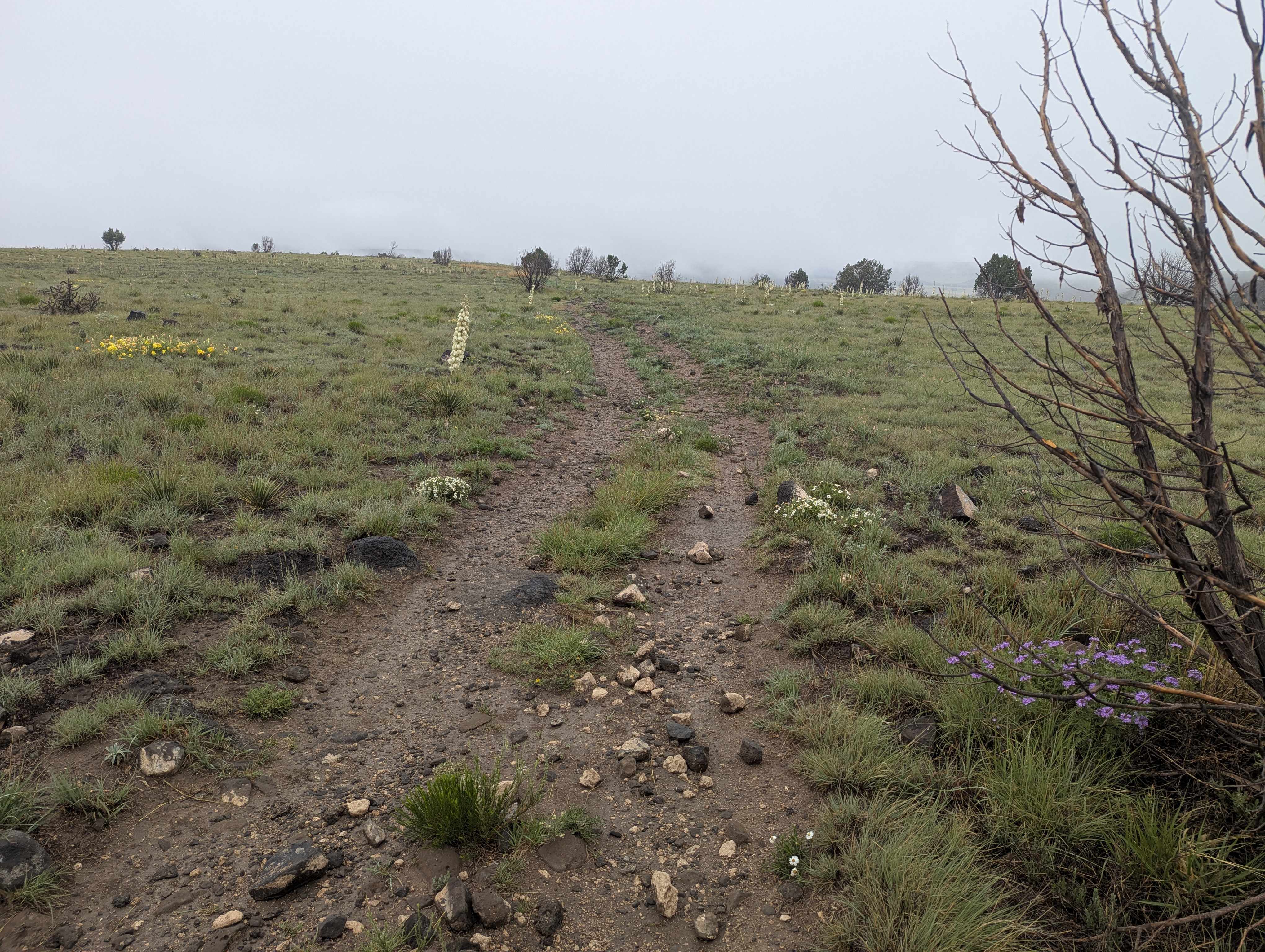
 Under the clouds on my way toward Black Mesa rising in the distance, the now familiar sticky clay under foot.
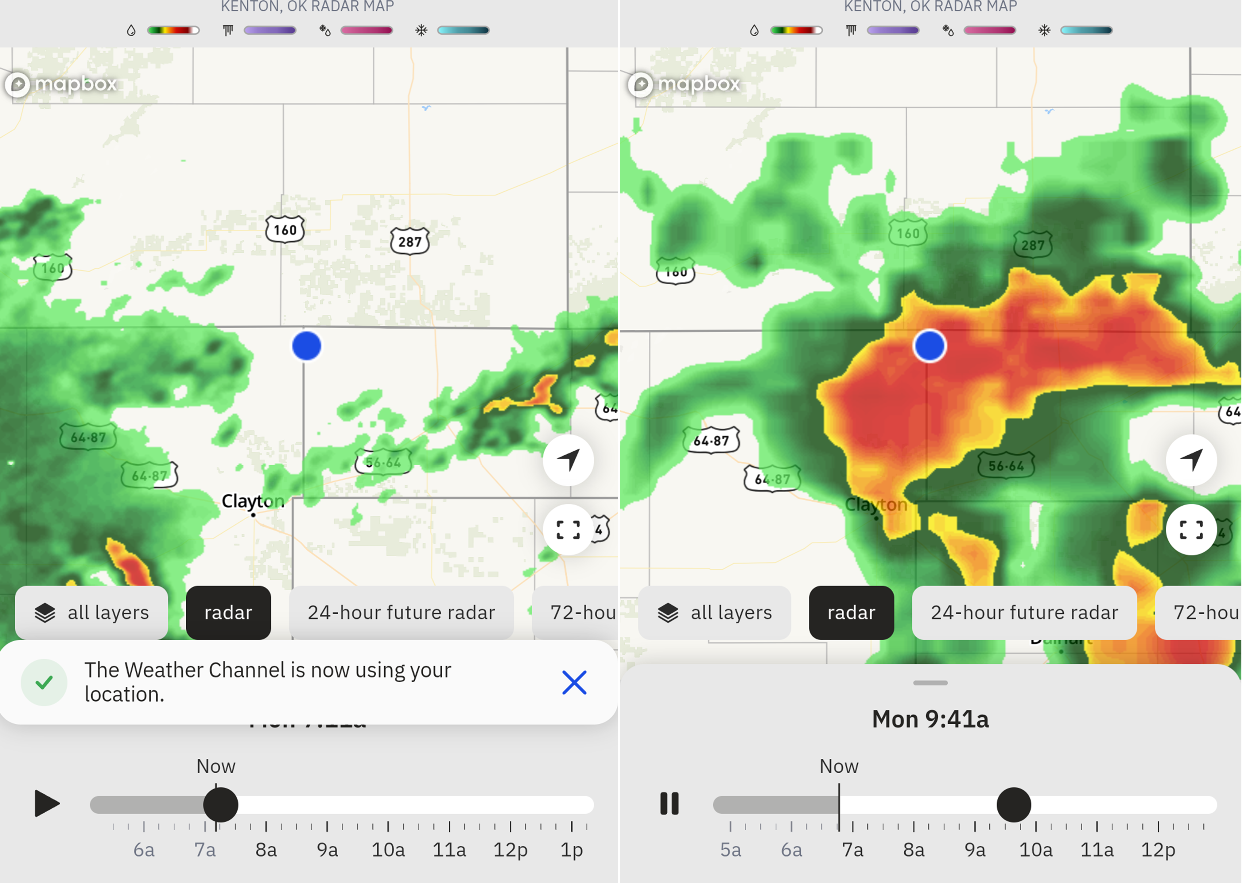 Checking the weather radar a couple miles into my hike. That red blob is what I was racing. Lightning and high places are not a combination to mess around with.
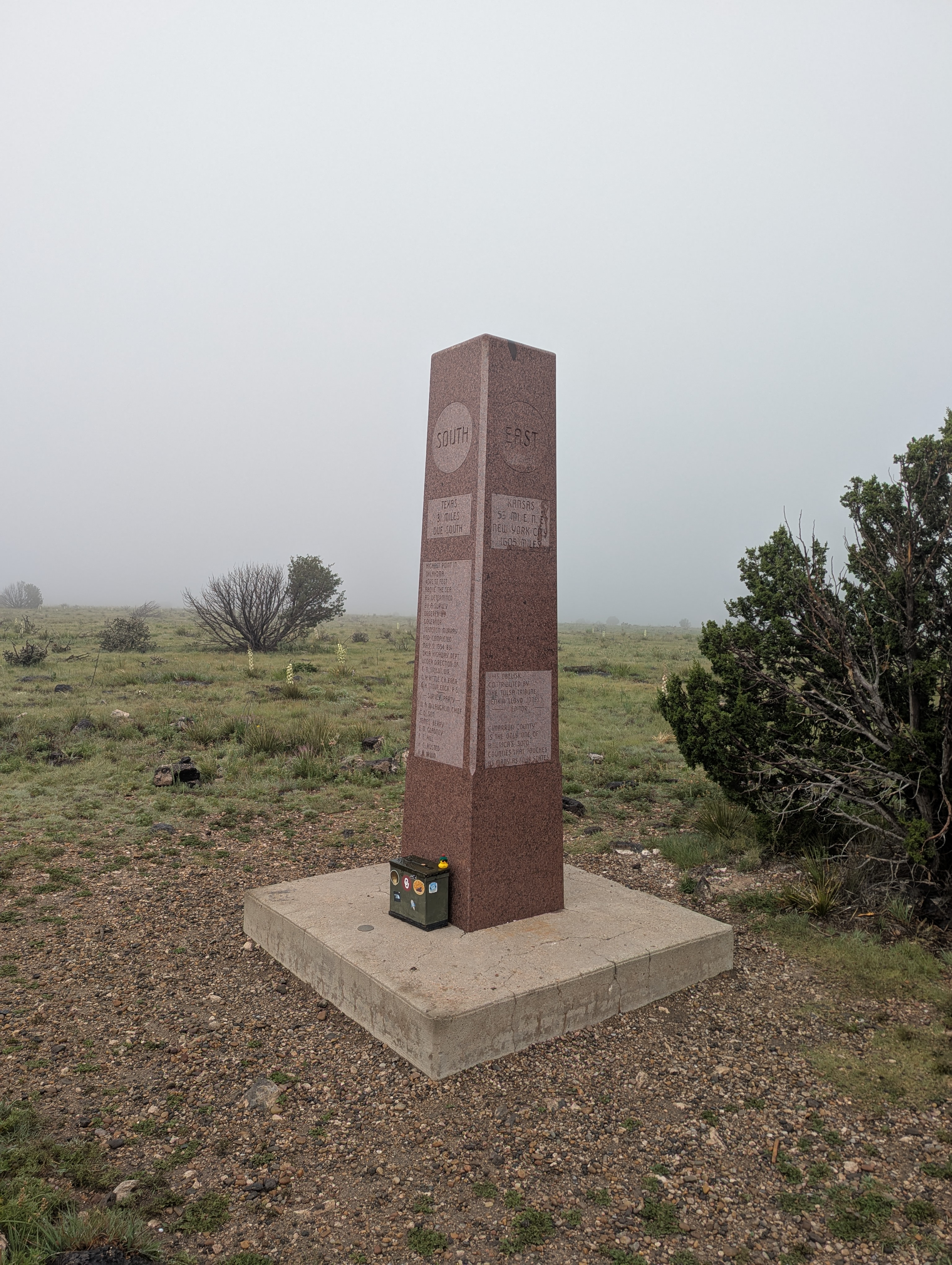 Doug sitting on the summit register next to the nice granite monument. I am convinced the shorter the high point, the bigger the monument, both for compensation reasons and because it’s a lot easier to get big rocks to shorter peaks.
 Really nice different colored wildflowers blooming on top of the mesa.
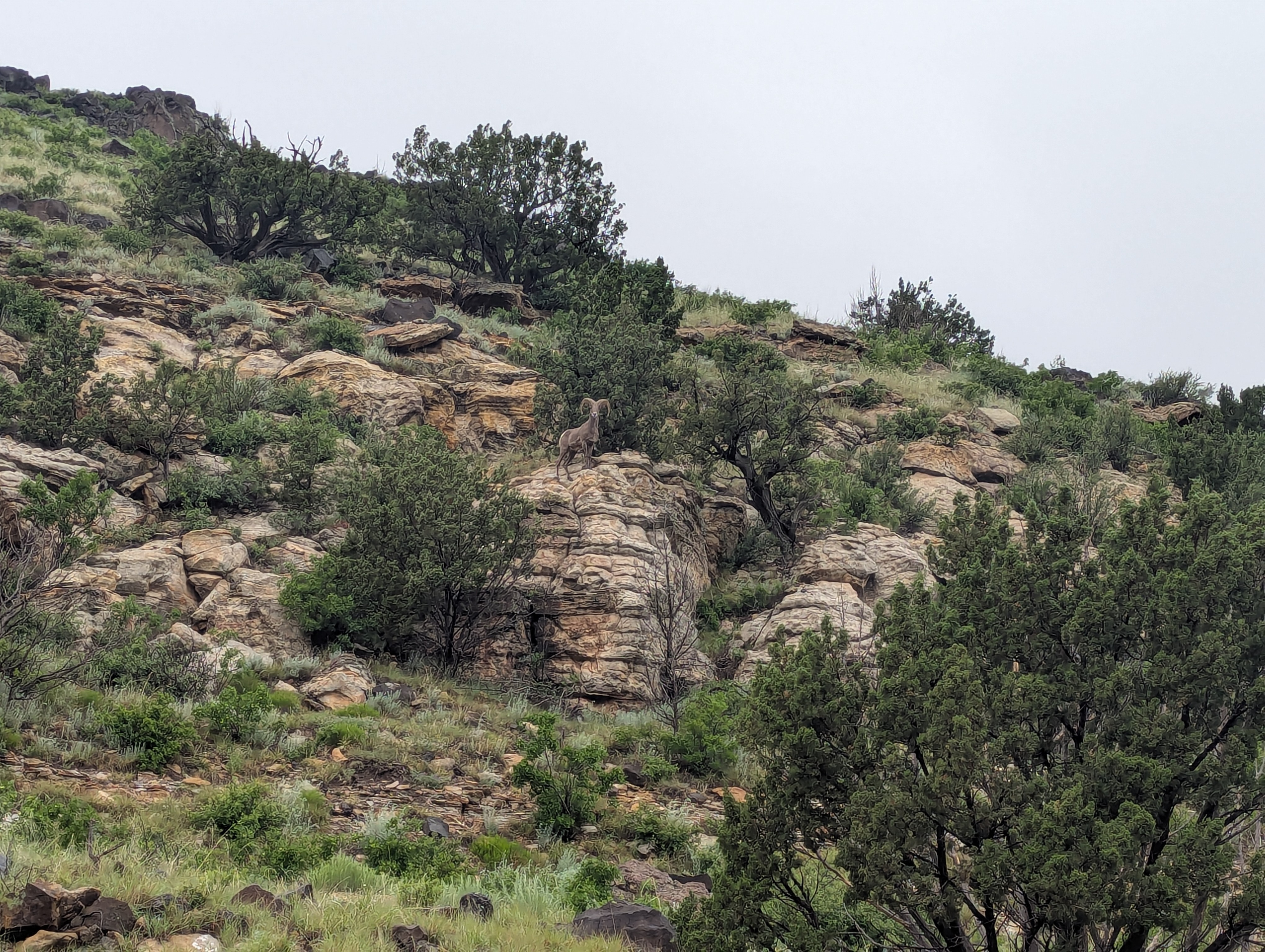 Is that, a big horn sheep?
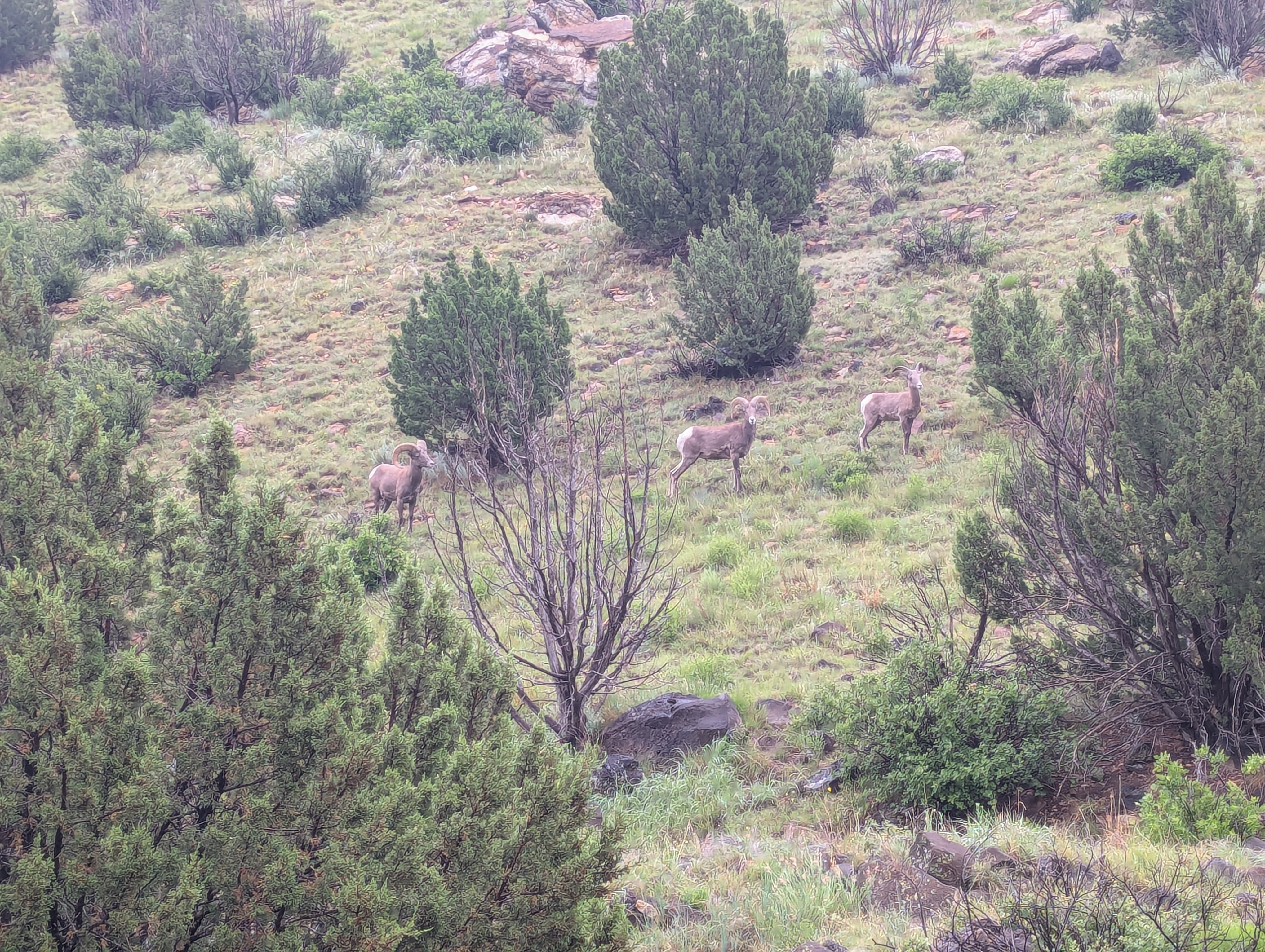 And there were three more hiding just below me.
 Eastern Kansas in a photo. Lumpy but flat on my way to the state high point.
 Didn't use my jacket or axe on any of the other peaks, but the conditions on top of Kansas warranted full skin protection, no frostbite allowed. Please ignore the vehicle in the back, not sure what jerk parked it there.
 A panorama from the top of Kansas.
 Doug really liked the stickered summit register mail box.
May 27th - Day 9 - Taum Sauk Mountain and Drive to St. Louis
Another night at a rest stop in the car did me well, but I was ready to get the heck out of Kansas. My goal for the day was the Missouri state high point Taum Sauk Mountain and then make it back up to St. Louis where I would stay the night with my Aunt, Uncle, and cousin who insisted they could still host me even after being hit with a tornado less than two week before.
I barely made it around Topeka before the morning traffic took hold and continued down into Missouri where the heavily wooded rolling hills reminded me a lot of eastern Pennsylvania. I made it to Taum Sauk mountain uneventfully. I ended up parking in the camping area and took the long way around to the summit giving myself time to stretch my legs. There is a lovely little rock right at the "summit" that makes for a cute landmark. I don't think the tree growing out of it knows that it is on top of the show me state and I think that’s nice.
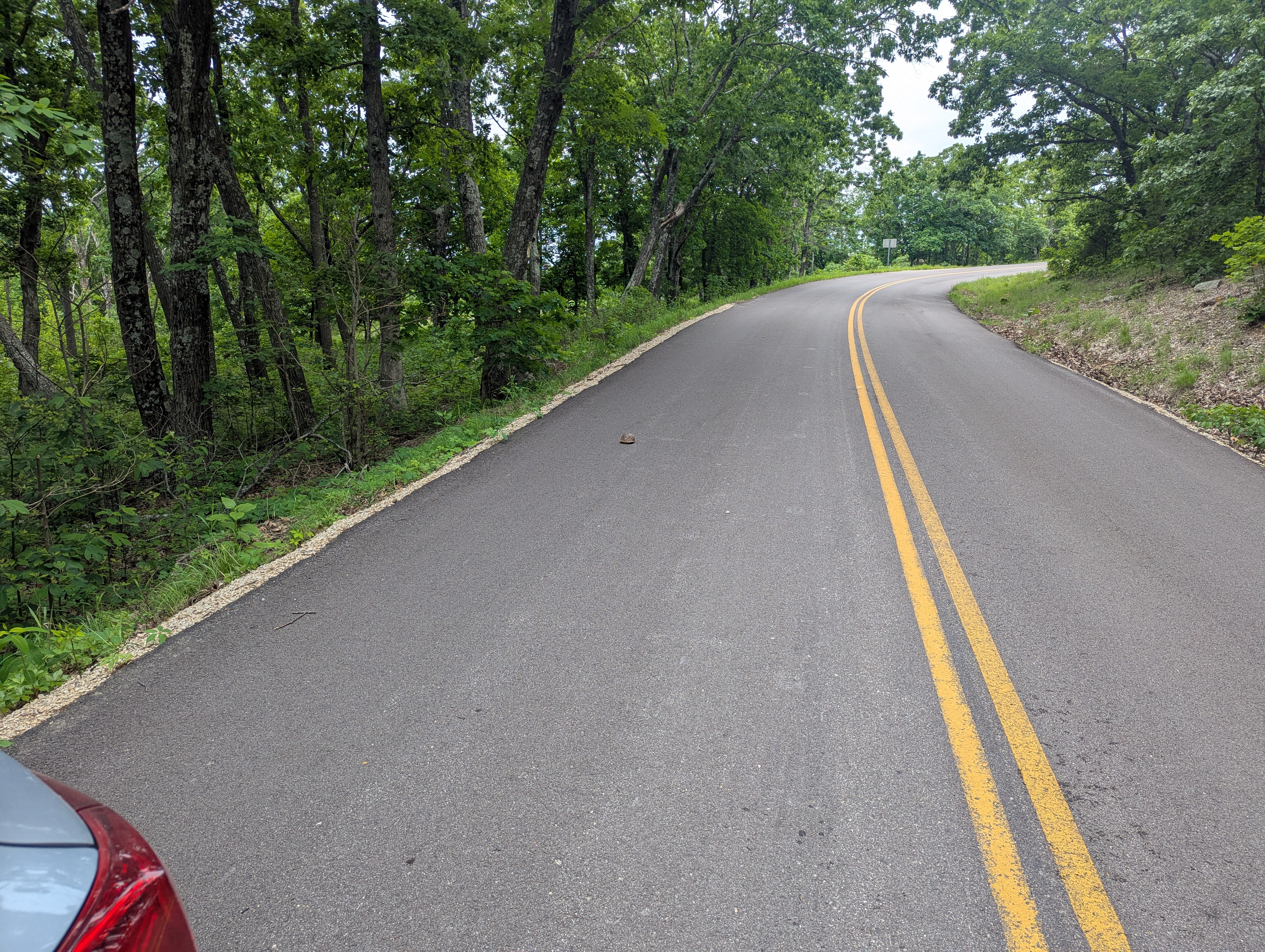
I almost had a graphic run in with a box turtle on the road on the way off the mountain and made sure to scoot them to the side before I continued on my way. I made it to St. Louis around 5pm and quickly found myself driving through a park that had clearly experienced the brunt of the tornado. I had kind of been hoping to see one on my way across the plains, but after seeing the damage in the park and to the brick appartements around my cousin's I am quite glad I did not. After some great catching up and a nice BBQ dinner (thank you all for hosting me!) it was time for bed with another early rise on the menu for the next day.
Story continues after Day 9 photos.
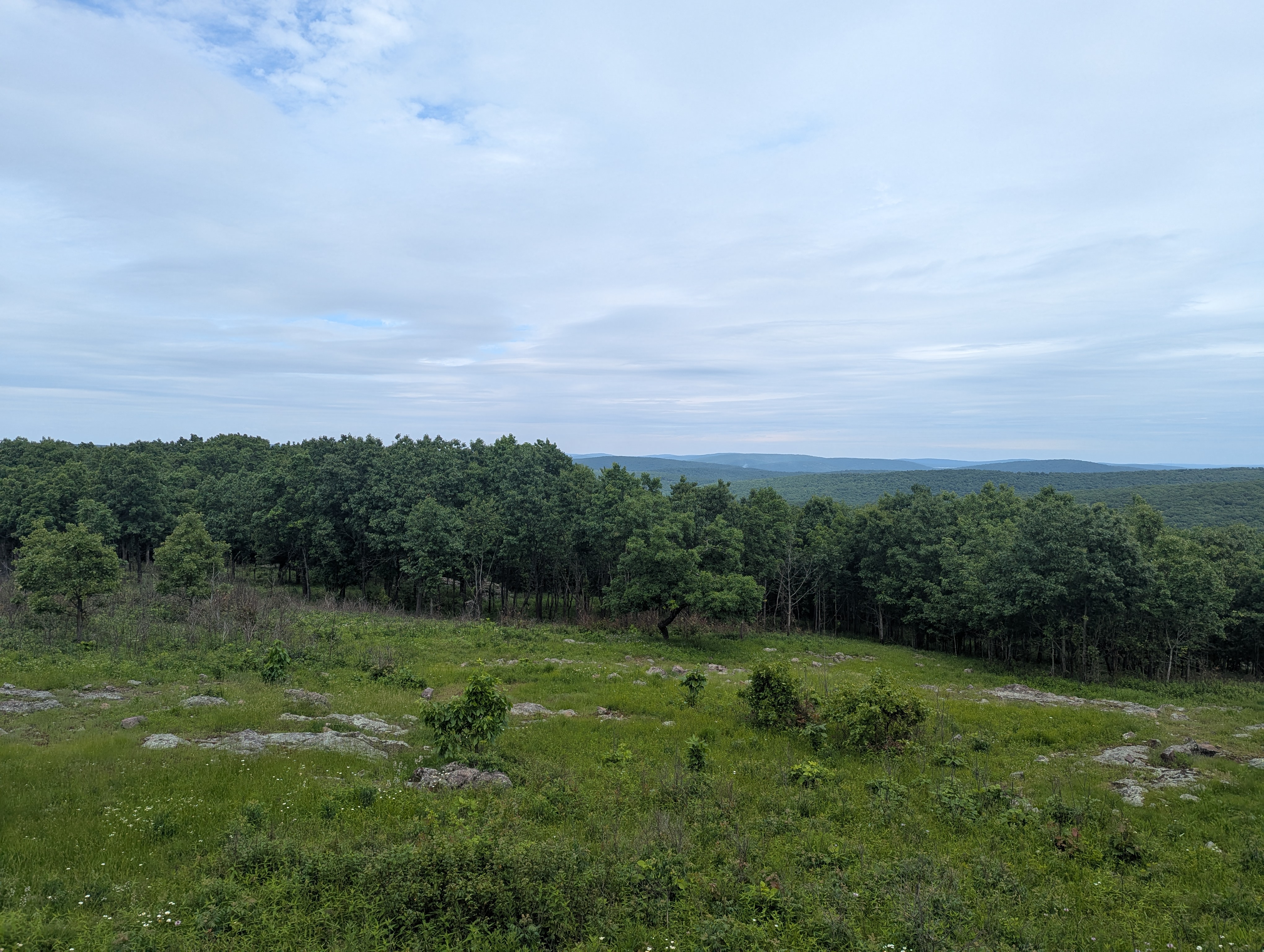 A view looking out over south eastern Missouri from near its top.
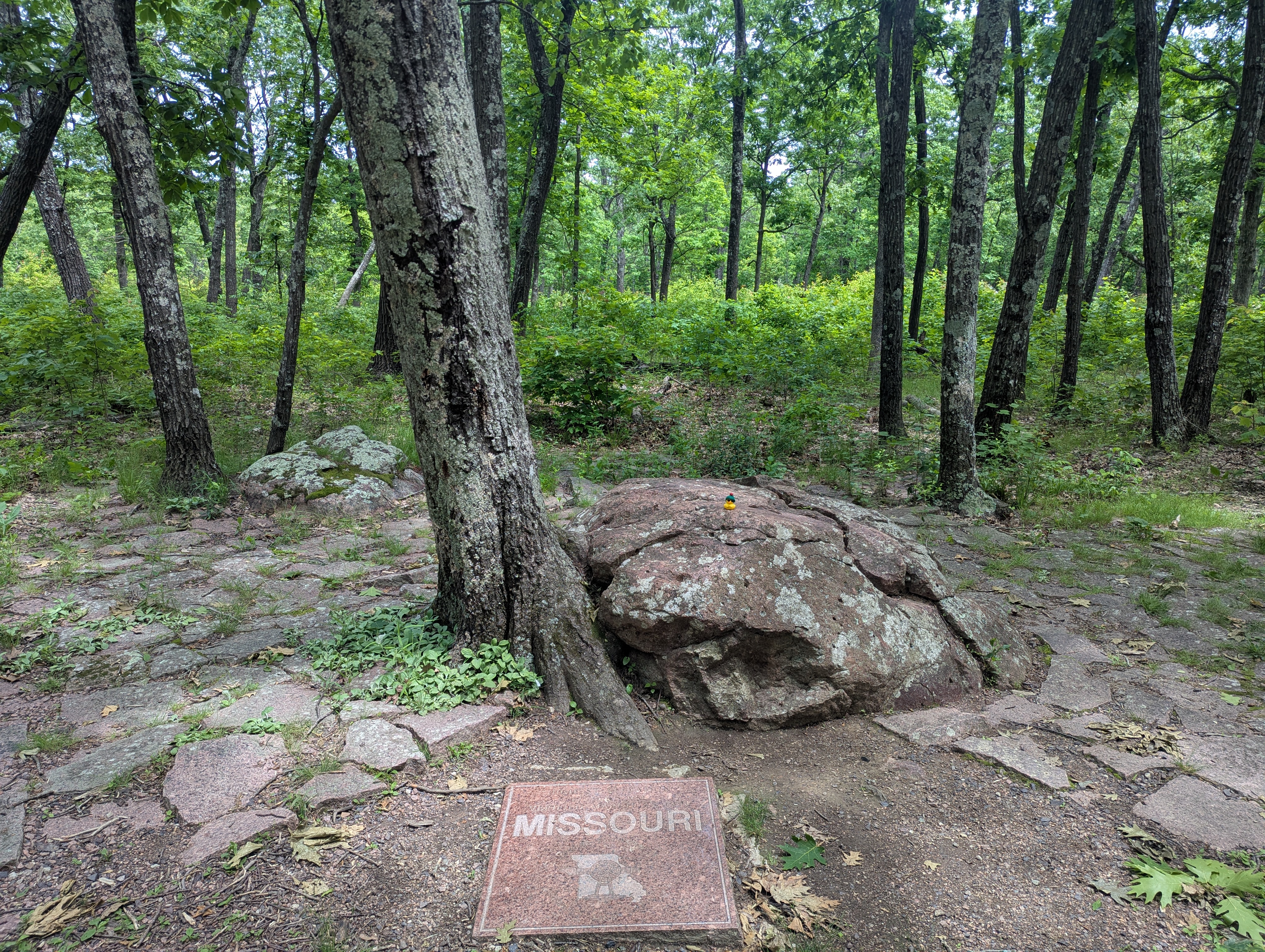 Doug on the rock and next to the tree at the top of the show me state.
 Sir, I don’t think that is a good place to be hanging out…
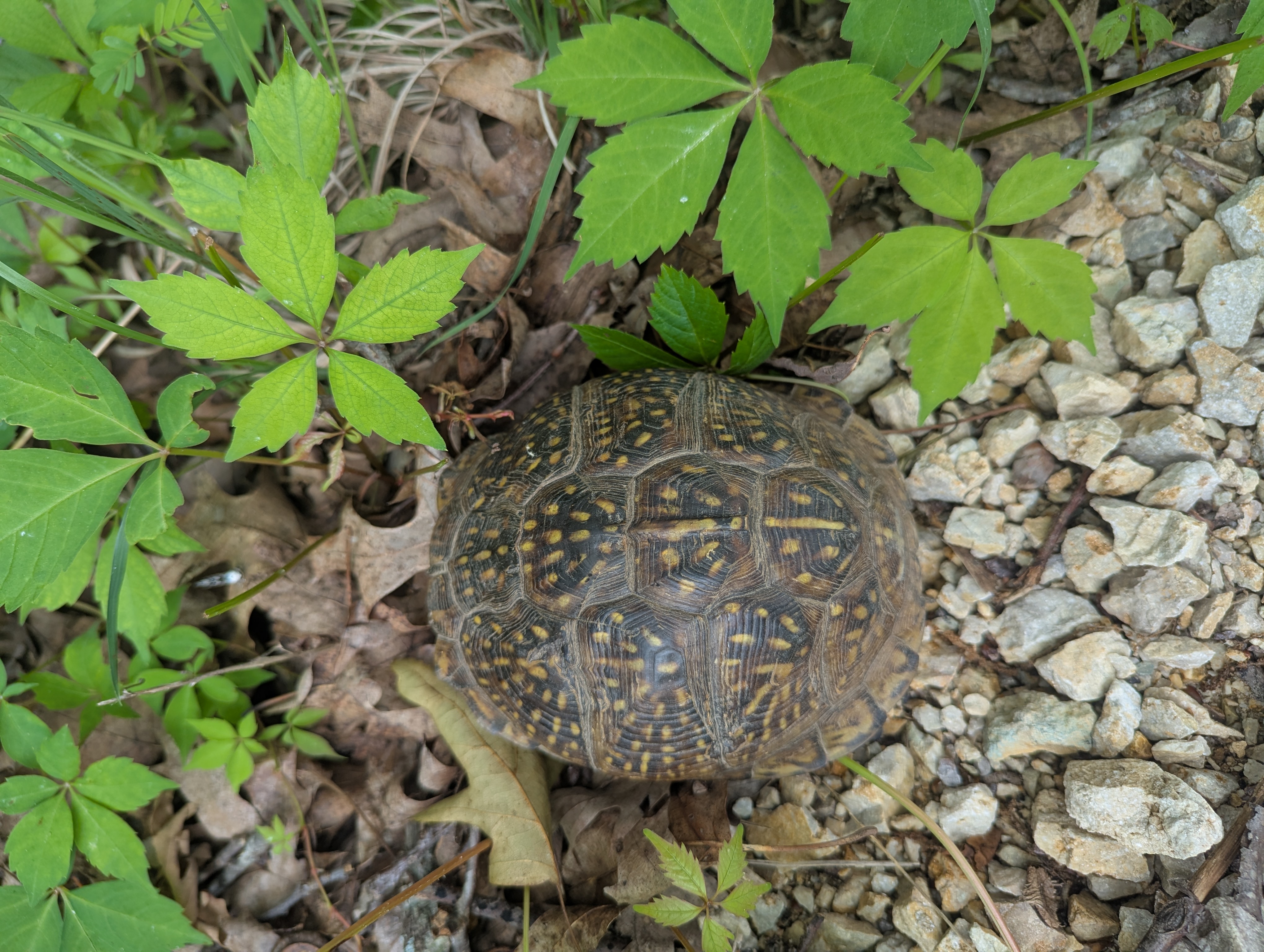 The turtles new resting place well of the side of the road.
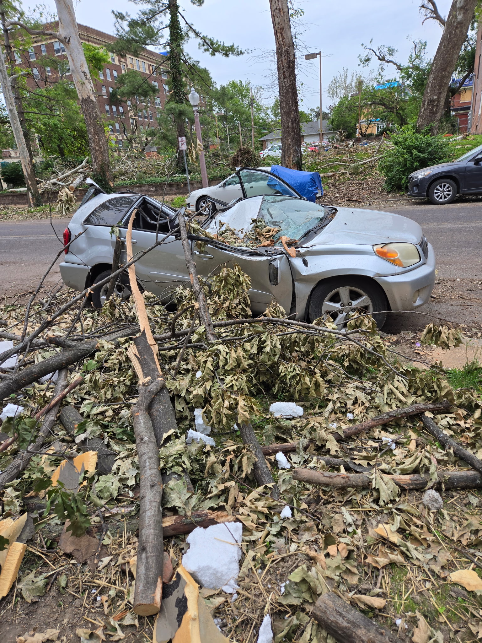 The tree that crushed this car had been removed, but the car along with many others remained in the tornado ravaged St. Louis suburb.
May 28th - Day 10 - Gateway Arch, Hoosier Hill IN, Campbell Hill OH, and Drive to Pittsburgh
I had set myself on getting from St. Louis to Pittsburgh on this long day of driving only broken up by stops in Indiana and Ohio for their "high points". But first I had to see Gateway Arch National Park. There early in the morning I was able to find free street parking and stroll around the greens. I made a quick stop at the Old Courthouse building to tag the parks high point and then went down to the arch. The arch is quite beautiful, especially in the morning light. Maybe it's just because I am a civil engineer at heart but after a couple turns around its legs I felt ready to accept its place as a national park among the other greats. I had never seen the Mississippi River before, and it was as expected a river.
My drive to Indiana through Illinois was uneventful. The Indiana high point, Hoosier Hill, is adjacent to yet more farm fields in a small wooded patch that conceals its "peak". I enjoyed yet another mailbox summit register and a quick snack on the bench before proceeding to Ohio. Ohio's high point, Campbell Hill, is somewhat strange because of how built up it is, with lots of buildings around and infrastructure on top. Sorry Ohio, but I think my feelings for the high point are similar to the state in general.
Continuing on I briefly cut through one of West Virginia's pan handles before entering the familiar ground around Pittsburgh where I spent my undergrad at CMU. One of my college roommates was still there (love will do that I guess) and gracious enough to let me spend the night, I was on a role with beds and showers now. Thanks for hosting me :). I really do miss Pittsburgh and driving through it for the first time, instead of being on a bus or a bike, really made me long to come back. If only it had an ocean nearby.
Story continues after Day 10 photos.
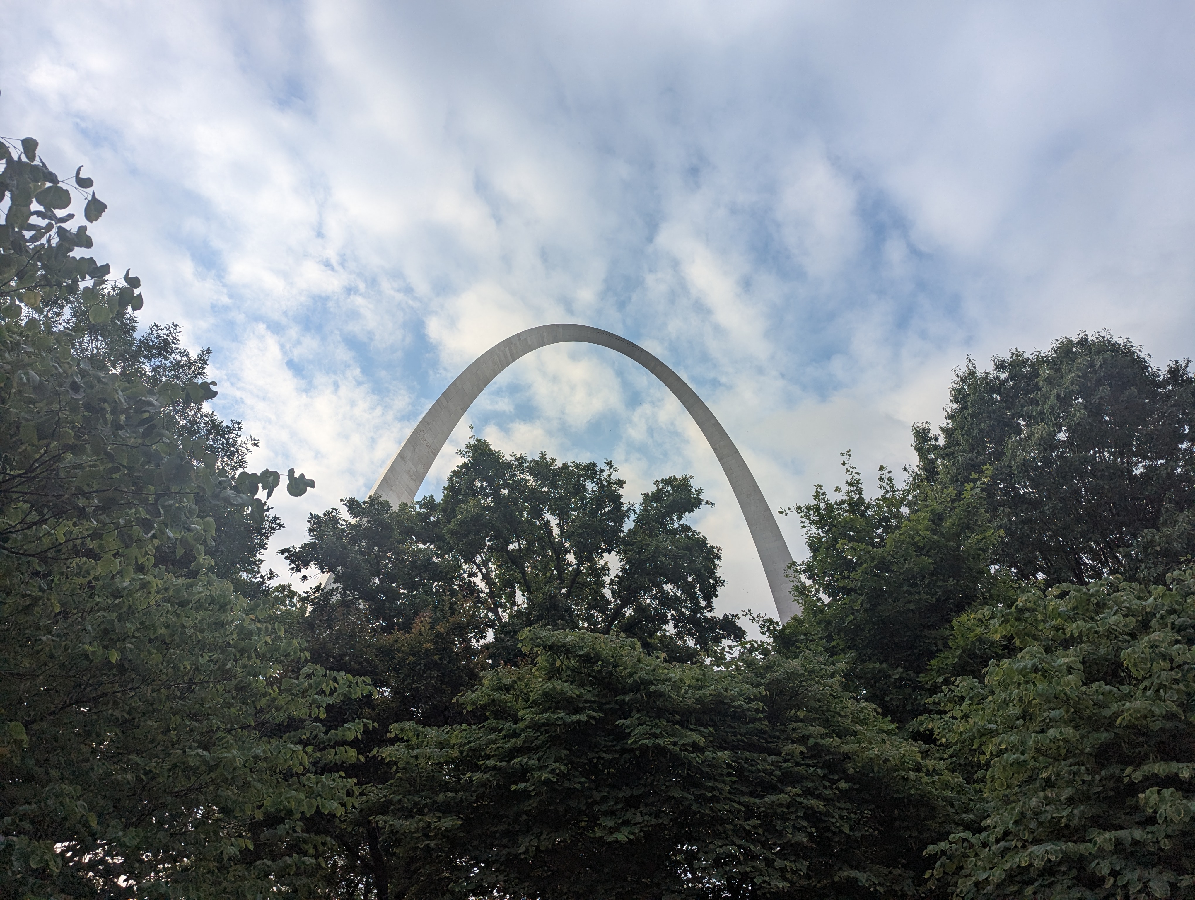 Oh hello there you beautiful steely curve boy.
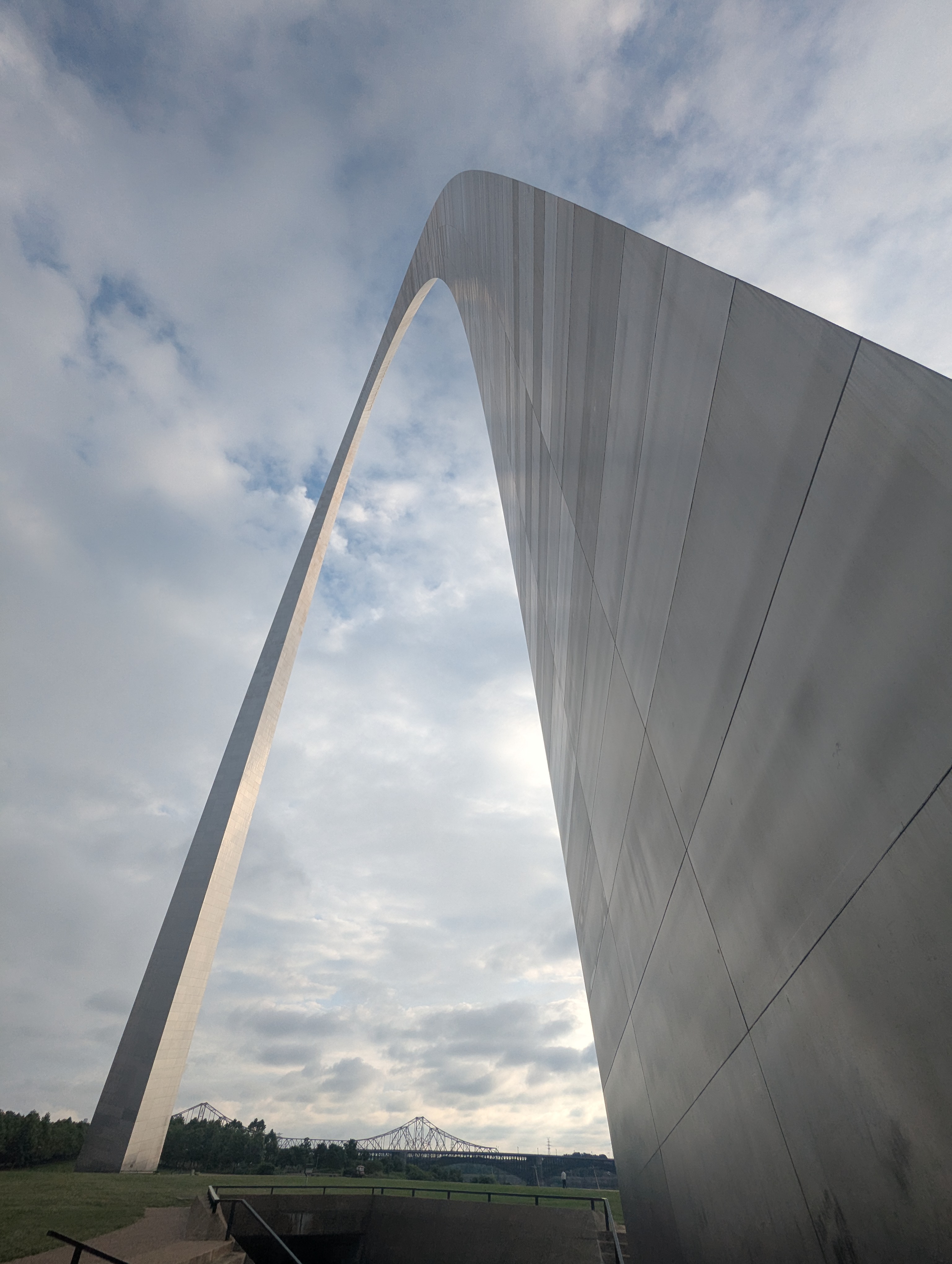 Elegant steel swooping over practical steel.
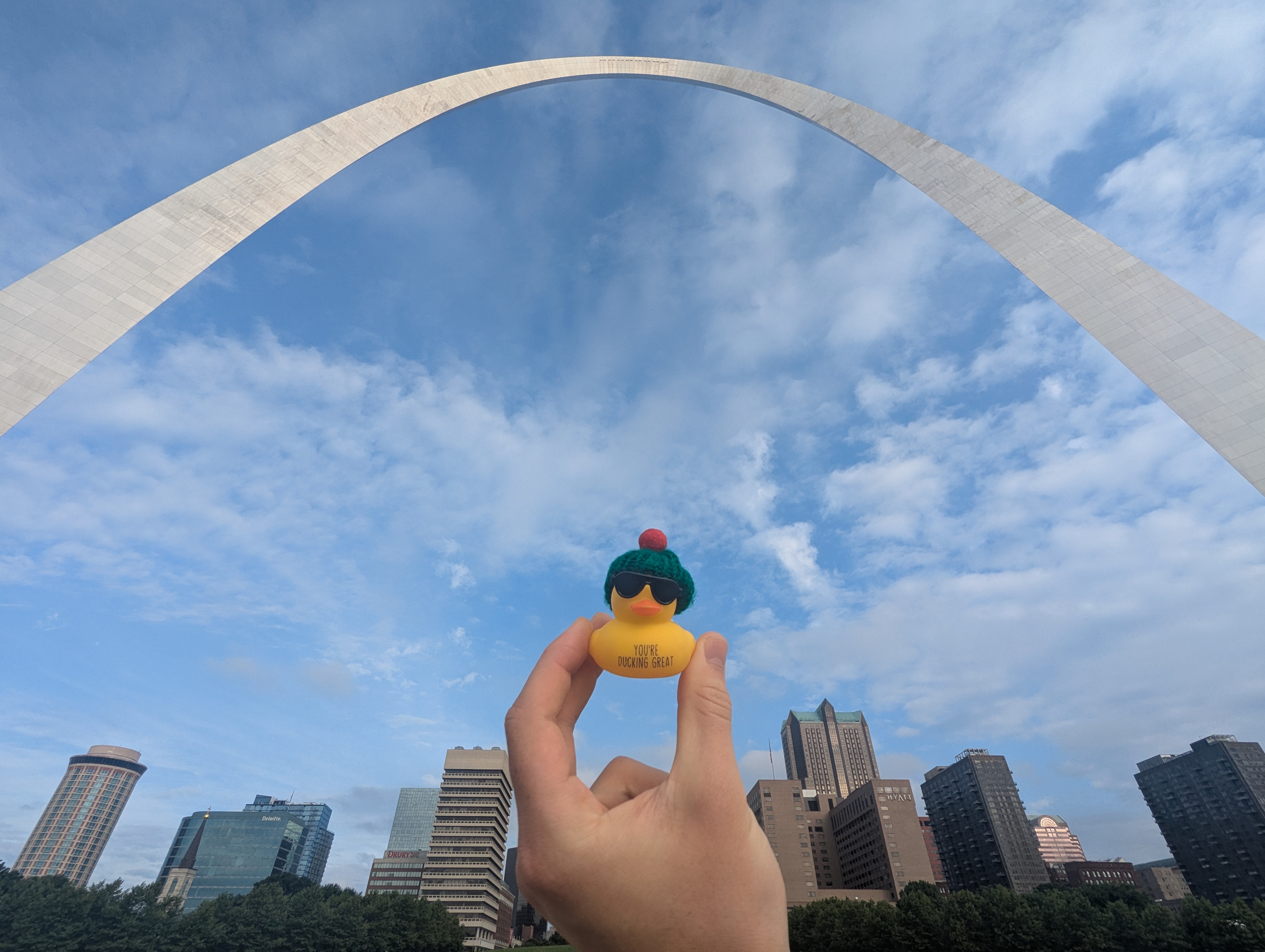 Doug framed be the city and its arch.
 Ok ok, just one more.
 The context for the Indiana state high point.
 Doug on the summit rock of Hoosier Hill.
 A panorama of the summit of Indiana.
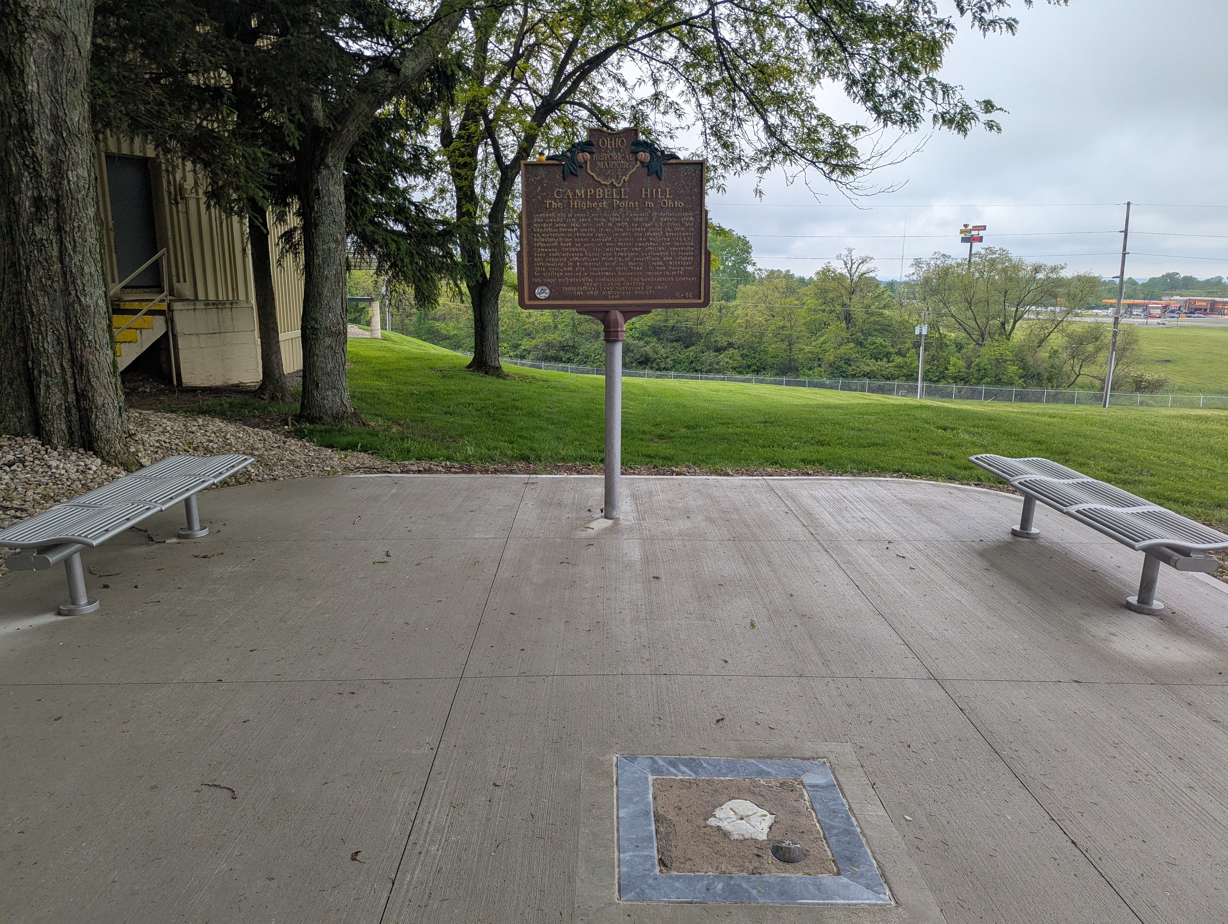 Campbell Hill with a nice Loves gas station in the distance.
May 29th - Day 11 - Ebright Azimuth DE and Drive to Philly
With a bit of time to kill and hoping to meet up with yet another college roommate for a place to crash in Philadelphia overnight I decided to drop in to say high to my old professors and work study boss in the civil engineering department. As luck would have it I got to see many old friends, help out moving some furniture around Porter Hall just like the good old days, and go to lunch with folks to boot. Thanks for lunch and for all of the swag :).
Having already tagged the PA, WV, and MD high points, I continued on east in the afternoon, now shooting for the northern tip of Delaware where their state hid their summit in the suburbs. A few close calls with the PA state troopers and some horse and buggies later I reached the manicured lawns and wide streets that signaled I was close to the summit. I again donned my protective gear, but think I scared some of the joggers with the ice axe and balaclava as I crossed the street to the peak of Ebright Azimuth. Satisfied with the bagging the second lowest state high point I continued on to Philly where I was able to catch trivia with some folks and ice cream before calling it a night on my roommate's couch.
Story continues after Day 11 photos.
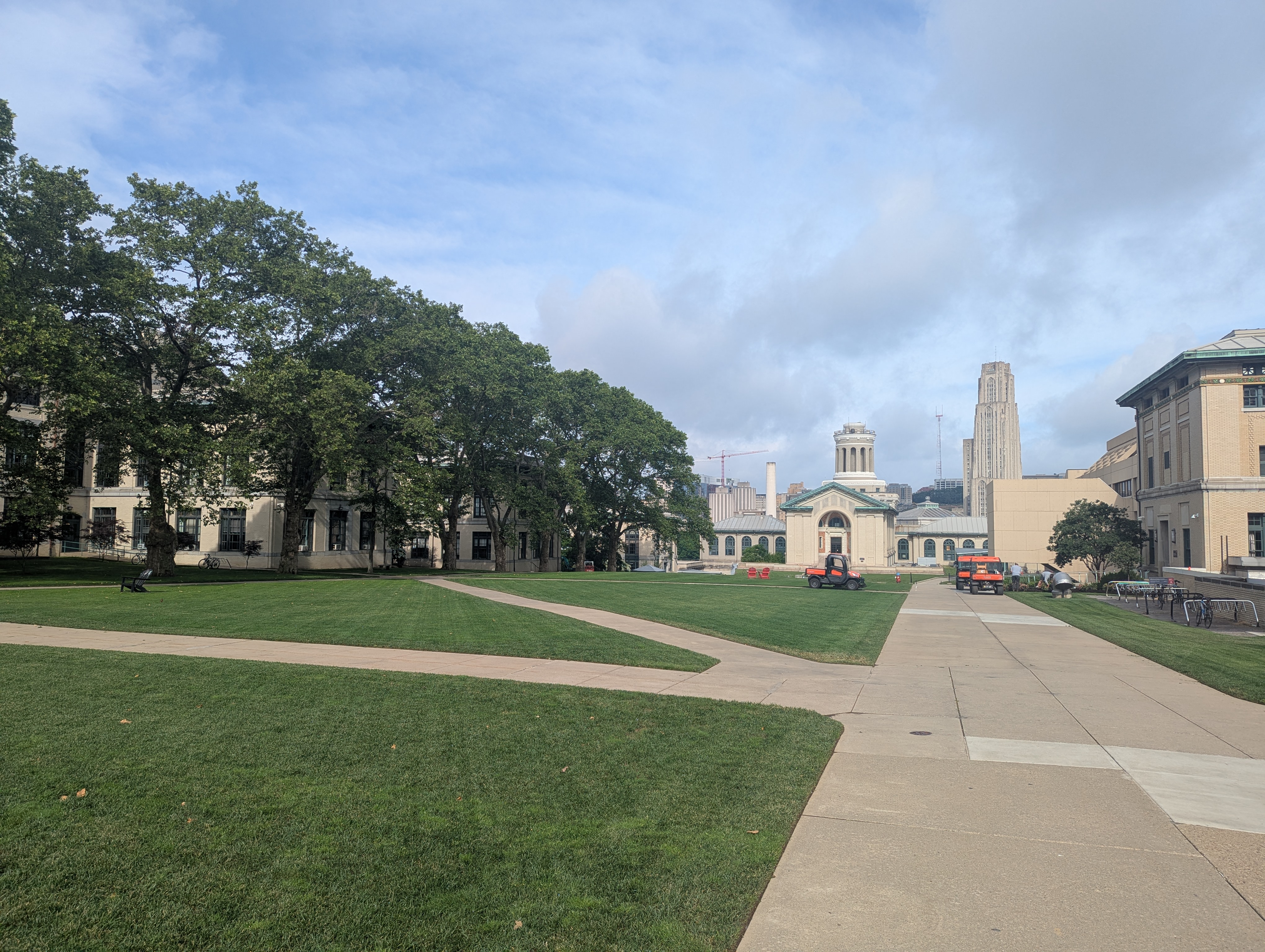 After having lived there for roughly five years, this was the first time I was on CMU's campus this deep into summer. I was pleased to see the perpetual cycle of killing and replanting the grass just to be killed again by outdoor tents was still continuing.
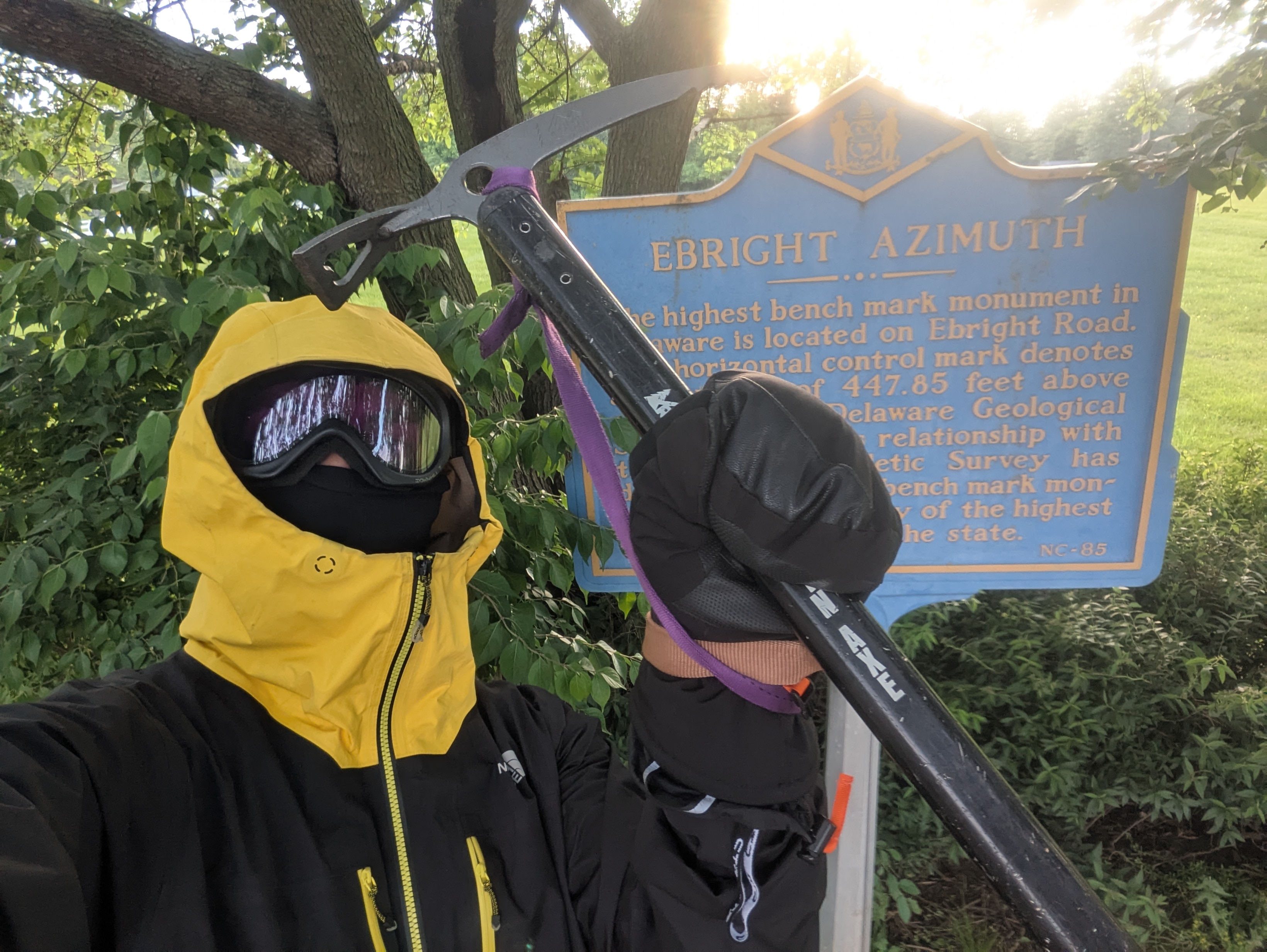 Geared up at the summit of Delaware, spooking the neighbors peeking through their windows.
May 30th - Day 12 - High Point NJ, Jerimoth Hill RI, and Drive to Woods Hole MA
We started our morning with a nice stroll to the unsoundoutable Schuylkill River and nearby parks before my host's work day started. Thanks for the housing and the breakfast :). I headed north through the garden state to its high point, High Point NJ, on its far northern edge. New Jersey really did feel like endless back and forth between hills, farmland, and suburban sprawl. I made it to the High Point parking lot just as a school bus filled with third graders started unloading. I speed walked to the bathroom and then on to the summit monument beating the cacophony of kids by less than a minute for some quick pictures before the area was enveloped. Needless to say I didn't stick around long.
Onward through New York, Connecticut, and into Rhode Island where I sought my final high point for the trip: Jerimoth Hill. It was a nice stroll through the woods that gave me time to reflect on how far I had traveled. And here again like Missouri there was a cute little rock to mark the summit. With the end in sight I continued east but was caught up in end of work day traffic skirting around the northern end of Providence. It was smooth sailing from there down to the Cape and Woods Hole. I had almost made it in one piece, but a BMW SUV had to put me through my paces by trying to merge directly into me, without signal naturally. If hadn't A. slammed on my brakes, B. veered to the left onto the shoulder, and C. laid on my horn they would have side swiped me. I got it all on dash cam too :). Just check over your shoulder people, it's not that hard. I can see in the dash cam video that they even had a blind spot warning light on in the side mirror. To the displeasure of BMW drivers everywhere I made it to the Atlantic unscathed, completing my second goal for the trip.
 City and the Schuylkill.
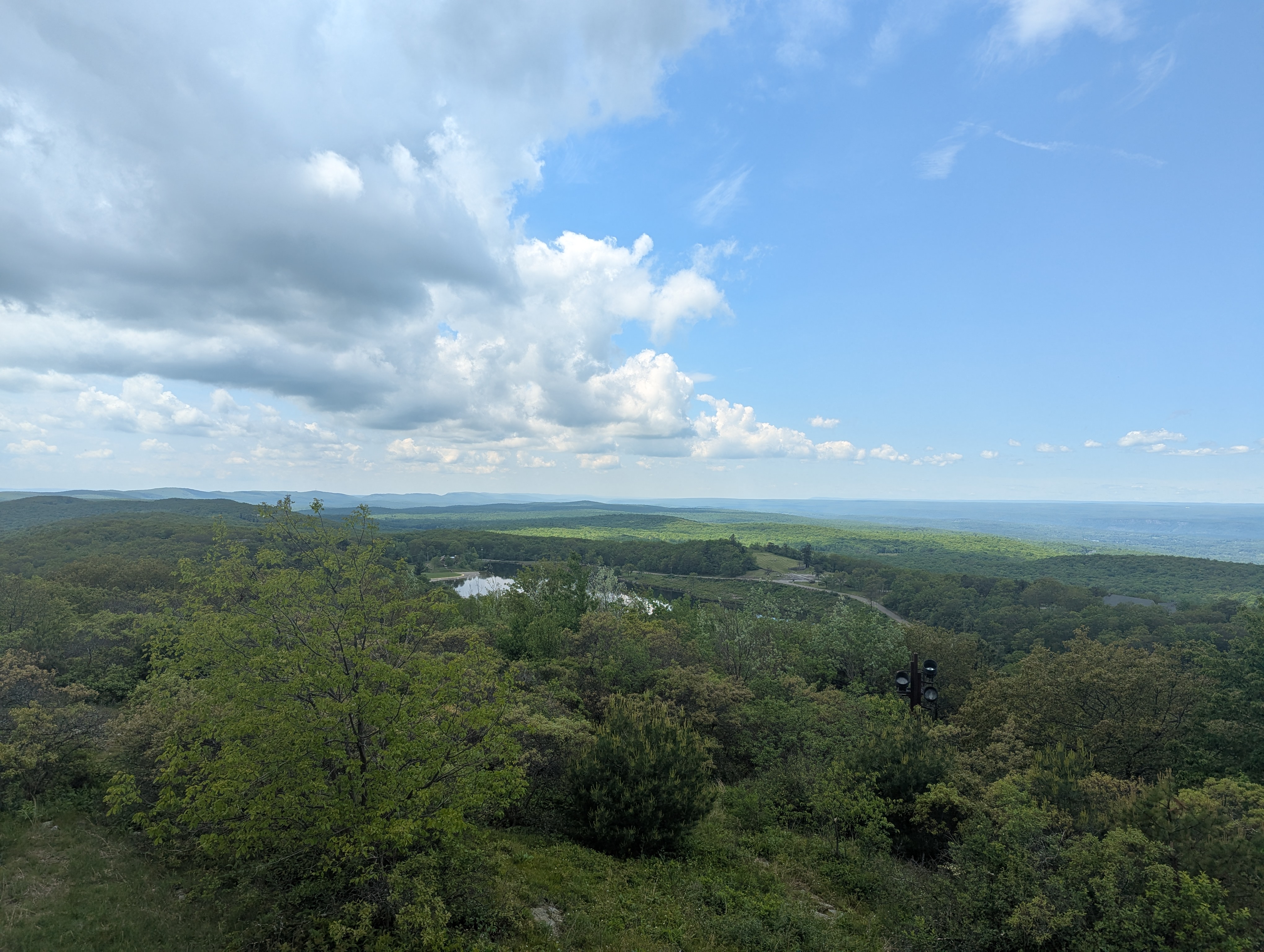 Nice clouds over High Point New Jersey.
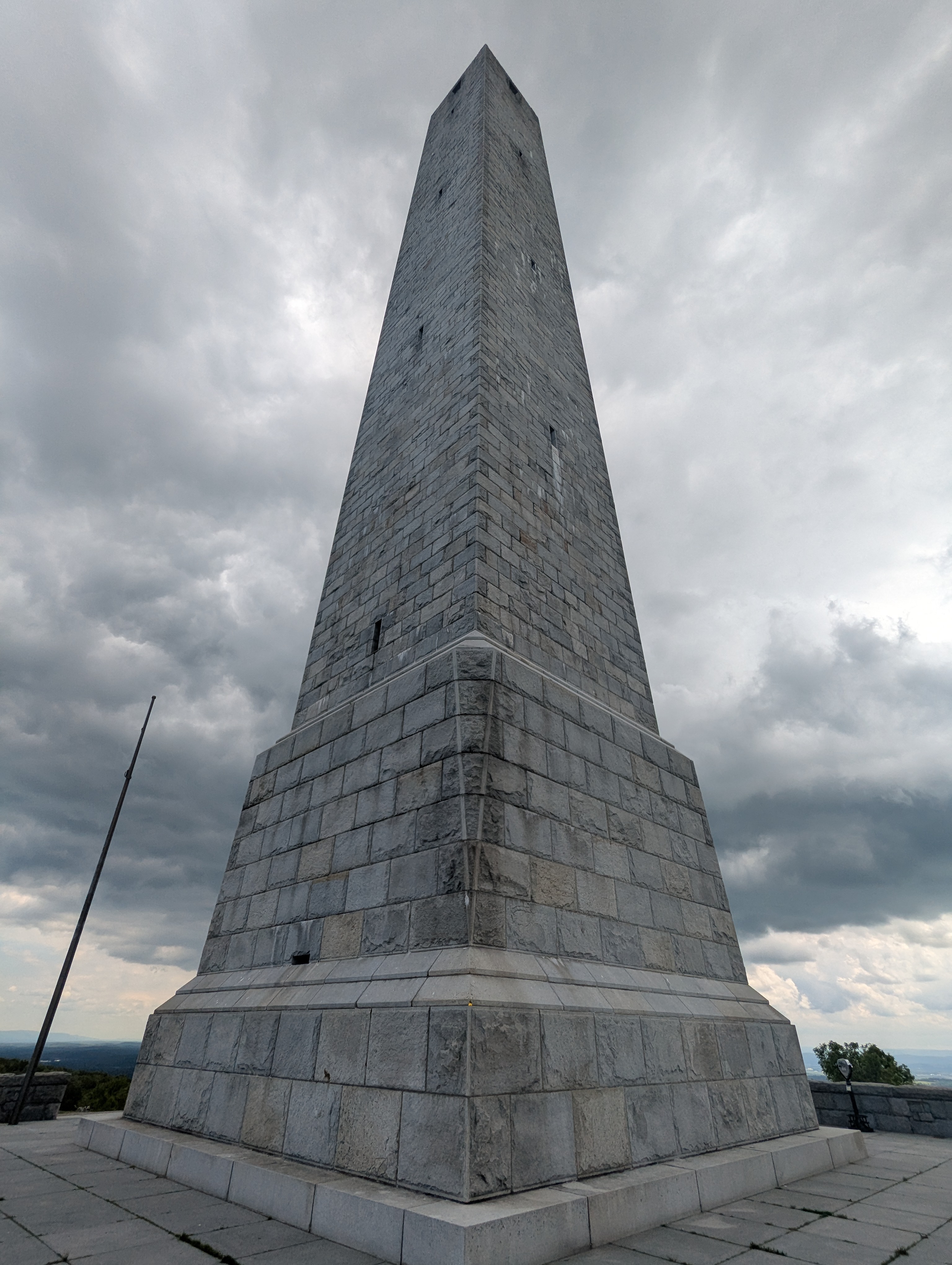 I think NJ has the largest high point monument, Doug here for scale before I had to rescue him from the approaching tsunami of 3rd graders.
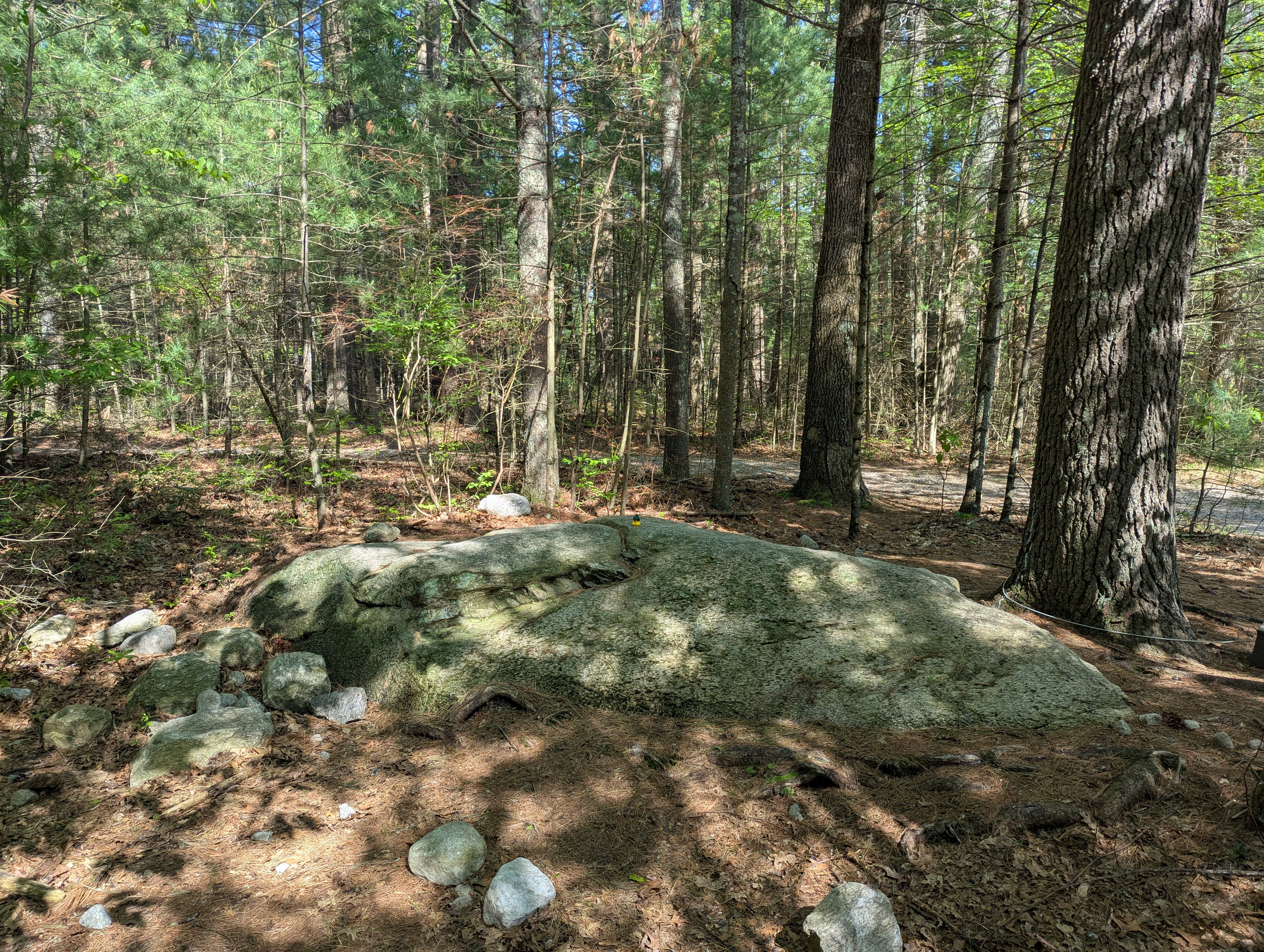 A final high point and a final high point boulder with Doug on top of Jerimoth Hill Rhode Island.
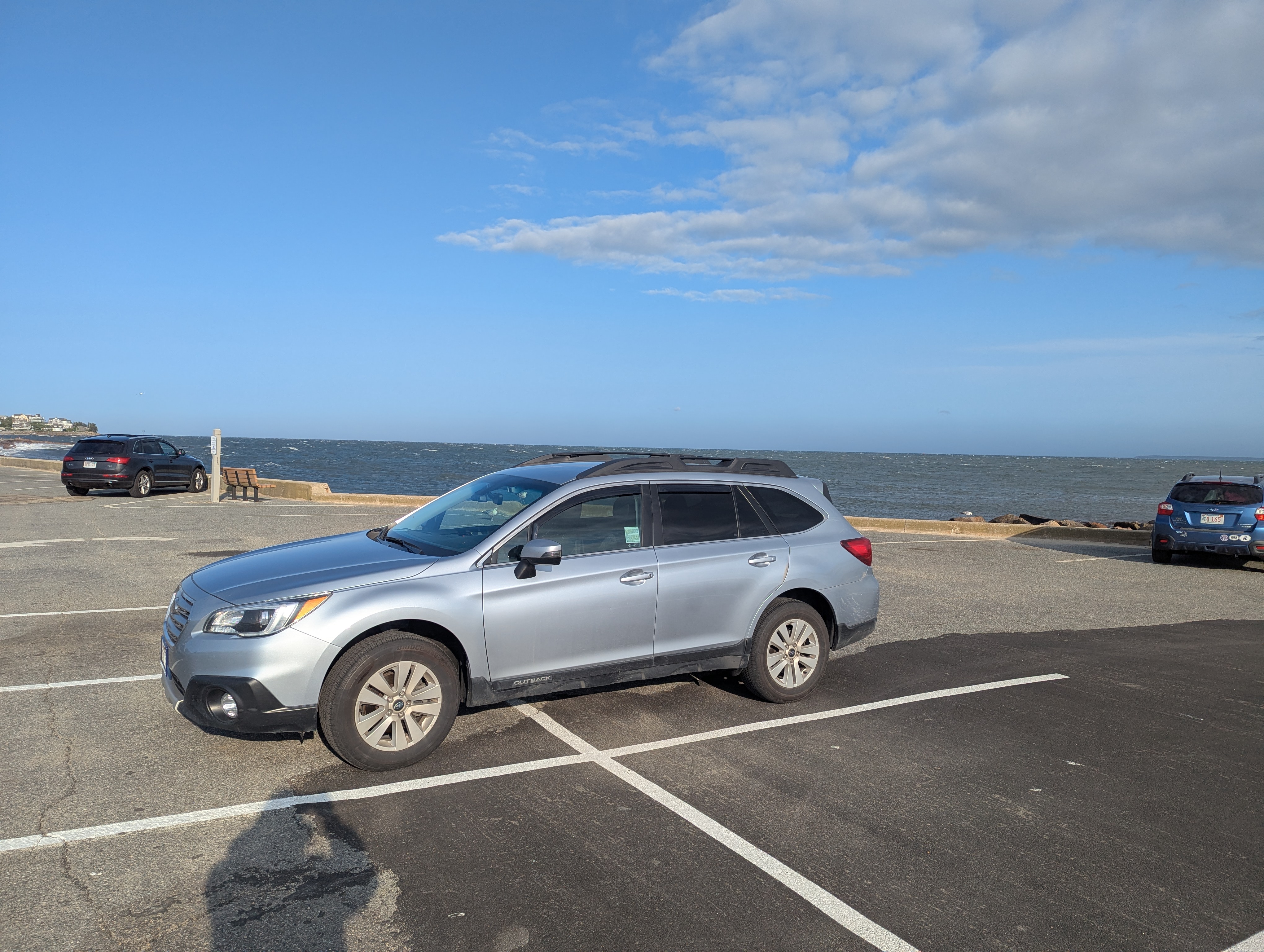 Coast to coast, the Atlantic Ocean stretching out beyond Mu into the distance. Someday I will cross that too, but I need to focus on the rest of the high points first :D.